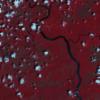
Static Map Catalogue - Full Metadata Record
Collection Tropforest
Tropforest Dataset. More details.
DE1_OTPF_DE1_SL6_2F_20110131T012323_20110131T012323_000000_E142_S009
Download Product | BrowseDate at scene centre | 2011-01-31T01:23:23Z |
End Acquisition | 2011-01-31T01:23:23Z |
Availability Time | 2011-01-31T01:23:23Z |
Satellite | DEIMOS |
Sensor | SLIM6 |
Sensor Type | OPTICAL |
Sensor Mode | NA |
Orbit | 000000 |
Orbit Direction | DESCENDING |
Illumination Azimuth Angle | 116.3173111013 |
Illumination Elevation Angle | 66.88201324384 |
Footprint | -8.90988603332 141.908899001 -9.0907649165 141.909350659 -9.0902656793 142.0913286 -8.9093968868 142.090786598 -8.90988603332 141.908899001 |
Scene Centre | -9.00008953653 142.000091215 |
Size | 2565015 |
Cloud Cover Percentage | 4.803 |
Acquisition Type | NOMINAL |
Product type | DE1_SL6_2F |
Processing Center | Astrium Services |
Processing Date | 2011-10-26T00:00:00Z |
Observed Country | Papua New Guinea |
Bounding Box | -8.9093968868 141.908899001 -9.0907649165 141.908899001 -9.0907649165 142.0913286 -8.9093968868 142.0913286 |
Longitude | E142 |
Latitude | S009 |
