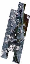
Static Map Catalogue - Full Metadata Record
Collection SkySat
SkySat ESA Archive. More details.
SSC_OPER_SSC_DEF_CO_20190722T154506_N25-874_W080-152_01
Download Product | BrowsePath | W080 |
Row | N25 |
Start Date | 2019-07-22T15:45:06Z |
Stop Date | 2019-07-22T15:45:06Z |
Availability Time | 2019-07-22T15:45:06Z |
Platform Short Name | SkySat |
Instrument Short Name | SkySat Camera |
Sensor Type | OPTICAL |
Operational mode | CAMERA |
Resolution | 0.5 |
Orbit Number | 0 |
Orbit Direction | |
Illumination Azimuth Angle | 98.2 |
Illumination Elevation Angle | 65.9 |
Across Track Incidence Angle | 26.4 |
Footprint | 25.7873977904 -80.1812286326 25.7873504346 -80.1810828557 25.7961332957 -80.178981888 25.7960881468 -80.1788424881 25.8048830356 -80.1767416694 25.8048355143 -80.1765945617 25.8100241983 -80.1753686815 25.8033241963 -80.1549081585 25.7985515192 -80.1560797103 25.7985745919 -80.1561495722 25.7897996106 -80.1583072475 25.7898257811 -80.1583861946 25.7810462307 -80.1605333203 25.7810716213 -80.1606094957 25.7708404297 -80.1631121818 25.7620103427 -80.1364804836 25.7708285898 -80.1343067122 25.7708135968 -80.1342613949 25.7796284636 -80.1320842417 25.7796121043 -80.1320346147 25.7884290294 -80.1298517232 25.7884193271 -80.1298221612 25.7972440854 -80.1276382668 25.7972408271 -80.1276283021 25.8060756346 -80.1254450838 25.80607226 -80.1254347199 25.8148986633 -80.1232504372 25.8148947371 -80.1232383411 25.8237332794 -80.1210502054 25.8237304507 -80.1210414474 25.8325568732 -80.1188635178 25.8325499552 -80.118842002 25.8413558319 -80.116660604 25.8413517143 -80.1166477762 25.8501566596 -80.1144707175 25.8501479106 -80.1144434061 25.8601919453 -80.1119443643 25.8601940172 -80.1119508018 25.8678177397 -80.1100635357 25.8677854786 -80.1099620703 25.8766314901 -80.1077896479 25.8766233179 -80.1077638411 25.8854242069 -80.1055980155 25.8854020236 -80.1055279568 25.8942284236 -80.1033554098 25.8942225208 -80.1033366757 25.9030637858 -80.1011478607 25.9030442929 -80.1010855296 25.9118692042 -80.0989162798 25.9118586205 -80.0988822516 25.9206547954 -80.0966972812 25.9206447969 -80.0966650591 25.9305398028 -80.0942397531 25.9308771648 -80.0953188575 25.9384223242 -80.0939674356 25.9469009695 -80.115648272 25.9509254679 -80.1146929009 25.9508899208 -80.1145783108 25.959648784 -80.1125086802 25.9596050837 -80.1123672068 25.9683993011 -80.1102784808 25.9683681755 -80.1101771112 25.9783775715 -80.1077888795 25.9865081423 -80.134306387 25.9777527768 -80.1363876693 25.9777864158 -80.1364965766 25.9690982273 -80.1385717568 25.9691363318 -80.1386939115 25.9604104824 -80.1407983742 25.9604556327 -80.1409434398 25.955950126 -80.1420289685 25.9630202812 -80.1651431632 25.9542604817 -80.167237718 25.9543049025 -80.1673822597 25.9455635899 -80.1694650091 25.9456189192 -80.1696442964 25.9368563381 -80.1717336812 25.936894835 -80.1718584493 25.9281990067 -80.1739073741 25.9282637188 -80.174115613 25.9194941938 -80.1761926448 25.9195506343 -80.1763741539 25.9107821533 -80.178455007 25.9108449259 -80.1786560905 25.9020636617 -80.1807342662 25.9021235724 -80.1809252675 25.8933571706 -80.1830073276 25.8934167646 -80.1831967668 25.884700236 -80.1852672668 25.8847544194 -80.1854381075 25.8759789356 -80.1875070585 25.8760291994 -80.1876653197 25.8672826388 -80.1897385831 25.8673328757 -80.189896088 25.8585811908 -80.1919726685 25.8586331451 -80.1921350226 25.8498516188 -80.1942061485 25.8499010947 -80.1943602824 25.8411277825 -80.1964311755 25.8411768267 -80.1965838933 25.8324285186 -80.1986600383 25.8324764535 -80.1988083732 25.8237184888 -80.2008796463 25.8237691053 -80.2010357489 25.8150179135 -80.2031124168 25.8150751284 -80.2032881028 25.8063166093 -80.2053631574 25.8063702711 -80.2055277464 25.7976031702 -80.2076056061 25.797661136 -80.2077830493 25.7873668797 -80.2102232598 25.7786001264 -80.1833282404 25.7873977904 -80.1812286326 |
Scene Centre | 25.8742708202 -80.1520953477 |
Size | 12011390640 |
Product type | SSC_DEF_CO |
Acquisition Type | NOMINAL |
Cloud-Cover Percentage | 0.21 |
Original Name | 20190722_154506_ssc2_u0001_SkySatCollect |
Bounding Box | 25.9865081423 -80.2102232598 25.7620103427 -80.2102232598 25.7620103427 -80.0939674356 25.9865081423 -80.0939674356 |
