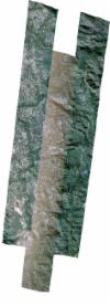
Static Map Catalogue - Full Metadata Record
Collection SkySat
SkySat ESA Archive. More details.
SSC_OPER_SSC_DEF_CO_20210608T130719_S13-494_W047-289_01
Download Product | BrowsePath | W047 |
Row | S13 |
Start Date | 2021-06-08T13:07:19Z |
Stop Date | 2021-06-08T13:07:19Z |
Availability Time | 2021-06-08T13:07:19Z |
Platform Short Name | SkySat |
Instrument Short Name | SkySat Camera |
Sensor Type | OPTICAL |
Operational mode | CAMERA |
Resolution | 0.5 |
Orbit Number | 0 |
Orbit Direction | |
Illumination Azimuth Angle | 39.4 |
Illumination Elevation Angle | 43.1 |
Across Track Incidence Angle | 26.7 |
Footprint | -13.599155422 -47.2944257527 -13.5916234923 -47.2931458089 -13.5915819184 -47.2932855548 -13.58335207 -47.292062147 -13.5833334929 -47.292124494 -13.5832543466 -47.2921129117 -13.5832547216 -47.2921116622 -13.5831865269 -47.292102987 -13.5788766286 -47.2914722761 -13.5820839129 -47.2724198405 -13.5726890933 -47.2709007554 -13.5726770276 -47.2709573113 -13.5645243033 -47.2697017359 -13.5645241268 -47.2697025721 -13.5567878214 -47.2684062821 -13.5567675135 -47.2684876789 -13.5566005662 -47.2684598674 -13.5566191538 -47.2683868438 -13.5485455374 -47.2671131689 -13.5485525869 -47.2670881767 -13.5470570877 -47.2668783546 -13.5469878538 -47.2668674324 -13.5469875126 -47.266868593 -13.5394857342 -47.2658160755 -13.5395042537 -47.2657516405 -13.5308441285 -47.2644781999 -13.5308808012 -47.2643536144 -13.5218588519 -47.263145526 -13.5218855079 -47.2630564058 -13.5136191871 -47.2616917481 -13.5136388872 -47.2616300918 -13.5044228054 -47.2604173096 -13.5044282077 -47.2603991799 -13.4936574322 -47.2589789436 -13.4936563836 -47.2589823881 -13.484984419 -47.2576482169 -13.4849674799 -47.2577022512 -13.4769220865 -47.2566797763 -13.4769394142 -47.2566222656 -13.4656156151 -47.2552271821 -13.4656005587 -47.2552850199 -13.4575097342 -47.2539004384 -13.4574512962 -47.2541176174 -13.447105084 -47.2529708463 -13.4396791173 -47.2515009833 -13.4396298072 -47.2516659635 -13.4334279314 -47.250656104 -13.433491608 -47.2504394837 -13.4220396544 -47.249091358 -13.4160557443 -47.247955863 -13.4160833989 -47.2478720543 -13.4096514382 -47.2468815934 -13.4096979799 -47.2467518161 -13.3980902677 -47.2452117978 -13.3904051165 -47.2684691988 -13.4013360859 -47.2700682186 -13.4013577727 -47.2700077469 -13.4062449265 -47.2707317432 -13.4062443347 -47.2707335132 -13.4063050887 -47.2707406558 -13.4084333502 -47.2710559423 -13.4084540213 -47.2709932972 -13.4182294643 -47.2721425569 -13.418242629 -47.2720848136 -13.4249371542 -47.2731338982 -13.4200908704 -47.2907792656 -13.4115435718 -47.2895522451 -13.4115198533 -47.2896512221 -13.402587408 -47.2883744637 -13.402569378 -47.2884490028 -13.3955619906 -47.2873642154 -13.388393264 -47.2859246578 -13.3809112285 -47.3092706013 -13.3919671586 -47.310841051 -13.3919896391 -47.3107503692 -13.3990561315 -47.3117535146 -13.3990915434 -47.3116073575 -13.4079797905 -47.3128700666 -13.4080218726 -47.3126967204 -13.4170476277 -47.3139494676 -13.4170853034 -47.3137889934 -13.4260674894 -47.3150286493 -13.4261020183 -47.3148783171 -13.434923551 -47.3161183781 -13.4349689873 -47.3159186826 -13.4436991122 -47.3171836135 -13.4437431051 -47.3169918387 -13.4524523007 -47.318233486 -13.4524963255 -47.3180440993 -13.4612179133 -47.3192916642 -13.4612586127 -47.3191177886 -13.4700580257 -47.3203799074 -13.4700936769 -47.3202280889 -13.4795963462 -47.3215502421 -13.4796254092 -47.3214263557 -13.488749589 -47.3226339559 -13.4887797142 -47.3224945269 -13.4975506091 -47.3238138986 -13.4975750225 -47.3237050984 -13.5064381285 -47.3249907002 -13.5064605369 -47.3248901904 -13.5157549199 -47.3260964693 -13.515763151 -47.3260573082 -13.524465512 -47.3273694645 -13.5244825369 -47.3272934417 -13.5340870043 -47.3284544864 -13.5341007477 -47.3283846256 -13.5395520999 -47.3291542412 -13.5441273345 -47.3298501113 -13.5441664055 -47.3296607326 -13.5525730788 -47.330910236 -13.5526098154 -47.3307288968 -13.5615143886 -47.3318059256 -13.5615379287 -47.331675891 -13.5698417233 -47.332845655 -13.5732678861 -47.3140321093 -13.5765388494 -47.3144928442 -13.5765399206 -47.3144892743 -13.5782779365 -47.3147383104 -13.5783064158 -47.3146432349 -13.586634112 -47.3157968952 -13.5866684426 -47.3156782035 -13.5952737845 -47.3167439941 -13.5953060042 -47.3166156231 -13.6041606305 -47.3176145022 -13.6084380375 -47.2959226159 -13.5991617147 -47.2944007143 -13.599155422 -47.2944257527 |
Scene Centre | -13.4946784348 -47.2890287264 |
Size | 12278699938 |
Product type | SSC_DEF_CO |
Acquisition Type | NOMINAL |
Cloud-Cover Percentage | 0 |
Original Name | 20210608_130719_ssc13_u0001_SkySatCollect |
Bounding Box | -13.3809112285 -47.332845655 -13.6084380375 -47.332845655 -13.6084380375 -47.2452117978 -13.3809112285 -47.2452117978 |
