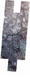
Static Map Catalogue - Full Metadata Record
Collection SkySat
SkySat ESA Archive. More details.
SSC_OPER_SSC_DEF_CO_20210607T130838_S13-521_W047-359_01
Download Product | BrowsePath | W047 |
Row | S13 |
Start Date | 2021-06-07T13:08:38Z |
Stop Date | 2021-06-07T13:08:38Z |
Availability Time | 2021-06-07T13:08:38Z |
Platform Short Name | SkySat |
Instrument Short Name | SkySat Camera |
Sensor Type | OPTICAL |
Operational mode | CAMERA |
Resolution | 0.5 |
Orbit Number | 0 |
Orbit Direction | |
Illumination Azimuth Angle | 39.2 |
Illumination Elevation Angle | 43.3 |
Across Track Incidence Angle | 2.8 |
Footprint | -13.5937288272 -47.3575897186 -13.593736402 -47.3575191511 -13.586497356 -47.3568819631 -13.5865104712 -47.3567315878 -13.579674037 -47.3561059285 -13.5796786826 -47.356046329 -13.5745671142 -47.355571317 -13.5761469557 -47.3388218543 -13.56917993 -47.3382113915 -13.5691856697 -47.3381461158 -13.5624109744 -47.3375225687 -13.5624239391 -47.3373703305 -13.5557607902 -47.3367510815 -13.5557667035 -47.3366875869 -13.5478038959 -47.3359657587 -13.5477922926 -47.3360840388 -13.5411549596 -47.3354834503 -13.5411368033 -47.3356833705 -13.5345278948 -47.3350909051 -13.5345180348 -47.33520615 -13.5278884154 -47.3346011298 -13.5278858674 -47.3346309379 -13.5222906383 -47.3341261261 -13.5222949807 -47.33407487 -13.5154196905 -47.3334576607 -13.5154293593 -47.3333431287 -13.5085458964 -47.3327044943 -13.508560093 -47.3325411984 -13.5016145589 -47.3319120441 -13.5016324668 -47.331706765 -13.4947131132 -47.3310808256 -13.4947320572 -47.3308641773 -13.4879766981 -47.3302766821 -13.4879825373 -47.3302092925 -13.4800548573 -47.3294682856 -13.4800506108 -47.3295167935 -13.4734581258 -47.3289098877 -13.473457658 -47.3289152353 -13.4681563406 -47.3284312162 -13.4681606913 -47.3283811008 -13.4614652993 -47.3277692143 -13.4614724852 -47.3276863099 -13.4547378886 -47.3270817012 -13.4547464021 -47.3269835504 -13.4468016094 -47.3262621544 -13.4451456429 -47.345507686 -13.4518644877 -47.3461102593 -13.4518566216 -47.3462004126 -13.4585486719 -47.3468102397 -13.4585420709 -47.3468859322 -13.4651827733 -47.3474922355 -13.4651788725 -47.3475368402 -13.4706886243 -47.3480404801 -13.4694239634 -47.3627232109 -13.465561048 -47.3623673196 -13.4655647509 -47.3623249887 -13.4588773977 -47.3617125117 -13.4588835543 -47.361642091 -13.4521529101 -47.3610265646 -13.4521602417 -47.3609410775 -13.4442012977 -47.36021145 -13.4425678353 -47.3795275175 -13.4492826719 -47.3801431771 -13.4492756731 -47.3802249413 -13.4559253808 -47.3808267361 -13.455920289 -47.3808848186 -13.4625559988 -47.3815015021 -13.4625532071 -47.381533337 -13.4705130114 -47.3822735982 -13.4705148093 -47.3822530279 -13.4770975885 -47.3828622016 -13.4771028638 -47.3828021337 -13.482469585 -47.3832989768 -13.4824647912 -47.3833531696 -13.4893780069 -47.3839962327 -13.4893597238 -47.3842027137 -13.4963046207 -47.3848493566 -13.4962869786 -47.3850493529 -13.5032009997 -47.3856943626 -13.503187119 -47.3858517511 -13.5100542204 -47.3864912889 -13.5100444266 -47.3866020434 -13.5168471859 -47.3872363833 -13.5168428144 -47.3872852265 -13.5248198646 -47.3880289315 -13.5248222222 -47.3880023006 -13.5315372591 -47.3886300153 -13.5315473918 -47.3885163257 -13.53813694 -47.3891335345 -13.5381544216 -47.3889399077 -13.5447858485 -47.389559045 -13.5447956985 -47.3894491419 -13.5502398384 -47.3899582724 -13.550233619 -47.3900290405 -13.5571257715 -47.3906747792 -13.5571139736 -47.3908387163 -13.5639237106 -47.3914754652 -13.5639182592 -47.3915568086 -13.5719573839 -47.3923094538 -13.5731510613 -47.374902013 -13.5770013233 -47.3752456879 -13.5769950091 -47.3753263088 -13.5837745169 -47.3759447775 -13.5837602423 -47.3761171508 -13.5905187463 -47.3767303232 -13.5905092299 -47.3768198431 -13.5985199976 -47.3775462889 -13.6006721038 -47.3582203968 -13.5937288272 -47.3575897186 |
Scene Centre | -13.5216221331 -47.3592858041 |
Size | 11271091826 |
Product type | SSC_DEF_CO |
Acquisition Type | NOMINAL |
Cloud-Cover Percentage | 0 |
Original Name | 20210607_130838_ssc4_u0001_SkySatCollect |
Bounding Box | -13.4425678353 -47.3923094538 -13.6006721038 -47.3923094538 -13.6006721038 -47.3262621544 -13.4425678353 -47.3262621544 |
