Static Map Catalogue - Full Metadata Record
Collection SkySat
SkySat ESA Archive. More details.
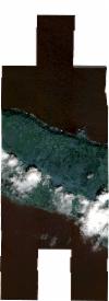
SSC_OPER_SSC_DEF_CO_20200410T130826_N38-666_W028-073_01
Download Product | BrowsePath | W028 |
Row | N38 |
Start Date | 2020-04-10T13:08:26Z |
Stop Date | 2020-04-10T13:08:26Z |
Availability Time | 2020-04-10T13:08:26Z |
Platform Short Name | SkySat |
Instrument Short Name | SkySat Camera |
Sensor Type | OPTICAL |
Operational mode | CAMERA |
Resolution | 0.5 |
Orbit Number | 0 |
Orbit Direction | |
Illumination Azimuth Angle | 158.7 |
Illumination Elevation Angle | 58 |
Across Track Incidence Angle | 3.4 |
Footprint | 38.5808970993 -28.0295096545 38.5896278319 -28.0295114634 38.5896276166 -28.030126806 38.5977563336 -28.0301286729 38.5977595507 -28.0295173845 38.6076677371 -28.0295286028 38.6076676464 -28.029554975 38.6162475488 -28.0294019474 38.6162475429 -28.0294832373 38.6249248575 -28.0293714716 38.6249248931 -28.0294661715 38.6335995076 -28.0293455345 38.6335993416 -28.0295027469 38.642209939 -28.0296274956 38.6422096036 -28.0297837834 38.650714112 -28.0298863093 38.6507137753 -28.0300359157 38.6596458463 -28.0301677254 38.6596456586 -28.0302789439 38.6685549696 -28.0304612096 38.6685549046 -28.0304930413 38.677435014 -28.0306858697 38.6774349629 -28.0307627372 38.6863386266 -28.0308295325 38.6863386173 -28.0308436776 38.6954218684 -28.0308931109 38.6954201302 -28.0317183244 38.7037902239 -28.0326231814 38.7037732106 -28.0335984205 38.712078808 -28.0327763973 38.712078035 -28.0331045847 38.7205561873 -28.0322664002 38.7205546844 -28.0328439221 38.7293669533 -28.0319716458 38.7292944987 -28.0587146033 38.7203964963 -28.0595934888 38.7203981815 -28.0590100125 38.7133613825 -28.0597042194 38.717147945 -28.0597952761 38.717146928 -28.0596869822 38.7257121215 -28.0597477391 38.7257112917 -28.0596448594 38.7344251798 -28.0596948525 38.7344241407 -28.0595501938 38.7431751065 -28.0596026651 38.7431796602 -28.0586257518 38.7519877422 -28.0590015026 38.7519909199 -28.0583364203 38.7623583516 -28.0587777944 38.762214286 -28.0896220994 38.753408489 -28.0892489251 38.7534055106 -28.0899034929 38.7449312243 -28.0895433785 38.7449373938 -28.0903938973 38.7360825902 -28.0901873108 38.7360835449 -28.0903121551 38.7299064024 -28.0901736549 38.7298046991 -28.1176455329 38.7210046364 -28.117580272 38.7210034397 -28.1179140013 38.712551784 -28.1178501572 38.7125493606 -28.1183962529 38.7038684857 -28.1183166534 38.7038680891 -28.1184122961 38.6952901433 -28.1183206573 38.6952899716 -28.1184004885 38.6852889207 -28.1178494048 38.6852890126 -28.1178228903 38.6763364625 -28.1176475778 38.6763367176 -28.1175732368 38.667474821 -28.1174335658 38.6674750233 -28.1173733503 38.6586207067 -28.1175026581 38.6586211002 -28.1173980509 38.6497413806 -28.1176174938 38.6497419854 -28.117456141 38.6408295236 -28.1176204357 38.6408299843 -28.1174505554 38.6323332357 -28.1174729506 38.6323337211 -28.1173052065 38.6237363867 -28.1172909958 38.6237369169 -28.1171525437 38.6150178314 -28.1171693201 38.6150197893 -28.1167241351 38.6076294092 -28.1167633948 38.6076293462 -28.116805306 38.5987699149 -28.1168516067 38.5987691506 -28.1173866941 38.5887189339 -28.1174388172 38.5887199253 -28.1167605014 38.5796523182 -28.1168072851 38.5796524464 -28.1167132554 38.5709286153 -28.1167577871 38.5709663988 -28.0864179107 38.5810181949 -28.0863632406 38.5810180795 -28.0864555668 38.5897439696 -28.0864079743 38.5897430725 -28.0870832498 38.5976262604 -28.0870403803 38.5976270722 -28.0865034998 38.6034699571 -28.0864712633 38.6035339053 -28.0596521082 38.5986885564 -28.0596241008 38.5986882661 -28.0602683764 38.5887475983 -28.0602601117 38.5887479815 -28.0596458298 38.5796754103 -28.0596383055 38.5796754283 -28.0596043487 38.5709455718 -28.0595970847 38.5709585598 -28.0294717889 38.5808971091 -28.0294739064 38.5808970993 -28.0295096545 |
Scene Centre | 38.6666519263 -28.0738789153 |
Size | 6653748692 |
Product type | SSC_DEF_CO |
Acquisition Type | NOMINAL |
Cloud-Cover Percentage | 0.11 |
Original Name | 20200410_130826_ss01_u0001_SkySatCollect |
Bounding Box | 38.7623583516 -28.1184122961 38.5709286153 -28.1184122961 38.5709286153 -28.0293455345 38.7623583516 -28.0293455345 |
