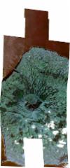
Static Map Catalogue - Full Metadata Record
Collection SkySat
SkySat ESA Archive. More details.
SSC_OPER_SSC_DEF_CO_20191022T125048_N38-605_W028-711_01
Download Product | BrowsePath | W028 |
Row | N38 |
Start Date | 2019-10-22T12:50:48Z |
Stop Date | 2019-10-22T12:50:48Z |
Availability Time | 2019-10-22T12:50:48Z |
Platform Short Name | SkySat |
Instrument Short Name | SkySat Camera |
Sensor Type | OPTICAL |
Operational mode | CAMERA |
Resolution | 0.5 |
Orbit Number | 0 |
Orbit Direction | |
Illumination Azimuth Angle | 164.6 |
Illumination Elevation Angle | 39.1 |
Across Track Incidence Angle | 24.7 |
Footprint | 38.5275710925 -28.6651797781 38.5355799748 -28.6654674932 38.5355878862 -28.6658225878 38.5436471419 -28.666044377 38.543664214 -28.6666599497 38.5517297607 -28.6669594539 38.5517417941 -28.6673285751 38.5597761836 -28.6674774974 38.5597849064 -28.6677064262 38.5678711263 -28.6682397085 38.5678756704 -28.6683496636 38.5759275115 -28.6683854689 38.5759335393 -28.6685113953 38.583925086 -28.6683020925 38.5839350898 -28.6684870088 38.5923386432 -28.6684212748 38.5923424594 -28.6684889907 38.6006652925 -28.6684582958 38.6006722539 -28.6685804067 38.6087884227 -28.6677267473 38.6087982916 -28.6678827931 38.6168650424 -28.6669483125 38.6168758775 -28.6671121107 38.6250404595 -28.6665018685 38.6250459082 -28.6665795387 38.6316240383 -28.6661249052 38.6316235755 -28.6661190013 38.6317400155 -28.6661168897 38.6332014123 -28.6660158883 38.6332068279 -28.666090289 38.6414999716 -28.6659398925 38.6415016839 -28.6659635683 38.6499784302 -28.6657915529 38.6500092754 -28.6662050813 38.6583817802 -28.666148303 38.6606870132 -28.6942809379 38.6649350667 -28.6942555604 38.6649377539 -28.6942975909 38.6734617774 -28.6942537011 38.6735453245 -28.695478756 38.6817879124 -28.6953960728 38.6817959239 -28.6955080077 38.690455393 -28.6954218268 38.6928664796 -28.7274659111 38.6829918391 -28.7275765451 38.6829830871 -28.7274612411 38.6742435881 -28.7275591787 38.6741368799 -28.7260819212 38.665800303 -28.726210303 38.665797454 -28.7261686238 38.6626093111 -28.7262156969 38.6647103108 -28.7545415519 38.6547005852 -28.7546156788 38.6546930947 -28.754517704 38.6459813008 -28.7545963917 38.6459806902 -28.7545881149 38.6373436334 -28.7546695514 38.6373410183 -28.7546287093 38.6287301799 -28.7547294299 38.6287288936 -28.7547064637 38.6214092561 -28.754790946 38.6214214793 -28.7550476621 38.611554417 -28.7550483521 38.6115488521 -28.7549161252 38.6041637611 -28.7560743812 38.6041656691 -28.7561290531 38.6033039541 -28.7562092308 38.6031500143 -28.7562333743 38.6031496476 -28.7562235882 38.5947615292 -28.7570040555 38.5947609768 -28.7569881549 38.5872173683 -28.7576627573 38.5872201022 -28.7577553425 38.5863286467 -28.7577422331 38.5862897374 -28.7577457126 38.5862896082 -28.757741659 38.5788039198 -28.757631577 38.5788047388 -28.7576638946 38.5782072538 -28.7576228026 38.5775209429 -28.75761271 38.5775199613 -28.7575755341 38.5690361522 -28.756992061 38.5690359707 -28.7569847954 38.5619461992 -28.7567380372 38.5619477762 -28.7568034748 38.5613213742 -28.7567162902 38.560631683 -28.7566922857 38.560629714 -28.7566200228 38.5521228953 -28.7554360177 38.5521226451 -28.7554255744 38.5437644604 -28.7553430413 38.5437597183 -28.7551314589 38.5354337737 -28.7552539473 38.5354310223 -28.7551196141 38.5270467296 -28.7552458039 38.5270447865 -28.7551397321 38.5186655758 -28.7552943548 38.5181683059 -28.7226576373 38.5278678661 -28.7231957272 38.5278711781 -28.7234290992 38.5361721376 -28.7242148797 38.5361744744 -28.7243642668 38.5445005038 -28.7249608116 38.5445045922 -28.7251790559 38.5481251122 -28.7254766723 38.5478272171 -28.7007528815 38.543051588 -28.700177026 38.5430430138 -28.6999076345 38.5348410268 -28.6992673795 38.5348328956 -28.6989673981 38.5266072404 -28.6985269136 38.5266022227 -28.6982983373 38.5183896356 -28.6976593489 38.5178322601 -28.6646692361 38.5275652975 -28.664836987 38.5275710925 -28.6651797781 |
Scene Centre | 38.6053585874 -28.7112122893 |
Size | 7521817866 |
Product type | SSC_DEF_CO |
Acquisition Type | NOMINAL |
Cloud-Cover Percentage | 0.02 |
Original Name | 20191022_125048_ssc13_u0001_SkySatCollect |
Bounding Box | 38.6928664796 -28.7577553425 38.5178322601 -28.7577553425 38.5178322601 -28.6646692361 38.6928664796 -28.6646692361 |
