Static Map Catalogue - Full Metadata Record
Collection SkySat
SkySat ESA Archive. More details.
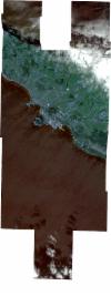
SSC_OPER_SSC_DEF_CO_20180929T151747_N38-670_W028-208_01
Download Product | BrowsePath | W028 |
Row | N38 |
Start Date | 2018-09-29T15:17:47Z |
Stop Date | 2018-09-29T15:17:47Z |
Availability Time | 2018-09-29T15:17:47Z |
Platform Short Name | SkySat |
Instrument Short Name | SkySat Camera |
Sensor Type | OPTICAL |
Operational mode | CAMERA |
Resolution | 0.5 |
Orbit Number | 0 |
Orbit Direction | |
Illumination Azimuth Angle | 213.5 |
Illumination Elevation Angle | 43.4 |
Across Track Incidence Angle | 12 |
Footprint | 38.6002425464 -28.1945771493 38.6066939454 -28.1945531837 38.6066931966 -28.1944854267 38.6143877118 -28.1944569513 38.6143874984 -28.1944368036 38.6190461377 -28.1944196085 38.6187183298 -28.1699686002 38.6277010351 -28.1699189977 38.6277014609 -28.1699496415 38.6341467679 -28.1699140788 38.6341460016 -28.1698529017 38.6431253467 -28.1698036244 38.6431414804 -28.1710432026 38.6489885418 -28.1710663317 38.6489885075 -28.1710602337 38.6568714774 -28.1710822271 38.6568713706 -28.17106211 38.664597899 -28.1708432488 38.6645975473 -28.1707923569 38.6734440782 -28.170128117 38.6734457484 -28.170245955 38.6798056456 -28.1699539027 38.6798044497 -28.1698500986 38.6874583038 -28.1696489501 38.6874570161 -28.1695387183 38.6951164796 -28.1694366006 38.6951161546 -28.1694082596 38.6959678749 -28.1694252496 38.6963955757 -28.1694195474 38.69639576 -28.169433785 38.7028351186 -28.1695622364 38.7028350736 -28.1695574026 38.7028881524 -28.1695632943 38.7041248069 -28.1695879629 38.704125972 -28.1697006914 38.7106584164 -28.1704257879 38.7106579114 -28.1702393869 38.7182860692 -28.1705152918 38.718272871 -28.1685985547 38.727783425 -28.1688847406 38.7277819224 -28.1697286443 38.7351130982 -28.1696903282 38.7351137086 -28.1697735084 38.7427518871 -28.1697338069 38.7427521405 -28.1697708913 38.7503851676 -28.1697314047 38.7505613229 -28.1975807572 38.7415724942 -28.1976228486 38.7415722258 -28.197576699 38.733954041 -28.1976124228 38.7339534597 -28.1975205324 38.7277323861 -28.1975497715 38.7277302659 -28.1987405251 38.7226687163 -28.1983687588 38.72255267 -28.2192851254 38.725934647 -28.2197017213 38.725934495 -28.2195738823 38.7350386674 -28.2200790167 38.7350387068 -28.2201436807 38.7414104273 -28.2201377946 38.7414022438 -28.2189352366 38.7503933267 -28.2188736716 38.7505869526 -28.246781838 38.7428503277 -28.2468310855 38.7428570011 -28.2481236393 38.7350550543 -28.2470001654 38.7350551624 -28.247177723 38.7259669029 -28.2468346498 38.7259668745 -28.2468107597 38.7184066484 -28.2470311617 38.7184063799 -28.2469971773 38.7112334541 -28.2472524363 38.7046878574 -28.2476411144 38.7046887549 -28.2477179045 38.7033894968 -28.2477182111 38.7033173449 -28.2477224955 38.7033172996 -28.2477182282 38.6956984594 -28.2477200261 38.6956984283 -28.2477168454 38.6894453313 -28.2477378471 38.6894454341 -28.2477478239 38.6818234614 -28.2477919347 38.681823518 -28.2477957334 38.6728214302 -28.2478731749 38.6728017172 -28.2464505645 38.6654545794 -28.2464952681 38.6654539644 -28.2464427444 38.6578034905 -28.2464890582 38.6578024371 -28.2464025326 38.6501665191 -28.246448533 38.6501658736 -28.2463974464 38.6425072666 -28.2464433626 38.6425070659 -28.2464280313 38.6361340589 -28.2464660806 38.6361345251 -28.2464991191 38.6271351697 -28.2465526635 38.6271343577 -28.2464946609 38.619479261 -28.2465398535 38.6191270123 -28.2221350705 38.6159732338 -28.2221446528 38.6159734113 -28.2221600887 38.6082540874 -28.2221834804 38.6082548476 -28.2222470647 38.5992801141 -28.2222766644 38.599279785 -28.2222481049 38.5916092748 -28.2222710958 38.5912786479 -28.1945881238 38.6002422411 -28.1945525552 38.6002425464 -28.1945771493 |
Scene Centre | 38.6709395313 -28.208361097 |
Size | 7020364444 |
Product type | SSC_DEF_CO |
Acquisition Type | NOMINAL |
Cloud-Cover Percentage | 0.09 |
Original Name | 20180929_151747_ssc10_u0001_SkySatCollect |
Bounding Box | 38.7505869526 -28.2481236393 38.5912786479 -28.2481236393 38.5912786479 -28.1685985547 38.7505869526 -28.1685985547 |
