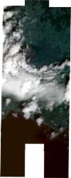
Static Map Catalogue - Full Metadata Record
Collection SkySat
SkySat ESA Archive. More details.
SSC_OPER_SSC_DEF_CO_20180921T123044_N38-447_W028-391_01
Download Product | BrowsePath | W028 |
Row | N38 |
Start Date | 2018-09-21T12:30:44Z |
Stop Date | 2018-09-21T12:30:44Z |
Availability Time | 2018-09-21T12:30:44Z |
Platform Short Name | SkySat |
Instrument Short Name | SkySat Camera |
Sensor Type | OPTICAL |
Operational mode | CAMERA |
Resolution | 0.5 |
Orbit Number | 0 |
Orbit Direction | |
Illumination Azimuth Angle | 150.8 |
Illumination Elevation Angle | 48.4 |
Across Track Incidence Angle | 11.2 |
Footprint | 38.3718402376 -28.3537061572 38.3718402838 -28.3537011888 38.379530774 -28.3537713472 38.3795311717 -28.3537274204 38.3871963429 -28.3537975699 38.3871969201 -28.3537321823 38.3946845157 -28.3538009937 38.3946861108 -28.3536352973 38.402682977 -28.3537946044 38.4026837489 -28.3537111799 38.4104907016 -28.3539050966 38.4104914522 -28.3538202752 38.4179757413 -28.3539198778 38.4179759979 -28.3538470423 38.4252263162 -28.3539530223 38.4252261196 -28.3538701525 38.4326000947 -28.3539408412 38.4326004507 -28.3538662241 38.4399925677 -28.3539282563 38.4399934024 -28.3538589027 38.4475047371 -28.3539351891 38.4475075585 -28.3538274646 38.4547816031 -28.3539136001 38.4547860349 -28.35376047 38.462612968 -28.3538374275 38.4626229888 -28.3536439934 38.4701685401 -28.3539972314 38.4701808361 -28.3537220191 38.4778473315 -28.3538858676 38.4778515513 -28.3537676924 38.4856533503 -28.3538873363 38.4856562067 -28.3537702318 38.4934565575 -28.3538788053 38.4934581913 -28.3537701571 38.5013112995 -28.3538611965 38.501312684 -28.3537351941 38.5092458574 -28.3538074739 38.5092468464 -28.3537019548 38.5186956694 -28.3537699754 38.5184612301 -28.3778222536 38.5244326918 -28.3778958839 38.5242108026 -28.4049268604 38.519132179 -28.404875601 38.5190378692 -28.42826149 38.5109091099 -28.4281508516 38.5109078678 -28.428755928 38.501465202 -28.4288944535 38.5014663262 -28.4287262866 38.4937106507 -28.4286670644 38.4936973661 -28.4272114243 38.4870760826 -28.4271119686 38.4870814853 -28.4282765519 38.479070316 -28.428135572 38.479077258 -28.4283837066 38.4711777474 -28.4282519305 38.4711889456 -28.4284211677 38.463462168 -28.4283032324 38.4634702058 -28.42844444 38.4559711553 -28.4283370956 38.4559763204 -28.4285038207 38.4489853595 -28.4284066925 38.4489889791 -28.4288351737 38.4418756108 -28.4286845079 38.4418758287 -28.4288422747 38.4348174361 -28.4286871031 38.4348164749 -28.4288364094 38.4273436113 -28.4287134829 38.4273418967 -28.4288733419 38.41967988 -28.428766167 38.4196783391 -28.4288933676 38.4105363036 -28.4288665545 38.4105368186 -28.4288321239 38.404243985 -28.4287339018 38.4042423525 -28.4289033287 38.3965671005 -28.4287834576 38.3965656789 -28.4289276523 38.3888977437 -28.4288078273 38.3888961635 -28.428964492 38.3812021412 -28.4288442163 38.3812007333 -28.428980574 38.380688484 -28.4289725587 38.3806883687 -28.4289837111 38.3714052024 -28.4288384502 38.371685184 -28.4016928036 38.3721978609 -28.4016997632 38.3721979544 -28.4016906766 38.3798983364 -28.4017952123 38.3798993964 -28.4016898474 38.3875738798 -28.4017940407 38.3875751201 -28.4016679383 38.3952568259 -28.40177231 38.3952579218 -28.401658314 38.4003419267 -28.4017274272 38.4005619831 -28.3813808433 38.394418096 -28.3814749498 38.3944232214 -28.3809425605 38.3885573666 -28.3808806699 38.3885565387 -28.3809718592 38.3808723955 -28.3808909503 38.3808717421 -28.3809610723 38.3803601386 -28.3809556918 38.3803600759 -28.3809624053 38.3710753565 -28.3808647694 38.3713282011 -28.3537014872 38.3718402376 -28.3537061572 |
Scene Centre | 38.4477600559 -28.3913095042 |
Size | 6929382790 |
Product type | SSC_DEF_CO |
Acquisition Type | NOMINAL |
Cloud-Cover Percentage | 0.34 |
Original Name | 20180921_123044_ssc3_u0002_SkySatCollect |
Bounding Box | 38.5244326918 -28.4289837111 38.3710753565 -28.4289837111 38.3710753565 -28.3536352973 38.5244326918 -28.3536352973 |
