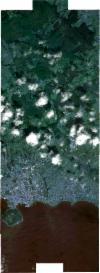
Static Map Catalogue - Full Metadata Record
Collection SkySat
SkySat ESA Archive. More details.
SSC_OPER_SSC_DEF_CO_20180913T122512_N38-692_W027-196_01
Download Product | BrowsePath | W027 |
Row | N38 |
Start Date | 2018-09-13T12:25:12Z |
Stop Date | 2018-09-13T12:25:12Z |
Availability Time | 2018-09-13T12:25:12Z |
Platform Short Name | SkySat |
Instrument Short Name | SkySat Camera |
Sensor Type | OPTICAL |
Operational mode | CAMERA |
Resolution | 0.5 |
Orbit Number | 0 |
Orbit Direction | |
Illumination Azimuth Angle | 147.7 |
Illumination Elevation Angle | 50.6 |
Across Track Incidence Angle | 10.9 |
Footprint | 38.6171967384 -27.206973881 38.617299377 -27.18638591 38.6120875196 -27.186422233 38.6122172487 -27.159399188 38.6199852263 -27.15934777 38.6199853531 -27.1593230044 38.6290007141 -27.1592635193 38.6290000163 -27.1594038703 38.6366998411 -27.1593533086 38.6366996437 -27.1593905212 38.6444419065 -27.1593399272 38.6444407436 -27.159546081 38.6510187725 -27.1595724351 38.6603407039 -27.1593742324 38.6603404282 -27.1593998795 38.668166971 -27.1593338025 38.6681667666 -27.1593546419 38.6759413967 -27.1593269983 38.6759412639 -27.1593490064 38.6821526044 -27.1592983582 38.6821544546 -27.1590007159 38.6913339714 -27.1588874215 38.6913333938 -27.1589505964 38.6992271872 -27.1587955913 38.6992268382 -27.1588372042 38.7069641302 -27.1589141907 38.7069640658 -27.1590075993 38.7147356365 -27.1590435679 38.7147353899 -27.1590985983 38.7224427399 -27.1591195621 38.7224426858 -27.1591353395 38.7301197862 -27.1591518669 38.7301198107 -27.159158289 38.7364208853 -27.1591639273 38.7364207263 -27.1591513154 38.7440825159 -27.1591597047 38.7440801483 -27.1589648785 38.7531460709 -27.1588814068 38.7531468979 -27.1590657335 38.7594757759 -27.1590984061 38.7594756323 -27.1590666947 38.7686177344 -27.1590537142 38.7685449759 -27.1831098533 38.7742512955 -27.1831097171 38.7741434809 -27.2102385389 38.768196344 -27.2101245953 38.767931033 -27.2343353117 38.7589359082 -27.2342979855 38.7589367174 -27.2342539648 38.7513726018 -27.2342233281 38.7513741491 -27.2340995737 38.74346705 -27.2341732261 38.7434671026 -27.2341708634 38.7356980894 -27.2342519499 38.7356985319 -27.234224814 38.727926018 -27.234277893 38.7279273387 -27.2342089832 38.7201639607 -27.2343007802 38.7201648415 -27.2342435971 38.7123878264 -27.2343093669 38.7123887908 -27.2341994241 38.7046476092 -27.2343295563 38.7046489112 -27.2342033083 38.6991660082 -27.234307812 38.6991640396 -27.2347416803 38.6894766805 -27.2345720417 38.6894791373 -27.2341948333 38.6811894415 -27.2343815209 38.6811904597 -27.2342766231 38.6733776767 -27.2344061845 38.6733784023 -27.2343242578 38.6655807919 -27.2344421978 38.6655815091 -27.234360661 38.6577967648 -27.2344783 38.6577973259 -27.2344085378 38.6500447143 -27.2345103951 38.6500451719 -27.2344386183 38.6423224608 -27.2345016646 38.6423227502 -27.2344489878 38.6345764687 -27.2345423833 38.6345794887 -27.234055878 38.6268351993 -27.2340985674 38.6268363689 -27.2339122155 38.6191709824 -27.2339543215 38.619171098 -27.2339348492 38.6114274402 -27.2339771553 38.6115789696 -27.2070026858 38.6171967384 -27.206973881 |
Scene Centre | 38.6928455077 -27.1967686358 |
Size | 8213417749 |
Product type | SSC_DEF_CO |
Acquisition Type | NOMINAL |
Cloud-Cover Percentage | 0.07 |
Original Name | 20180913_122512_ssc4_u0002_SkySatCollect |
Bounding Box | 38.7742512955 -27.2347416803 38.6114274402 -27.2347416803 38.6114274402 -27.1587955913 38.7742512955 -27.1587955913 |
