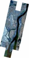
Static Map Catalogue - Full Metadata Record
Collection SkySat
SkySat ESA Archive. More details.
SSC_OPER_SSC_DEF_CO_20201217T014946_N35-154_E128-950_01
Download Product | BrowsePath | E128 |
Row | N35 |
Start Date | 2020-12-17T01:49:46Z |
Stop Date | 2020-12-17T01:49:46Z |
Availability Time | 2020-12-17T01:49:46Z |
Platform Short Name | SkySat |
Instrument Short Name | SkySat Camera |
Sensor Type | OPTICAL |
Operational mode | CAMERA |
Resolution | 0.5 |
Orbit Number | 0 |
Orbit Direction | |
Illumination Azimuth Angle | 156.5 |
Illumination Elevation Angle | 27.7 |
Across Track Incidence Angle | 14.1 |
Footprint | 35.0759156381 128.938354202 35.0814934339 128.939959994 35.0814888778 128.93998271 35.0882897718 128.941951632 35.0882858536 128.941971213 35.093729981 128.943530305 35.089424066 128.964596149 35.0961513661 128.966717357 35.0961356337 128.966793806 35.0973513286 128.967095721 35.0973632756 128.967099488 35.0973634333 128.967098727 35.1034391974 128.968607629 35.11091327 128.971198863 35.110915139 128.971189825 35.116449202 128.973152773 35.1164400109 128.973197536 35.1167896617 128.973273535 35.1175861393 128.973556048 35.1176079388 128.973451393 35.1234341852 128.974717767 35.1234287461 128.974744709 35.131411415 128.977113712 35.1314396551 128.97697481 35.1383288668 128.978803137 35.1383377755 128.978758811 35.1452159816 128.980613069 35.1452466572 128.980459514 35.1521404902 128.982426167 35.1521844762 128.982204916 35.1590836908 128.984172352 35.1591270721 128.983953057 35.166035517 128.985961711 35.1660778465 128.985746922 35.1730073821 128.987720221 35.173034619 128.987581378 35.1799403074 128.989590923 35.1799662787 128.989457939 35.1868725921 128.991431938 35.1868937651 128.991322967 35.1938033287 128.993329706 35.1938181765 128.993252915 35.2006925671 128.995211207 35.2007156742 128.995091141 35.2075472052 128.996969021 35.2075643559 128.996879494 35.2143788318 128.998809352 35.2143892361 128.998754775 35.2211973976 129.000701416 35.2212046663 129.000663091 35.228008326 129.002605497 35.2325322831 128.978649026 35.2245127256 128.976348061 35.2245040195 128.976394389 35.2177169259 128.974474343 35.2177076627 128.97452339 35.2109235679 128.97256296 35.2109038766 128.972666692 35.2066877619 128.971463592 35.2101104092 128.95313611 35.215285831 128.95462388 35.2153050019 128.954523967 35.2220799989 128.956461944 35.2220911404 128.956403614 35.2288634063 128.958337154 35.2288728241 128.958287681 35.2356415963 128.960222831 35.2401075415 128.936733456 35.2321351217 128.933960237 35.232116517 128.934058647 35.2253832624 128.932018898 35.2253679459 128.93209966 35.2186406789 128.930025681 35.2186207694 128.93013019 35.2118674245 128.928191672 35.2118467929 128.928299482 35.2050851296 128.926356 35.2050679818 128.926445183 35.1982466986 128.924490348 35.1982262074 128.924596544 35.1913647299 128.922622728 35.1913405518 128.922747541 35.1844880588 128.920783817 35.1844579466 128.920938682 35.1775987198 128.918971434 35.1775578289 128.919180922 35.1706826837 128.917206366 35.1706369998 128.917439498 35.1637722103 128.915473876 35.1637272135 128.915702427 35.1568853847 128.913737587 35.1568539679 128.913896443 35.1500163735 128.911941154 35.1500034906 128.912006028 35.1444927693 128.910429764 35.1444962582 128.910412397 35.137713847 128.908474778 35.1377297428 128.908395986 35.1309519276 128.906454318 35.1309690864 128.906369644 35.1242105062 128.904438607 35.1242196525 128.904393634 35.1174646774 128.902460999 35.1174697862 128.902435974 35.109387255 128.900126157 35.1093813818 128.90015503 35.1026144988 128.898223334 35.0982689037 128.919492023 35.0943203757 128.918372946 35.0943314009 128.918318226 35.0875433991 128.916394776 35.0875500708 128.916361708 35.0795131728 128.914096708 35.0795100268 128.914112374 35.0727167852 128.912144918 35.0678837667 128.936046278 35.0759138498 128.938363023 35.0759156381 128.938354202 |
Scene Centre | 35.1540068443 128.950414416 |
Size | 13321454237 |
Product type | SSC_DEF_CO |
Acquisition Type | NOMINAL |
Cloud-Cover Percentage | 0 |
Original Name | 20201217_014946_ssc4_u0002_SkySatCollect |
Bounding Box | 35.2401075415 128.898223334 35.0678837667 128.898223334 35.0678837667 129.002605497 35.2401075415 129.002605497 |
