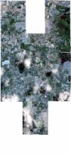
Static Map Catalogue - Full Metadata Record
Collection SkySat
SkySat ESA Archive. More details.
SSC_OPER_SSC_DEF_CO_20210622T034749_N11-471_E104-884_01
Download Product | BrowsePath | E104 |
Row | N11 |
Start Date | 2021-06-22T03:47:49Z |
Stop Date | 2021-06-22T03:47:49Z |
Availability Time | 2021-06-22T03:47:49Z |
Platform Short Name | SkySat |
Instrument Short Name | SkySat Camera |
Sensor Type | OPTICAL |
Operational mode | CAMERA |
Resolution | 0.5 |
Orbit Number | 0 |
Orbit Direction | |
Illumination Azimuth Angle | 53.5 |
Illumination Elevation Angle | 68.6 |
Across Track Incidence Angle | 6.2 |
Footprint | 11.4262415327 104.893802731 11.432973051 104.893912806 11.4329740339 104.893836696 11.4397332366 104.893950283 11.4397339256 104.893899891 11.4464846418 104.894001527 11.4464855523 104.893946175 11.4497212002 104.893999011 11.4494665867 104.910777748 11.4574338354 104.910927426 11.4574352738 104.910829469 11.464183728 104.910957357 11.4641848881 104.910879361 11.4709477546 104.911012803 11.4709489493 104.910934473 11.4777034621 104.911062896 11.4777054036 104.910940282 11.4844261151 104.911073785 11.4844291362 104.910887561 11.4910965108 104.911017182 11.4911005274 104.910774852 11.4977302651 104.910897228 11.4977343544 104.910657527 11.5043575458 104.910782568 11.5043613084 104.910564073 11.5114556064 104.910686676 11.5114583289 104.910531766 11.5181392685 104.910651671 11.5181415166 104.910527281 11.524865657 104.910644195 11.5252195396 104.891433466 11.5172882454 104.891287124 11.5172860674 104.891404047 11.5105561997 104.891277758 11.5105534038 104.891432092 11.5038585512 104.891305213 11.503854791 104.8915181 11.5005426533 104.891457371 11.5007767683 104.877260696 11.5041553703 104.877314007 11.5041579035 104.877126386 11.5112680311 104.877239579 11.5112699001 104.877106053 11.5179700155 104.877208218 11.5179713828 104.877115762 11.5247074002 104.87722112 11.5250030082 104.858074863 11.5170771092 104.857940477 11.517075584 104.858038127 11.5103222023 104.857925165 11.5103202667 104.858056238 11.5036014094 104.857943 11.5035986681 104.858138068 11.4964935456 104.858017198 11.496490495 104.85822939 11.4898515232 104.858116845 11.4898486112 104.858324962 11.4832016492 104.858215761 11.4831995626 104.858368584 11.4765065749 104.858252244 11.4765053117 104.858346667 11.4697554565 104.858235059 11.4697549786 104.858272204 11.4629816927 104.858177602 11.4629812161 104.858211807 11.456198438 104.858097815 11.4561975845 104.85816459 11.449453955 104.858058615 11.4492405418 104.874789338 11.4456640212 104.874733734 11.4456628854 104.874799816 11.4389052894 104.874714227 11.4389050614 104.874727491 11.4320675733 104.874626421 11.4320668391 104.874678709 11.4252783662 104.874567075 11.425277111 104.874664695 11.4185216973 104.874550419 11.4182954251 104.893791919 11.426240196 104.89391447 11.4262415327 104.893802731 |
Scene Centre | 11.4717586835 104.884499475 |
Size | 7829595999 |
Product type | SSC_DEF_CO |
Acquisition Type | NOMINAL |
Cloud-Cover Percentage | 0.09 |
Original Name | 20210622_034749_ssc1_u0002_SkySatCollect |
Bounding Box | 11.5252195396 104.857925165 11.4182954251 104.857925165 11.4182954251 104.911073785 11.5252195396 104.911073785 |
