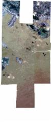
Static Map Catalogue - Full Metadata Record
Collection SkySat
SkySat ESA Archive. More details.
SSC_OPER_SSC_DEF_CO_20190206T032945_N01-210_E103-806_01
Download Product | BrowsePath | E103 |
Row | N01 |
Start Date | 2019-02-06T03:29:45Z |
Stop Date | 2019-02-06T03:29:45Z |
Availability Time | 2019-02-06T03:29:45Z |
Platform Short Name | SkySat |
Instrument Short Name | SkySat Camera |
Sensor Type | OPTICAL |
Operational mode | CAMERA |
Resolution | 0.5 |
Orbit Number | 0 |
Orbit Direction | |
Illumination Azimuth Angle | 123.3 |
Illumination Elevation Angle | 58.2 |
Across Track Incidence Angle | 15 |
Footprint | 1.13698351151 103.819521222 1.14554949317 103.819489718 1.14554931344 103.819513704 1.15710246289 103.819488085 1.15710359744 103.81936503 1.16175282044 103.819285455 1.16177428416 103.843535657 1.17291019393 103.843213608 1.17291009279 103.843139907 1.18225775805 103.843070666 1.18225785563 103.843039938 1.19147531581 103.842998985 1.19147601446 103.842914756 1.20066346251 103.843049702 1.2006677199 103.842778836 1.20992397114 103.842960273 1.2099281201 103.842773168 1.21914723009 103.842932985 1.21975237101 103.819434758 1.22013146854 103.819438026 1.22058792577 103.843695718 1.23230185896 103.843960299 1.23227313604 103.842736821 1.23763150708 103.842783709 1.23763231951 103.842749899 1.24574953714 103.842815897 1.24574726444 103.842887891 1.25509144694 103.842980864 1.25508536475 103.843149569 1.26448171894 103.843217372 1.26447687115 103.843343361 1.27386101803 103.843402597 1.2738572759 103.843489195 1.28314272269 103.843579908 1.28313590086 103.843732632 1.29401936288 103.843831146 1.29517630707 103.817473912 1.28579650146 103.817396829 1.28580242891 103.817252734 1.27636267294 103.81712957 1.27636519572 103.817064269 1.26684205214 103.817010499 1.26684676884 103.816876144 1.2610193117 103.816812335 1.26192351391 103.796771272 1.26552457569 103.796801314 1.2655192356 103.796940059 1.27503782096 103.797005532 1.2750342453 103.797093322 1.28448646242 103.797165501 1.28448161157 103.797280697 1.29534430837 103.797418342 1.29646704107 103.771235187 1.2869274357 103.77118563 1.28693308034 103.771043103 1.27734296581 103.770948127 1.27734596352 103.770867852 1.26771291233 103.770775062 1.26771763038 103.770639102 1.25810162627 103.770529003 1.25810737983 103.770350526 1.24811243525 103.770215254 1.24811467803 103.770151712 1.23872460562 103.770075622 1.23872544119 103.770047772 1.22802758305 103.769942478 1.22802482465 103.770034854 1.2186030629 103.769933695 1.21859998831 103.770058444 1.21047760533 103.769998836 1.21047880542 103.7699248 1.19961691647 103.769861635 1.1996147708 103.770001509 1.19140460626 103.769879172 1.19140524526 103.769814652 1.1818035528 103.76965383 1.18180395253 103.769592283 1.1721476996 103.769052091 1.17214764653 103.768950514 1.15968382905 103.768242521 1.1608610668 103.792394797 1.15593810042 103.792235082 1.15593704636 103.792310596 1.14726695988 103.792058908 1.14726699783 103.792047852 1.13696721 103.791599437 1.13696717047 103.791531725 1.12472069746 103.790973113 1.12478236414 103.819574851 1.13698352317 103.81954118 1.13698351151 103.819521222 |
Scene Centre | 1.21059413346 103.80610141 |
Size | 9609750983 |
Product type | SSC_DEF_CO |
Acquisition Type | NOMINAL |
Cloud-Cover Percentage | 0.02 |
Original Name | 20190206_032945_ssc12_u0001_SkySatCollect |
Bounding Box | 1.29646704107 103.768242521 1.12472069746 103.768242521 1.12472069746 103.843960299 1.29646704107 103.843960299 |
