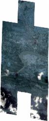
Static Map Catalogue - Full Metadata Record
Collection SkySat
SkySat ESA Archive. More details.
SSC_OPER_SSC_DEF_CO_20230730T091308_N33-776_E072-080_01
Download Product | BrowsePath | E072 |
Row | N33 |
Start Date | 2023-07-30T09:13:08Z |
Stop Date | 2023-07-30T09:13:08Z |
Availability Time | 2023-07-30T09:13:08Z |
Platform Short Name | SkySat |
Instrument Short Name | SkySat Camera |
Sensor Type | OPTICAL |
Operational mode | CAMERA |
Resolution | 0.5 |
Orbit Number | 0 |
Orbit Direction | |
Illumination Azimuth Angle | 246.5 |
Illumination Elevation Angle | 60.2 |
Across Track Incidence Angle | 28.5 |
Footprint | 33.7039230598 72.119098762 33.7039215089 72.119112606 33.7145656897 72.1189435914 33.7145701775 72.1189063895 33.7233689147 72.1190588718 33.7313865162 72.1196229784 33.7314051627 72.1194601813 33.7397327344 72.1198164866 33.7397733118 72.1195510649 33.7475010742 72.1192592153 33.7474882225 72.1193460157 33.7589351733 72.1185709032 33.7589442973 72.1184940156 33.7678320583 72.118418599 33.76784317 72.1183259349 33.7771721468 72.1179611515 33.7771728628 72.1179544073 33.7857319161 72.1180162695 33.7857439855 72.117912589 33.7944550612 72.1179641424 33.794462527 72.1178939682 33.803132119 72.117954435 33.8031391728 72.1178895547 33.8118755061 72.1178957447 33.8118803772 72.1178516538 33.8205428128 72.117881793 33.8231869484 72.0935317675 33.8282303056 72.0935335267 33.8282275421 72.0935595351 33.8368418251 72.0935500837 33.8368406319 72.0935613457 33.8453778362 72.0935941537 33.8453762594 72.0936092563 33.8552430547 72.0937546092 33.8579115694 72.0667103564 33.8497120766 72.0664868578 33.8497184205 72.0664262153 33.8412467846 72.0663699384 33.8412507173 72.066332923 33.8326806264 72.0663384657 33.8326853371 72.0662941675 33.8264322211 72.0663134531 33.8289849722 72.0417085063 33.8204448911 72.0416646411 33.82045157 72.0416052568 33.8118270921 72.0416189474 33.8118349674 72.0415491303 33.8032108286 72.0415395227 33.8032147322 72.041505046 33.7946057516 72.0415221516 33.7946145527 72.0414402118 33.7858804695 72.0415627426 33.7858896686 72.0414745029 33.7769815331 72.0416502996 33.7769850341 72.0416184293 33.7683308683 72.041663231 33.7683386892 72.0415989059 33.7594204157 72.0418217882 33.7594268427 72.0417649766 33.7509116946 72.0417226014 33.7509279129 72.0416254813 33.7420594418 72.0419259551 33.7420874143 72.0417327976 33.7336267796 72.0417791596 33.7336534814 72.0415628899 33.7235964499 72.0420340762 33.7236049774 72.041967294 33.7130764444 72.0421446876 33.713071423 72.0421848823 33.7039415287 72.0420533693 33.7010046724 72.0693737226 33.7096389434 72.0696609035 33.7096198437 72.0698137907 33.7200466137 72.0698342237 33.7200676765 72.0696692727 33.7297516533 72.0692568884 33.7341013578 72.0695545045 33.7308746332 72.0920499369 33.7268398829 72.0917257455 33.7268438907 72.0916917385 33.7262914323 72.0916816776 33.7253331543 72.0916046801 33.7253261023 72.0916640977 33.7178728696 72.0915283652 33.7178764796 72.0914984395 33.717272553 72.0915174327 33.716776561 72.0915084001 33.7167736355 72.0915331235 33.7080214771 72.0918083755 33.7080255067 72.0917705417 33.6979686771 72.0915235523 33.6943110753 72.1193022781 33.7039230598 72.119098762 |
Scene Centre | 33.7761175154 72.0806283492 |
Size | 11179876318 |
Product type | SSC_DEF_CO |
Acquisition Type | NOMINAL |
Cloud-Cover Percentage | 0.07 |
Original Name | 20230730_091308_ssc8_u0001_SkySatCollect |
Bounding Box | 33.8579115694 72.0414402118 33.6943110753 72.0414402118 33.6943110753 72.1198164866 33.8579115694 72.1198164866 |
