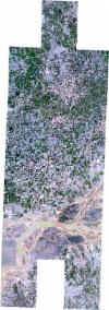
Static Map Catalogue - Full Metadata Record
Collection SkySat
SkySat ESA Archive. More details.
SSC_OPER_SSC_DEF_CO_20210609T085831_N33-979_E072-320_01
Download Product | BrowsePath | E072 |
Row | N33 |
Start Date | 2021-06-09T08:58:31Z |
Stop Date | 2021-06-09T08:58:31Z |
Availability Time | 2021-06-09T08:58:31Z |
Platform Short Name | SkySat |
Instrument Short Name | SkySat Camera |
Sensor Type | OPTICAL |
Operational mode | CAMERA |
Resolution | 0.5 |
Orbit Number | 0 |
Orbit Direction | |
Illumination Azimuth Angle | 252.3 |
Illumination Elevation Angle | 63.8 |
Across Track Incidence Angle | 11.6 |
Footprint | 33.9133078294 72.3480760084 33.9133077789 72.3481002338 33.9193419432 72.3480910568 33.919341831 72.3481255277 33.925362531 72.3481187981 33.9253624173 72.348139234 33.9313866641 72.3481320286 33.9313866322 72.3481370095 33.937411409 72.3481250496 33.9374113419 72.3481341886 33.9434264315 72.3481218776 33.9434263044 72.3481370922 33.9494275616 72.3481274931 33.9494268499 72.3482068261 33.9553954683 72.3481983275 33.955393978 72.3483454007 33.9614142929 72.3483392445 33.9614132266 72.3484434082 33.9674631249 72.3484386915 33.9674621885 72.3485277441 33.9735078258 72.3485225852 33.973506745 72.3486218815 33.9795586593 72.3486149418 33.9795577243 72.3486998987 33.9856131649 72.3486988834 33.9856126253 72.3487472607 33.9916987584 72.3487394149 33.9916980034 72.3488091705 33.9977466165 72.3488055888 33.9977447222 72.3489708552 34.0037578196 72.3489657413 34.0037549244 72.3492138389 34.0097814427 72.3492111812 34.0097792515 72.3493954821 34.0158221309 72.349389677 34.0158206251 72.3495064823 34.0218594202 72.3495015901 34.0218586114 72.3495616641 34.0290865487 72.3495528231 34.0293355147 72.3310987028 34.0326453791 72.3310907838 34.0326431208 72.3312872847 34.0386851373 72.3312643972 34.0386836183 72.3313886627 34.044705467 72.331377242 34.0447045855 72.3314480125 34.0519348051 72.3314200715 34.0521635068 72.3110380565 34.0461462183 72.311048943 34.0461470101 72.3109835743 34.0401199979 72.3109980077 34.0401213876 72.3108795887 34.0340850026 72.3109083613 34.0340871217 72.3107163741 34.0297777374 72.3107261369 34.0299901484 72.2932036439 34.0239344394 72.2932291697 34.0239351423 72.2931680264 34.0178737259 72.2932018811 34.0178751476 72.2930792414 34.011834321 72.2931089863 34.0118363528 72.2929208225 34.0058085803 72.2929484055 34.0058113855 72.2926931581 33.9997493312 72.2927253166 33.9997513279 72.2925424751 33.9936537976 72.2925797013 33.9936547765 72.2924851918 33.9875759469 72.292520813 33.9875765645 72.2924608262 33.9815046304 72.2924949159 33.9815057565 72.292383872 33.9754399763 72.2924185555 33.9754410746 72.2923010344 33.9693692848 72.2923358013 33.9693702233 72.292220781 33.9633249226 72.2922528641 33.9633258491 72.2921310351 33.9573309717 72.2921599598 33.9573322883 72.2919860459 33.9512888333 72.2920231287 33.9512894831 72.2919165216 33.9452448247 72.2919492906 33.9452450656 72.2919055269 33.9392018738 72.2919398336 33.9392020775 72.2919004444 33.9331391204 72.2919363096 33.9331393015 72.2918925064 33.9270817804 72.2919267397 33.9270820089 72.2918717791 33.921025421 72.2919031366 33.9210257306 72.2918301588 33.91494033 72.2918663713 33.9149405759 72.2917975327 33.9075837627 72.2918418966 33.9075200964 72.3121404193 33.9136059706 72.3121196621 33.9136057566 72.3121705406 33.9196699231 72.3121482702 33.9196696368 72.3122068533 33.9257270156 72.312186631 33.9257267858 72.3122309378 33.9303319276 72.3122149262 33.9302869478 72.327746517 33.9267593017 72.3277582404 33.926759469 72.3277273342 33.9207031728 72.3277457184 33.9207033119 72.3277039274 33.9146323636 72.3277103485 33.9146324228 72.3276782185 33.9072602597 72.3276739652 33.9072498573 72.3480863144 33.9133078294 72.3480760084 |
Scene Centre | 33.9797100558 72.3206795984 |
Size | 11171013071 |
Product type | SSC_DEF_CO |
Acquisition Type | NOMINAL |
Cloud-Cover Percentage | 0 |
Original Name | 20210609_085831_ssc17_u0001_SkySatCollect |
Bounding Box | 34.0521635068 72.2917975327 33.9072498573 72.2917975327 33.9072498573 72.3495616641 34.0521635068 72.3495616641 |
