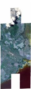
Static Map Catalogue - Full Metadata Record
Collection SkySat
SkySat ESA Archive. More details.
SSC_OPER_SSC_DEF_CO_20211012T091657_S20-418_E057-684_01
Download Product | BrowsePath | E057 |
Row | S20 |
Start Date | 2021-10-12T09:16:57Z |
Stop Date | 2021-10-12T09:16:57Z |
Availability Time | 2021-10-12T09:16:57Z |
Platform Short Name | SkySat |
Instrument Short Name | SkySat Camera |
Sensor Type | OPTICAL |
Operational mode | CAMERA |
Resolution | 0.5 |
Orbit Number | 0 |
Orbit Direction | |
Illumination Azimuth Angle | 300.3 |
Illumination Elevation Angle | 66.5 |
Across Track Incidence Angle | 17.2 |
Footprint | -20.4881750742 57.6555719133 -20.4892681289 57.6555716328 -20.4892679783 57.6555765596 -20.4966174101 57.6556078046 -20.4960216788 57.6766449773 -20.4886254239 57.676596138 -20.4886243531 57.6766311663 -20.4812987779 57.6765951199 -20.4812975543 57.6766430196 -20.4739403748 57.6766259952 -20.4739394115 57.6766653147 -20.4685840569 57.6766620656 -20.4680892525 57.6936797833 -20.4724242886 57.6937034643 -20.4724273168 57.6936011158 -20.4798092593 57.6936406181 -20.4798101397 57.6936103571 -20.4871920255 57.6936505354 -20.4871936243 57.6935943921 -20.4958459978 57.6936414144 -20.4952432424 57.7146598376 -20.4878654932 57.7146085312 -20.4878628951 57.7146972273 -20.4804755662 57.7146456778 -20.4804745597 57.7146793219 -20.4730904976 57.7146276173 -20.4730854759 57.7147926893 -20.4658015722 57.7147417725 -20.465797847 57.7148729706 -20.4583939194 57.7148062749 -20.4583912855 57.7148930873 -20.4510140079 57.7148346392 -20.4510117135 57.7149119029 -20.4436764939 57.714865848 -20.4436744973 57.7149384123 -20.4362792294 57.7148886594 -20.436276754 57.7149688269 -20.4289019205 57.7149107111 -20.4289005996 57.7149497636 -20.4216126447 57.7148978869 -20.4216097626 57.7149893468 -20.414262296 57.7149263497 -20.4142599767 57.7150016346 -20.4068866668 57.7149457001 -20.4068838278 57.7150317225 -20.3995091387 57.7149735207 -20.3995063477 57.7150557735 -20.3921207417 57.714991979 -20.3921175927 57.7150777513 -20.3847283621 57.715015555 -20.384725712 57.7150887773 -20.3772960821 57.7150043862 -20.3772921361 57.7151074006 -20.368223311 57.7150592428 -20.369164358 57.6956491856 -20.3642095241 57.6956229577 -20.3642051542 57.6957394736 -20.3564253939 57.6958175081 -20.3564232326 57.6958539981 -20.349284857 57.695750436 -20.349283747 57.6957747768 -20.3400435705 57.6958201345 -20.3412749844 57.6743609732 -20.3488108358 57.6743812075 -20.3488132576 57.6743335856 -20.3576947834 57.6743866028 -20.3576900928 57.6744657924 -20.3650024065 57.6744816783 -20.3650018686 57.67449602 -20.3694741992 57.6744545468 -20.3698018614 57.6551280598 -20.3788467513 57.6551279158 -20.3788454729 57.6551605564 -20.3862824212 57.6551808238 -20.3862807327 57.6552226236 -20.3936371135 57.6552360237 -20.3936335659 57.6553692447 -20.3995790294 57.6553694662 -20.399583671 57.655215536 -20.4068595907 57.6552306362 -20.4068853494 57.6542605025 -20.4163779259 57.6543650455 -20.4163194699 57.6553598361 -20.4230735806 57.6553757812 -20.4230730388 57.6553959805 -20.4304232829 57.6554038305 -20.430423091 57.6554103592 -20.4377670364 57.6554235288 -20.4377660532 57.6554570853 -20.4451065158 57.6554598979 -20.4450990754 57.6557069365 -20.4508850251 57.6556996741 -20.4508898739 57.6555074072 -20.4597466196 57.6555412253 -20.4597459028 57.6555662333 -20.4656933047 57.6555914775 -20.4656941658 57.6555572448 -20.4730939406 57.6555805278 -20.473094093 57.6555741864 -20.4804810831 57.6555917872 -20.4804815164 57.6555738875 -20.4879432177 57.6555719728 -20.4879432464 57.6555709277 -20.4881750742 57.6555719133 |
Scene Centre | -20.4183331312 57.6846839516 |
Size | 10595129139 |
Product type | SSC_DEF_CO |
Acquisition Type | NOMINAL |
Cloud-Cover Percentage | 0.08 |
Original Name | 20211012_091657_ssc8_u0001_SkySatCollect |
Bounding Box | -20.3400435705 57.6542605025 -20.4966174101 57.6542605025 -20.4966174101 57.7151074006 -20.3400435705 57.7151074006 |
