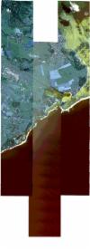
Static Map Catalogue - Full Metadata Record
Collection SkySat
SkySat ESA Archive. More details.
SSC_OPER_SSC_DEF_CO_20210803T060054_S20-463_E057-699_01
Download Product | BrowsePath | E057 |
Row | S20 |
Start Date | 2021-08-03T06:00:54Z |
Stop Date | 2021-08-03T06:00:54Z |
Availability Time | 2021-08-03T06:00:54Z |
Platform Short Name | SkySat |
Instrument Short Name | SkySat Camera |
Sensor Type | OPTICAL |
Operational mode | CAMERA |
Resolution | 0.5 |
Orbit Number | 0 |
Orbit Direction | |
Illumination Azimuth Angle | 43.4 |
Illumination Elevation Angle | 39.8 |
Across Track Incidence Angle | 10.3 |
Footprint | -20.533380126 57.7097611047 -20.5261187747 57.7098206153 -20.5261187104 57.7097367197 -20.5188563829 57.7097976255 -20.5188562018 57.7097069933 -20.5156151632 57.7097341803 -20.5156308697 57.7291038863 -20.5071423287 57.7291735949 -20.507142257 57.729111589 -20.4999224209 57.7291694125 -20.499922195 57.7290761891 -20.4926993769 57.7291343025 -20.4926990148 57.7290359048 -20.4855096049 57.7290943951 -20.4855092264 57.7290175591 -20.4783015225 57.7290765123 -20.4783009145 57.7289777213 -20.4726407632 57.7290242622 -20.4726417382 57.7291119967 -20.4640508131 57.7291424695 -20.4640492146 57.7289932511 -20.4568075091 57.7290328479 -20.4568066836 57.72895965 -20.449602022 57.7289942031 -20.4496006298 57.7288887089 -20.4423545148 57.7289337279 -20.4423535545 57.7288530965 -20.4351516333 57.7289058006 -20.4351506241 57.7288189532 -20.4279630374 57.7288791157 -20.4279617324 57.7287825792 -20.4207878488 57.7288420861 -20.4207864039 57.7287439358 -20.4136395909 57.7288038668 -20.4136382263 57.7287188351 -20.4065032432 57.7287819767 -20.4065019368 57.7287075153 -20.3993716534 57.7287671707 -20.3993702944 57.7286960675 -20.3922279976 57.7287548527 -20.3922263358 57.728672243 -20.385100195 57.7286678281 -20.3846440855 57.707045639 -20.3931903838 57.7070362364 -20.3931918825 57.707107507 -20.400309498 57.7070467327 -20.4003110774 57.7071258574 -20.4074629749 57.7070809732 -20.4074643697 57.7071569583 -20.4109714993 57.7071280032 -20.4106625098 57.6906475977 -20.4063857379 57.6906727524 -20.4063842053 57.690583124 -20.3991904496 57.690607544 -20.3991893977 57.6905458148 -20.3920153144 57.6906157206 -20.3920140652 57.6905489684 -20.3848253955 57.6906931702 -20.3844889497 57.669248815 -20.3929352889 57.6689691612 -20.392936497 57.6690334222 -20.4001382292 57.6689903953 -20.4001400322 57.6690862926 -20.4073033917 57.6690132273 -20.4073050794 57.6691020444 -20.414466652 57.6690437562 -20.41446835 57.66912816 -20.4216396545 57.6690567873 -20.4216417897 57.6691701558 -20.427629437 57.6691198364 -20.4276292717 57.6691090728 -20.4348067996 57.6690241768 -20.4348045165 57.6688970739 -20.4433613212 57.6688420005 -20.4433677765 57.6692919252 -20.4505648037 57.669159763 -20.4505653005 57.6691959633 -20.457894653 57.6690631026 -20.4578955885 57.6691465901 -20.4651291188 57.6690382971 -20.4651301384 57.669122955 -20.4723708314 57.669001927 -20.472372024 57.6690896424 -20.4796308062 57.6689570553 -20.4796322716 57.6690553462 -20.4869489589 57.6689202614 -20.486950973 57.6690401142 -20.4942769087 57.6689412095 -20.4942786498 57.6690437831 -20.5015828448 57.6689670522 -20.501583451 57.6690184103 -20.5087969374 57.6689330457 -20.5087971152 57.6689858942 -20.516098888 57.6688991085 -20.5161387793 57.6879655243 -20.5200523183 57.6879332865 -20.5200525462 57.6880109199 -20.5273098775 57.6879510174 -20.527309997 57.6880219358 -20.534604704 57.6879599501 -20.5346047196 57.6879983193 -20.5418998923 57.6879377926 -20.5418809084 57.709743665 -20.5333800987 57.709813223 -20.533380126 57.7097611047 |
Scene Centre | -20.463197022 57.6990077977 |
Size | 8870862680 |
Product type | SSC_DEF_CO |
Acquisition Type | NOMINAL |
Cloud-Cover Percentage | 0 |
Original Name | 20210803_060054_ssc13_u0001_SkySatCollect |
Bounding Box | -20.3844889497 57.6688420005 -20.5418998923 57.6688420005 -20.5418998923 57.7291735949 -20.3844889497 57.7291735949 |
