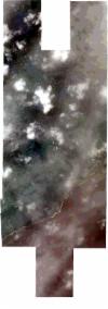
Static Map Catalogue - Full Metadata Record
Collection SkySat
SkySat ESA Archive. More details.
SSC_OPER_SSC_DEF_CO_20210601T091148_S20-444_E057-682_01
Download Product | BrowsePath | E057 |
Row | S20 |
Start Date | 2021-06-01T09:11:48Z |
Stop Date | 2021-06-01T09:11:48Z |
Availability Time | 2021-06-01T09:11:48Z |
Platform Short Name | SkySat |
Instrument Short Name | SkySat Camera |
Sensor Type | OPTICAL |
Operational mode | CAMERA |
Resolution | 0.5 |
Orbit Number | 0 |
Orbit Direction | |
Illumination Azimuth Angle | 338.7 |
Illumination Elevation Angle | 44.6 |
Across Track Incidence Angle | 6.5 |
Footprint | -20.5154435387 57.6937179931 -20.5154427039 57.6938496367 -20.5085498023 57.6937694479 -20.5085490779 57.6938780804 -20.5016767473 57.6937980074 -20.5016760338 57.6938998818 -20.4977135482 57.6938536439 -20.4976056197 57.7115157204 -20.490699881 57.7114311042 -20.4906990118 57.7115663754 -20.4838055529 57.7114816517 -20.4838047924 57.7115943815 -20.4769311166 57.711509665 -20.4769303641 57.7116160185 -20.4704341546 57.7115357342 -20.4704352419 57.711803217 -20.4632446279 57.7116178399 -20.4632445788 57.7117111904 -20.4562776981 57.7115804919 -20.4562774798 57.7117629825 -20.4493033221 57.7116358742 -20.4493028014 57.7118300914 -20.4423567885 57.7116824309 -20.4423560688 57.711851689 -20.4354399513 57.7117087977 -20.4354380097 57.7119162824 -20.4285806548 57.7118300247 -20.4285796483 57.7119337534 -20.42177057 57.7118468313 -20.4217698558 57.7119181802 -20.4149258173 57.7118194187 -20.4149245603 57.7119398132 -20.4080772277 57.7118537793 -20.408075723 57.7119935744 -20.4012761985 57.7119078148 -20.4012752419 57.7119939153 -20.3944991537 57.7119082999 -20.3944986397 57.7119530557 -20.3877315668 57.7118674075 -20.3877313192 57.7118883725 -20.3809563348 57.7118026879 -20.3809560592 57.7118256842 -20.3741678701 57.7117412821 -20.3741671367 57.7117988915 -20.3660606377 57.711719744 -20.3663201598 57.6911775992 -20.3731015283 57.6912615046 -20.3731021973 57.691206302 -20.3798667423 57.6913619074 -20.3798669554 57.6913435048 -20.3879731497 57.6914121471 -20.3879731316 57.6914136791 -20.3909537208 57.6914336971 -20.3911441895 57.6758574815 -20.3860109226 57.6758598379 -20.3860109942 57.6758500529 -20.3805838136 57.6758708755 -20.380583228 57.6759365433 -20.3738250542 57.6756738807 -20.3738248248 57.6757007577 -20.3657189374 57.6755739314 -20.3658840273 57.6551279717 -20.3726541761 57.6551793882 -20.3726542487 57.6551701106 -20.3807678644 57.655230747 -20.3807676765 57.6552518189 -20.3875241866 57.6553066494 -20.3875240426 57.6553248561 -20.3929200888 57.655361411 -20.392920124 57.6553563796 -20.3997017868 57.6553869064 -20.399702063 57.6553451185 -20.4065315533 57.6553931185 -20.4065321861 57.6552924506 -20.4133570272 57.6553466039 -20.4133575535 57.6552575152 -20.4201486416 57.6553125259 -20.4201488342 57.6552786556 -20.4269878344 57.6553278509 -20.4269881862 57.6552619853 -20.433826372 57.655308563 -20.4338267907 57.6552227497 -20.4407830791 57.6552684777 -20.440783656 57.6551429156 -20.4477418808 57.6551853851 -20.4477424688 57.6550449122 -20.4546447474 57.65509457 -20.4546454184 57.6549273761 -20.4612634348 57.6549747503 -20.4612631978 57.6549015455 -20.4666055275 57.6549553506 -20.4665537969 57.6536583854 -20.4740520858 57.6541340832 -20.4740371019 57.6537911328 -20.4816643901 57.6543815846 -20.4816604215 57.6542738154 -20.4889547142 57.6548146179 -20.4889547687 57.6547865397 -20.497076425 57.6548530216 -20.4970377288 57.6733414585 -20.5005838811 57.6733830901 -20.5005845364 57.67328158 -20.5074692449 57.67336241 -20.5074699113 57.6732537064 -20.5143675494 57.6733346879 -20.5143683173 57.6732025262 -20.5224728762 57.6732976516 -20.5223494789 57.6937981891 -20.5154435387 57.6937179931 |
Scene Centre | -20.4440983367 57.6828261503 |
Size | 9984801864 |
Product type | SSC_DEF_CO |
Acquisition Type | NOMINAL |
Cloud-Cover Percentage | 0.41 |
Original Name | 20210601_091148_ssc7_u0001_SkySatCollect |
Bounding Box | -20.3657189374 57.6536583854 -20.5224728762 57.6536583854 -20.5224728762 57.7119939153 -20.3657189374 57.7119939153 |
