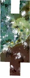
Static Map Catalogue - Full Metadata Record
Collection SkySat
SkySat ESA Archive. More details.
SSC_OPER_SSC_DEF_CO_20210517T090738_S20-437_E057-719_01
Download Product | BrowsePath | E057 |
Row | S20 |
Start Date | 2021-05-17T09:07:38Z |
Stop Date | 2021-05-17T09:07:38Z |
Availability Time | 2021-05-17T09:07:38Z |
Platform Short Name | SkySat |
Instrument Short Name | SkySat Camera |
Sensor Type | OPTICAL |
Operational mode | CAMERA |
Resolution | 0.5 |
Orbit Number | 0 |
Orbit Direction | |
Illumination Azimuth Angle | 338.1 |
Illumination Elevation Angle | 47.4 |
Across Track Incidence Angle | 17.6 |
Footprint | -20.5087296476 57.7309777332 -20.5087303411 57.7310238395 -20.501594661 57.7309732443 -20.5015953783 57.7310239869 -20.4944959241 57.7309709844 -20.4944970148 57.7310537268 -20.4890608967 57.7310130389 -20.4894547028 57.7511273314 -20.4823022219 57.7510921089 -20.4823028911 57.7511279935 -20.475153397 57.7510925548 -20.4751540811 57.7511311799 -20.4680406701 57.7510957107 -20.4680418662 57.7511670629 -20.4608953635 57.7511311849 -20.4608957855 57.7511578754 -20.4524315132 57.7511151011 -20.4524288314 57.7509513214 -20.4465939952 57.7509080038 -20.4465976972 57.7511744245 -20.4380955427 57.75108519 -20.4380949382 57.7510417956 -20.4322684173 57.7510019798 -20.4322685224 57.7510102625 -20.4251162016 57.7509635971 -20.425116354 57.7509767616 -20.4179441352 57.7509359339 -20.4179459179 57.7511093818 -20.4094437871 57.7510951276 -20.4094428149 57.7509845983 -20.4032629266 57.7509522522 -20.4032615464 57.7510899999 -20.3963534346 57.7509784767 -20.3963534169 57.7509877531 -20.3893828976 57.7509080438 -20.3893832571 57.7509678888 -20.3809241845 57.7509228093 -20.3809241197 57.7509129741 -20.3750777262 57.7508908665 -20.3750779097 57.7509448611 -20.3679199923 57.7509104548 -20.3679201832 57.7509876816 -20.3594705655 57.750941339 -20.3594052872 57.7294159146 -20.367865975 57.7290513019 -20.3678663821 57.729216049 -20.3736681252 57.7286933019 -20.373667335 57.7285400942 -20.3807765551 57.7285460019 -20.3807763298 57.7285118489 -20.3861241921 57.7285406936 -20.3859600558 57.7102654116 -20.3817149618 57.7103117594 -20.3817149971 57.7103219573 -20.3745458717 57.7104353321 -20.3745460296 57.7104655566 -20.36603429 57.7104745044 -20.3660341744 57.7104552502 -20.3589884731 57.7104408225 -20.3589276343 57.6882349668 -20.3658990465 57.6879390418 -20.3658988109 57.6878997706 -20.3667171054 57.6879043166 -20.3673969396 57.6878754587 -20.3673970505 57.6879080939 -20.3730297591 57.6879393859 -20.3730295561 57.6879156303 -20.3733982015 57.6879414327 -20.3744284302 57.687947156 -20.374428777 57.6880135654 -20.3802129149 57.6884184122 -20.3802121306 57.6882777691 -20.3887430768 57.6880846808 -20.3887434934 57.688200659 -20.3943434957 57.6880338245 -20.3943433535 57.6880170101 -20.3948501037 57.6880187317 -20.3957598593 57.6879916284 -20.3957600642 57.6880218232 -20.4014239709 57.6880410658 -20.4014238182 57.6880251438 -20.4094680761 57.6881231652 -20.4156249013 57.6881556906 -20.4156246618 57.6881347703 -20.4227038276 57.6881383379 -20.4227038173 57.688137535 -20.4227959675 57.6881383843 -20.4241062435 57.6881390447 -20.4241063755 57.6881504626 -20.4311997771 57.6882158436 -20.4311998303 57.6882203205 -20.4382832212 57.6882541708 -20.438286944 57.6885382155 -20.4440413016 57.6884787781 -20.4440386858 57.6882903403 -20.4510997577 57.6882625888 -20.4510995426 57.6882409226 -20.4580885335 57.6881879067 -20.4580882204 57.6881377633 -20.4650944503 57.6880630082 -20.4650931777 57.6879666776 -20.4734702717 57.6877163591 -20.4734776048 57.6882902508 -20.4793838064 57.6883216767 -20.4793833546 57.6882997499 -20.4878934922 57.6883483165 -20.4883006324 57.7086400565 -20.4928080081 57.7086748696 -20.4928068836 57.7085984836 -20.4999207953 57.7086534183 -20.4999201037 57.7086091815 -20.5070376441 57.7086641693 -20.5070369421 57.7086217761 -20.5155129474 57.7086872643 -20.5158700083 57.7310289759 -20.5087296476 57.7309777332 |
Scene Centre | -20.4374016959 57.7194453918 |
Size | 10526573766 |
Product type | SSC_DEF_CO |
Acquisition Type | NOMINAL |
Cloud-Cover Percentage | 0.13 |
Original Name | 20210517_090738_ssc8_u0001_SkySatCollect |
Bounding Box | -20.3589276343 57.6877163591 -20.5158700083 57.6877163591 -20.5158700083 57.7511744245 -20.3589276343 57.7511744245 |
