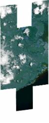
Static Map Catalogue - Full Metadata Record
Collection SkySat
SkySat ESA Archive. More details.
SSC_OPER_SSC_DEF_CO_20210327T063340_S20-432_E057-666_01
Download Product | BrowsePath | E057 |
Row | S20 |
Start Date | 2021-03-27T06:33:40Z |
Stop Date | 2021-03-27T06:33:40Z |
Availability Time | 2021-03-27T06:33:40Z |
Platform Short Name | SkySat |
Instrument Short Name | SkySat Camera |
Sensor Type | OPTICAL |
Operational mode | CAMERA |
Resolution | 0.5 |
Orbit Number | 0 |
Orbit Direction | |
Illumination Azimuth Angle | 49.8 |
Illumination Elevation Angle | 56.1 |
Across Track Incidence Angle | 27 |
Footprint | -20.5192182433 57.6823669517 -20.5192140854 57.6823998748 -20.5067435112 57.6823187971 -20.5067442354 57.6823130324 -20.4982250343 57.6822575872 -20.4982228049 57.6822751238 -20.4904277249 57.6822199731 -20.4867767855 57.7110100425 -20.4761023417 57.7109241965 -20.4761000391 57.7109423876 -20.4655083662 57.7108695281 -20.4655026271 57.710916105 -20.4548687675 57.710854408 -20.4548676461 57.7108636803 -20.4436324342 57.7108317754 -20.4436304537 57.7108479903 -20.4324735016 57.7107762516 -20.4324634201 57.7108585512 -20.4213992587 57.7107855131 -20.4213922173 57.7108424869 -20.4104093724 57.710752561 -20.4104003438 57.7108258489 -20.3994729961 57.710746964 -20.3994718849 57.7107559569 -20.3868861307 57.7106847163 -20.386890449 57.7106453961 -20.3775515473 57.7105976809 -20.3775476359 57.7106327493 -20.3664999583 57.7106175503 -20.3664801373 57.7107685412 -20.3554567374 57.7107669145 -20.3554268025 57.7109826638 -20.3437995424 57.7111598256 -20.3437664151 57.711378584 -20.3308721248 57.7114249667 -20.3354968718 57.6800439554 -20.3469662075 57.6799003124 -20.3469802691 57.6798039264 -20.3579559877 57.679801572 -20.3579731363 57.679675759 -20.3689413741 57.6798093565 -20.3689636778 57.6796414439 -20.3760895306 57.6799993963 -20.3796236263 57.652615945 -20.3735289786 57.652588042 -20.3735243376 57.6526268153 -20.3625366386 57.6525910091 -20.3625300479 57.6526447357 -20.3513700176 57.6526706551 -20.3513593361 57.6527500812 -20.3383784288 57.6529282552 -20.3417944268 57.622364648 -20.3539318417 57.6216033502 -20.3539522372 57.6214530538 -20.3647442396 57.6217414046 -20.3647579998 57.6216331224 -20.3772089877 57.6218433878 -20.3772020575 57.6219012856 -20.3879296821 57.622011741 -20.3879247615 57.6220550172 -20.3991200343 57.6218753635 -20.3990923732 57.62210214 -20.4099510657 57.6220994992 -20.4099299255 57.6222756576 -20.420840239 57.6222578903 -20.4208302714 57.6223406207 -20.4317836153 57.6222805653 -20.4317655211 57.622433464 -20.4428371497 57.6223605692 -20.4428149667 57.6225471075 -20.4540012025 57.622439454 -20.4539843309 57.6225822081 -20.4652253831 57.6224907657 -20.4652032576 57.6226763528 -20.4757888605 57.6225660094 -20.4757623629 57.6227870953 -20.4865168298 57.622676958 -20.4865011915 57.6228049222 -20.4973167611 57.622604988 -20.4938148948 57.6513888051 -20.5021474248 57.6514039506 -20.5021397763 57.651464114 -20.5125562926 57.6515138824 -20.5125480091 57.6515788966 -20.5231002006 57.6516293599 -20.5230969597 57.6516550218 -20.5336461886 57.6517055091 -20.5297990364 57.6824356686 -20.5192182433 57.6823669517 |
Scene Centre | -20.4322649341 57.6664390103 |
Size | 10905107999 |
Product type | SSC_DEF_CO |
Acquisition Type | NOMINAL |
Cloud-Cover Percentage | 0.2 |
Original Name | 20210327_063340_ss01_u0001_SkySatCollect |
Bounding Box | -20.3308721248 57.6214530538 -20.5336461886 57.6214530538 -20.5336461886 57.7114249667 -20.3308721248 57.7114249667 |
