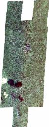
Static Map Catalogue - Full Metadata Record
Collection SkySat
SkySat ESA Archive. More details.
SSC_OPER_SSC_DEF_CO_20210501T125416_S14-740_E040-332_01
Download Product | BrowsePath | E040 |
Row | S14 |
Start Date | 2021-05-01T12:54:16Z |
Stop Date | 2021-05-01T12:54:16Z |
Availability Time | 2021-05-01T12:54:16Z |
Platform Short Name | SkySat |
Instrument Short Name | SkySat Camera |
Sensor Type | OPTICAL |
Operational mode | CAMERA |
Resolution | 0.5 |
Orbit Number | 0 |
Orbit Direction | |
Illumination Azimuth Angle | 296.7 |
Illumination Elevation Angle | 28.3 |
Across Track Incidence Angle | 26.1 |
Footprint | -14.8159492288 40.3370981031 -14.809039203 40.3376615706 -14.8090486038 40.3373671938 -14.8020612383 40.3380409313 -14.8020703713 40.3377645901 -14.7983684337 40.3381018615 -14.7977561453 40.3578977311 -14.789412094 40.3586229153 -14.7894235517 40.3582608935 -14.7825154268 40.3587967742 -14.7825254116 40.3584654506 -14.7756494775 40.3589773698 -14.7756578931 40.3586587788 -14.7686981314 40.3592211049 -14.7687055633 40.3589557695 -14.7616260206 40.3595390063 -14.7616328895 40.3592940567 -14.7545597453 40.3598686276 -14.7545640441 40.3596937306 -14.7474201188 40.3603333562 -14.7474258805 40.3601273024 -14.7402510134 40.3607867546 -14.7402566598 40.3606100323 -14.7330294048 40.3612953759 -14.733033749 40.3611594179 -14.7271655885 40.3616750482 -14.7271645518 40.3617064147 -14.7188834405 40.362304912 -14.7188885218 40.3620929721 -14.7119020965 40.3626187909 -14.7119080601 40.3623586999 -14.7048937757 40.3628936973 -14.7048999143 40.3626213192 -14.6992656755 40.3630894523 -14.6992606363 40.3633239904 -14.6909138633 40.3639315401 -14.6909436102 40.362294003 -14.685397413 40.3626867408 -14.6853921289 40.3628066676 -14.6784026837 40.3632978277 -14.6783956389 40.3634644315 -14.6713284819 40.364012389 -14.6713016461 40.3645931405 -14.6628414507 40.3652363313 -14.6628555072 40.3649488213 -14.6554741328 40.3654809597 -14.6564745602 40.3447808931 -14.6649054565 40.3441771681 -14.6648936515 40.3444221343 -14.6708770872 40.3440120189 -14.6709064144 40.3433895291 -14.6778560868 40.3429456409 -14.677864152 40.3427554415 -14.6824238045 40.3424145687 -14.6831444861 40.3265348698 -14.6800581508 40.3267379574 -14.6800505631 40.3269169148 -14.6729456361 40.3275007815 -14.6729147795 40.3281461154 -14.6645389572 40.3286861039 -14.6645493888 40.3284533776 -14.6571353677 40.3290192123 -14.6580591535 40.3082881574 -14.6665641132 40.3076064391 -14.6665533569 40.3078404011 -14.6724720695 40.3074101762 -14.6725007637 40.3067865452 -14.6794949063 40.306285288 -14.6795051844 40.3060471658 -14.686516841 40.3056037823 -14.6865237903 40.3054384756 -14.6950345943 40.3047234972 -14.6950316844 40.304783702 -14.7022888559 40.3041965825 -14.7022409071 40.3051891003 -14.7076200683 40.3048406249 -14.7076152331 40.3050550689 -14.7131962138 40.3046332206 -14.7132009483 40.3044469679 -14.7216600041 40.303609873 -14.7216545325 40.3038007345 -14.7286109718 40.3032099346 -14.7286014472 40.3035785885 -14.7356633979 40.3029182888 -14.7356626026 40.3029484751 -14.7427738889 40.3023268043 -14.7427703262 40.3024568954 -14.7499354057 40.3017564336 -14.7499311342 40.3018964586 -14.7570085173 40.3013019879 -14.7570044075 40.3014485773 -14.7640532386 40.3008560485 -14.7640494392 40.3010103331 -14.7712111859 40.3003222531 -14.7712049679 40.3005334758 -14.7783331739 40.299844468 -14.7783258566 40.3000890231 -14.7852796539 40.299479578 -14.7852718343 40.299746318 -14.7922219831 40.2990856177 -14.7922144836 40.2993427815 -14.7991912091 40.2986999794 -14.798649475 40.316796848 -14.8041955426 40.3163262373 -14.8041865999 40.316586981 -14.8111818225 40.315949406 -14.8111735216 40.316210422 -14.8181100655 40.315593209 -14.8180997336 40.3158868596 -14.8250532053 40.3152662103 -14.8242834659 40.33669942 -14.8159384499 40.3374154426 -14.8159492288 40.3370981031 |
Scene Centre | -14.7402660631 40.3320904696 |
Size | 12800221398 |
Product type | SSC_DEF_CO |
Acquisition Type | NOMINAL |
Cloud-Cover Percentage | 0.01 |
Original Name | 20210501_125416_ssc18_u0001_SkySatCollect |
Bounding Box | -14.6554741328 40.2986999794 -14.8250532053 40.2986999794 -14.8250532053 40.3654809597 -14.6554741328 40.3654809597 |
