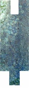
Static Map Catalogue - Full Metadata Record
Collection SkySat
SkySat ESA Archive. More details.
SSC_OPER_SSC_DEF_CO_20240813T060359_S02-828_E037-590_01
Download Product | BrowsePath | E037 |
Row | S02 |
Start Date | 2024-08-13T06:03:59Z |
Stop Date | 2024-08-13T06:03:59Z |
Availability Time | 2024-08-13T06:03:59Z |
Platform Short Name | SkySat |
Instrument Short Name | SkySat Camera |
Sensor Type | OPTICAL |
Operational mode | CAMERA |
Resolution | 0.5 |
Orbit Number | 0 |
Orbit Direction | |
Illumination Azimuth Angle | 70.1 |
Illumination Elevation Angle | 35.1 |
Across Track Incidence Angle | 2.3 |
Footprint | -2.90032855273 37.6004233888 -2.89371805859 37.600457703 -2.89371799625 37.6004340734 -2.88708168699 37.6004594515 -2.88708163009 37.6004387688 -2.8822637442 37.600463598 -2.88231467241 37.6174858854 -2.87414924258 37.6175297515 -2.87414918581 37.6175112606 -2.8675284789 37.6175362648 -2.86752842703 37.6175221572 -2.86089931916 37.6175450687 -2.86089925381 37.6175249518 -2.8542971696 37.6175311487 -2.85429716743 37.6175305908 -2.84766850059 37.6175580537 -2.84766847003 37.6175496653 -2.8410575564 37.6175811514 -2.84105750905 37.6175695974 -2.83442569994 37.6175987462 -2.83442563195 37.6175811403 -2.82780553573 37.6176046868 -2.82780547446 37.6175897557 -2.82117340101 37.6176191423 -2.82117333376 37.6176018881 -2.81456537541 37.617643287 -2.81456528797 37.6176232102 -2.80794005087 37.6176529675 -2.80793998907 37.6176378991 -2.80133521797 37.6176690151 -2.80133512459 37.6176489498 -2.79471322676 37.6176787912 -2.79471314031 37.6176591149 -2.78809966601 37.6176880606 -2.78809957379 37.6176675948 -2.78073808471 37.6176859268 -2.78073806708 37.6176813959 -2.77413305001 37.6177060924 -2.77413299345 37.6176937993 -2.76750976679 37.6177219411 -2.76750967443 37.6177004817 -2.76090292519 37.6177320817 -2.76090281555 37.6177081352 -2.75428644618 37.6177375246 -2.75428633274 37.617710742 -2.74767867534 37.6177383212 -2.74759777067 37.5985108971 -2.75575339537 37.5984809238 -2.75575350401 37.5985086619 -2.76236036021 37.5984803197 -2.76236045938 37.5985039652 -2.76897169757 37.5984715003 -2.7689717838 37.598492105 -2.77382699282 37.5984669125 -2.77378044907 37.5837971408 -2.76771646733 37.5838365317 -2.76771632848 37.5838085045 -2.76110381431 37.5838436653 -2.7611036675 37.5838148435 -2.75448638539 37.5838484655 -2.7544862155 37.5838147123 -2.74787364011 37.5838486624 -2.74777350316 37.564569324 -2.7559426707 37.5645258997 -2.75594285596 37.564562539 -2.76255609182 37.5645276559 -2.7625562489 37.5645581791 -2.76917487228 37.5645200977 -2.76917499848 37.5645464105 -2.77579969387 37.5645110674 -2.77579982865 37.564540495 -2.78240639125 37.564511606 -2.78240652046 37.5645357642 -2.78902205944 37.5644951732 -2.78902221313 37.5645235899 -2.79637854293 37.5644788417 -2.79637866915 37.564504744 -2.802995463 37.5644614968 -2.80299559683 37.5644894877 -2.80960960741 37.5644546977 -2.80960971437 37.5644765932 -2.81622764282 37.5644310728 -2.81622775499 37.5644537783 -2.82285118157 37.5644231022 -2.82285128042 37.5644448815 -2.82947434301 37.5644017136 -2.82947444581 37.5644240276 -2.83609257284 37.5643888007 -2.83609266421 37.5644076671 -2.84272380666 37.5643612482 -2.84272390165 37.5643814064 -2.84935439395 37.564338143 -2.84935446826 37.5643543362 -2.8559806796 37.5643130305 -2.85598076404 37.5643319612 -2.86259034745 37.5643066203 -2.86259042786 37.5643236255 -2.86921491444 37.5642888634 -2.86921500699 37.564309253 -2.87585466662 37.5642689902 -2.87585474348 37.5642886234 -2.88248539008 37.5642496157 -2.88255302963 37.581176436 -2.88854002797 37.581151788 -2.88854003675 37.5811547773 -2.89517896909 37.581121408 -2.89517901084 37.5811361963 -2.90178538507 37.5811415562 -2.90178540287 37.5811480606 -2.90842402614 37.5811196455 -2.9084762985 37.6004029896 -2.90032860347 37.6004430401 -2.90032855273 37.6004233888 |
Scene Centre | -2.82803734217 37.5909939685 |
Size | 9494067131 |
Product type | SSC_DEF_CO |
Acquisition Type | NOMINAL |
Cloud-Cover Percentage | 0 |
Original Name | 20240813_060359_ssc4_u0001_SkySatCollect |
Bounding Box | -2.74759777067 37.5642496157 -2.9084762985 37.5642496157 -2.9084762985 37.6177383212 -2.74759777067 37.6177383212 |
