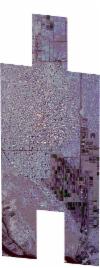
Static Map Catalogue - Full Metadata Record
Collection SkySat
SkySat ESA Archive. More details.
SSC_OPER_SSC_DEF_CO_20240123T115044_N15-602_E032-647_01
Download Product | BrowsePath | E032 |
Row | N15 |
Start Date | 2024-01-23T11:50:44Z |
Stop Date | 2024-01-23T11:50:44Z |
Availability Time | 2024-01-23T11:50:44Z |
Platform Short Name | SkySat |
Instrument Short Name | SkySat Camera |
Sensor Type | OPTICAL |
Operational mode | CAMERA |
Resolution | 0.5 |
Orbit Number | 0 |
Orbit Direction | |
Illumination Azimuth Angle | 218.5 |
Illumination Elevation Angle | 45.8 |
Across Track Incidence Angle | 27.2 |
Footprint | 15.5249663325 32.6810734835 15.533724455 32.6810787451 15.5337247599 32.6810755018 15.5407041004 32.6810830768 15.5407039021 32.6810851625 15.549428411 32.6810959247 15.5494276068 32.6811043505 15.5581436391 32.6811199243 15.5581417421 32.6811395821 15.5668611845 32.6811481075 15.5668589081 32.6811714941 15.5755673012 32.6811870865 15.5755652175 32.6812082858 15.5842768423 32.6812175965 15.584274306 32.6812431531 15.5929854894 32.6812612344 15.5929829698 32.6812864234 15.602666779 32.6813024161 15.6026648088 32.6813219962 15.6113698575 32.6813356581 15.6113672845 32.6813608892 15.6210570618 32.6813804961 15.6210559817 32.6813909928 15.6307354815 32.681400057 15.6307321692 32.6814319417 15.639457058 32.6814415419 15.6394542486 32.681468234 15.6504875916 32.6814971194 15.6528078826 32.659512062 15.6581874898 32.6594863638 15.6581865075 32.6594959078 15.6680661863 32.6594532651 15.6680647333 32.6594672929 15.6769620864 32.6594271749 15.6769600311 32.6594467819 15.6881051782 32.6594116515 15.6906609819 32.6352004666 15.6794949245 32.6352643205 15.6794934865 32.6352780394 15.670565278 32.6353258367 15.670564783 32.6353306165 15.6606684301 32.635381293 15.6606666419 32.6353986671 15.6558682564 32.6354238539 15.6581628762 32.6135365902 15.6470750061 32.6136406172 15.6470719506 32.6136699429 15.6382798695 32.6137524997 15.6382771914 32.6137784964 15.6285136168 32.6138682038 15.6285105625 32.613898174 15.6187617508 32.6139891683 15.6187593679 32.6140126017 15.6099777568 32.6140913719 15.6099750388 32.6141183712 15.6002228122 32.6142065151 15.6002211485 32.6142231661 15.5914421443 32.6143035962 15.5914398595 32.6143266909 15.5826468762 32.6144128549 15.5826449691 32.6144323808 15.5738777245 32.6145113496 15.5738755875 32.6145333056 15.5651022118 32.614607526 15.5651002868 32.6146274163 15.5563122384 32.6147038011 15.5563091275 32.6147365044 15.5475689313 32.6147975577 15.5475648986 32.6148394149 15.5387356977 32.6149269677 15.538731543 32.6149715547 15.530000556 32.6150347214 15.5299933565 32.6151109206 15.5211556725 32.615184789 15.5190446328 32.6386878185 15.5294588908 32.638651855 15.5294624323 32.6386132555 15.5382403658 32.6385698108 15.5382440471 32.6385305338 15.5470291029 32.6384985736 15.5470315636 32.6384726306 15.551701657 32.6384558199 15.5499003756 32.6575112508 15.5429419451 32.6575410335 15.5429409521 32.657551479 15.5342106863 32.6575771466 15.53420916 32.6575932737 15.5254628276 32.6576246255 15.5254605251 32.657649203 15.516731457 32.6576607507 15.5145541698 32.6810718261 15.524965566 32.6810816932 15.5249663325 32.6810734835 |
Scene Centre | 15.6026101861 32.6475168548 |
Size | 12383331432 |
Product type | SSC_DEF_CO |
Acquisition Type | NOMINAL |
Cloud-Cover Percentage | 0 |
Original Name | 20240123_115044_ssc6_u0001_SkySatCollect |
Bounding Box | 15.6906609819 32.6135365902 15.5145541698 32.6135365902 15.5145541698 32.6814971194 15.6906609819 32.6814971194 |
