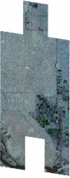
Static Map Catalogue - Full Metadata Record
Collection SkySat
SkySat ESA Archive. More details.
SSC_OPER_SSC_DEF_CO_20240123T113650_N15-594_E032-647_01
Download Product | BrowsePath | E032 |
Row | N15 |
Start Date | 2024-01-23T11:36:50Z |
Stop Date | 2024-01-23T11:36:50Z |
Availability Time | 2024-01-23T11:36:50Z |
Platform Short Name | SkySat |
Instrument Short Name | SkySat Camera |
Sensor Type | OPTICAL |
Operational mode | CAMERA |
Resolution | 0.5 |
Orbit Number | 0 |
Orbit Direction | |
Illumination Azimuth Angle | 214.7 |
Illumination Elevation Angle | 47.8 |
Across Track Incidence Angle | 27.4 |
Footprint | 15.5213438402 32.6811461734 15.5284791341 32.6812860558 15.5285013592 32.6811390788 15.5365242326 32.6813009969 15.5365469366 32.6811504598 15.5445841266 32.6812962708 15.5446064419 32.6811475002 15.5526232324 32.6813102252 15.5526456839 32.6811600689 15.5606589658 32.6813293767 15.5606818817 32.6811759564 15.5687062751 32.6813412818 15.5687295458 32.6811849646 15.5767593164 32.681346668 15.5767816786 32.681196499 15.5848078395 32.6813628339 15.5848315661 32.6812034688 15.5928724609 32.6813665174 15.592895044 32.6812141772 15.6009226828 32.6813752475 15.6009456184 32.6812204548 15.6089701146 32.6813850593 15.6089934711 32.6812279425 15.6170271482 32.681396365 15.6170493559 32.6812464232 15.6250752998 32.6814141746 15.6250993797 32.6812517683 15.6331387471 32.681425948 15.6331616499 32.6812707962 15.6412114303 32.6814405105 15.6443446195 32.6601632398 15.6507114869 32.6602682036 15.6507303033 32.660141478 15.6587437655 32.6602630838 15.6587618732 32.6601409355 15.6667633988 32.6602706981 15.6667806123 32.6601546697 15.674785772 32.6602853739 15.6784252567 32.6357258743 15.6686246469 32.6355639732 15.6686080597 32.6356767725 15.6606048484 32.6355400112 15.660586056 32.6356676526 15.6525718947 32.6355338154 15.6525546719 32.6356506462 15.6467580606 32.6355586561 15.6499788495 32.6134306197 15.640165737 32.6133112695 15.6401497374 32.6134216559 15.6321251596 32.6133183292 15.6321102286 32.613421054 15.6240810888 32.6133292964 15.6240633215 32.6134509289 15.6160365063 32.6133465253 15.616019966 32.6134596853 15.6079839784 32.6133626142 15.6079671548 32.6134773194 15.5999390639 32.6133709823 15.5999227663 32.6134818292 15.5918803855 32.6133844954 15.5918637353 32.6134974484 15.5838337107 32.6133996432 15.5838165422 32.6135160464 15.5757821707 32.613423363 15.575765909 32.613533574 15.5695807917 32.6134599209 15.5695810339 32.6134582874 15.5597374794 32.6133321306 15.5597214854 32.6134404414 15.5517193595 32.6133396287 15.5517028055 32.6134512084 15.5436941118 32.6133731925 15.543678414 32.613478577 15.5356675299 32.6133859611 15.5356508761 32.6134975112 15.5276292705 32.6134020662 15.52761929 32.6134684894 15.5204692075 32.6133906809 15.5167838493 32.6380127592 15.5266569623 32.638152605 15.5266721282 32.638052478 15.533814941 32.6381497897 15.5338346316 32.638018856 15.5418456362 32.6381407494 15.5418633669 32.6380225276 15.548709313 32.6381281413 15.5458590034 32.6568742864 15.5384100962 32.6567560916 15.5383905303 32.6568869253 15.5303673081 32.6567484149 15.5303476235 32.6568798794 15.5223119862 32.6567316851 15.5222936604 32.6568539202 15.515136089 32.6567105075 15.5114828358 32.681081204 15.5213255199 32.6812674523 15.5213438402 32.6811461734 |
Scene Centre | 15.5949566684 32.64737589 |
Size | 12585933867 |
Product type | SSC_DEF_CO |
Acquisition Type | NOMINAL |
Cloud-Cover Percentage | 0 |
Original Name | 20240123_113650_ssc9_u0001_SkySatCollect |
Bounding Box | 15.6784252567 32.6133112695 15.5114828358 32.6133112695 15.5114828358 32.6814405105 15.6784252567 32.6814405105 |
