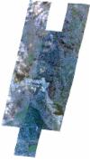
Static Map Catalogue - Full Metadata Record
Collection SkySat
SkySat ESA Archive. More details.
SSC_OPER_SSC_DEF_CO_20200719T080435_S02-069_E030-242_01
Download Product | BrowsePath | E030 |
Row | S02 |
Start Date | 2020-07-19T08:04:35Z |
Stop Date | 2020-07-19T08:04:35Z |
Availability Time | 2020-07-19T08:04:35Z |
Platform Short Name | SkySat |
Instrument Short Name | SkySat Camera |
Sensor Type | OPTICAL |
Operational mode | CAMERA |
Resolution | 0.5 |
Orbit Number | 0 |
Orbit Direction | |
Illumination Azimuth Angle | 50.8 |
Illumination Elevation Angle | 52.7 |
Across Track Incidence Angle | 27.1 |
Footprint | -2.14829523945 30.2326364463 -2.14829591537 30.2326429323 -2.13929620029 30.2345801793 -2.13091413891 30.2366602354 -2.13091412173 30.2366600738 -2.12656167136 30.2378356326 -2.1287480309 30.2576357315 -2.12062323225 30.2594573024 -2.1206274734 30.2594921851 -2.11244031319 30.2613977674 -2.1124450689 30.261433592 -2.1042155949 30.2634447195 -2.10421571839 30.2634457253 -2.10413306094 30.2634648892 -2.10311270741 30.2637142443 -2.10311122902 30.2637017983 -2.09602063527 30.2653457343 -2.09602412912 30.2653796485 -2.08622230807 30.2683330638 -2.0862182763 30.2682804797 -2.07906209046 30.2701183746 -2.07906384682 30.2701438879 -2.07063711426 30.2724055233 -2.07063986746 30.2724483596 -2.06964008843 30.2726731133 -2.06946423107 30.2727203113 -2.06946372279 30.2727127609 -2.06244736216 30.2742900626 -2.06245363239 30.2743789333 -2.05447759468 30.2759803518 -2.05447848982 30.2759933442 -2.04636936985 30.27775704 -2.04637257797 30.2777967069 -2.04523049638 30.2780047396 -2.04517842571 30.2780160647 -2.04517826931 30.2780142529 -2.03850832565 30.2792291983 -2.03850856536 30.2792315148 -2.0299766742 30.2816244371 -2.02997992832 30.2816721041 -2.02166283728 30.2837265704 -2.02166730389 30.2837888615 -2.0122273301 30.2859449165 -2.01222674368 30.2859370599 -2.00518310215 30.2876689419 -2.0051889675 30.2877562262 -1.99599138689 30.289521824 -1.99598601446 30.289458114 -1.98803128834 30.2910432391 -1.98620654674 30.2676241411 -1.99538983582 30.2659159848 -1.99539241808 30.2659472727 -2.00359233218 30.2639961759 -2.00359798442 30.2640802887 -2.01046962082 30.2623959662 -2.01046753335 30.2623679993 -2.01673026256 30.2609046668 -2.01513099806 30.2431408936 -2.01062252599 30.244288843 -2.01062332784 30.2442980931 -2.01045914521 30.2443304431 -2.00927080073 30.2446330199 -2.00926474025 30.2445657844 -2.00136625883 30.2461220734 -2.00136377471 30.2460960851 -1.99366263041 30.2477256022 -1.98483075102 30.2501318665 -1.98290045495 30.2265860973 -1.99264619065 30.2240971858 -1.99266340726 30.2242920828 -2.00057479531 30.2225685638 -2.00058345784 30.2226626314 -2.00859411916 30.2208893629 -2.00860285176 30.2209901012 -2.01666162729 30.2191284388 -2.01666603872 30.2191728823 -2.02474507244 30.2173335861 -2.02475439901 30.2174241681 -2.03285817808 30.2154915765 -2.03286892769 30.2155968136 -2.04108066369 30.2134621646 -2.04108884888 30.2135385351 -2.04913132373 30.2116829387 -2.04914014638 30.2117655099 -2.05731519853 30.2097164377 -2.05732191535 30.2097825793 -2.06570759989 30.2074138602 -2.06571547496 30.2074972919 -2.07379315479 30.2055758835 -2.07380164332 30.2056672681 -2.08182109587 30.2038572106 -2.08182689438 30.2039278999 -2.08996844507 30.201971612 -2.08997414639 30.202050691 -2.09788297254 30.2004715722 -2.09788574092 30.2005035566 -2.1059705073 30.1986916905 -2.10598000675 30.1987919002 -2.11417590425 30.1966949063 -2.11417932994 30.196729412 -2.12233369872 30.1947611025 -2.12452844499 30.2148217165 -2.1284970447 30.2139247117 -2.12849701041 30.2139243891 -2.12854336026 30.2139142432 -2.12970693062 30.2136512465 -2.12970779673 30.2136593481 -2.13756751429 30.2119388567 -2.14474381014 30.210147152 -2.14473951407 30.2101064166 -2.15393788056 30.2080986321 -2.15634949538 30.2308636603 -2.14829523945 30.2326364463 |
Scene Centre | -2.06962570508 30.2429021708 |
Size | 12193558259 |
Product type | SSC_DEF_CO |
Acquisition Type | NOMINAL |
Cloud-Cover Percentage | 0.03 |
Original Name | 20200719_080435_ssc4_u0002_SkySatCollect |
Bounding Box | -1.98290045495 30.1947611025 -2.15634949538 30.1947611025 -2.15634949538 30.2910432391 -1.98290045495 30.2910432391 |
