Static Map Catalogue - Full Metadata Record
Collection SkySat
SkySat ESA Archive. More details.
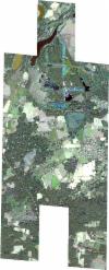
SSC_OPER_SSC_DEF_CO_20191013T095208_N51-754_E013-914_01
Download Product | BrowsePath | E013 |
Row | N51 |
Start Date | 2019-10-13T09:52:08Z |
Stop Date | 2019-10-13T09:52:08Z |
Availability Time | 2019-10-13T09:52:08Z |
Platform Short Name | SkySat |
Instrument Short Name | SkySat Camera |
Sensor Type | OPTICAL |
Operational mode | CAMERA |
Resolution | 0.5 |
Orbit Number | 0 |
Orbit Direction | |
Illumination Azimuth Angle | 163.4 |
Illumination Elevation Angle | 29.2 |
Across Track Incidence Angle | 28 |
Footprint | 51.6791717675 13.9682354348 51.6791683981 13.9683032624 51.6890838929 13.9681483981 51.6890817387 13.9681985308 51.6985281797 13.9681785838 51.6985233486 13.9682768201 51.7081756787 13.9681694184 51.7081700224 13.9682758163 51.7187673974 13.9681157894 51.7187641513 13.9681868738 51.7291880972 13.9680695858 51.7291837831 13.9681666841 51.7389029587 13.9680820534 51.7388982198 13.9681838634 51.7486427409 13.9680957636 51.748639792 13.9681585867 51.7583408964 13.9681035681 51.7583385751 13.9681541852 51.7680756528 13.9680344094 51.7680720598 13.9681098094 51.7777364259 13.9680481511 51.7777325146 13.9681228387 51.787442072 13.9680651016 51.7874381163 13.9681402289 51.7988388328 13.9680399037 51.8006606238 13.9332233083 51.8062725267 13.9330623036 51.8062618618 13.9332821215 51.8159638126 13.9330161744 51.8159535442 13.933236549 51.8256232771 13.9329667701 51.8256033387 13.9333784317 51.8369851319 13.9330676512 51.8388420893 13.8940638694 51.8293240495 13.8942414065 51.8293360168 13.8939848156 51.8195679627 13.8942345374 51.8195775305 13.8940297098 51.810003725 13.8942051612 51.8100157623 13.8939579274 51.8037613404 13.8940899285 51.8053923931 13.8604500174 51.7956530357 13.8606969744 51.7956683482 13.8603762588 51.785908962 13.860654527 51.7859230256 13.8603572959 51.7761966753 13.8606159103 51.776210656 13.8603217184 51.7665362288 13.860554742 51.766548538 13.8603031158 51.7568182637 13.8605406258 51.7568340123 13.8602148695 51.7470632715 13.8604774731 51.747078742 13.8601700615 51.736760868 13.8604316204 51.7367775289 13.8600908251 51.7263390951 13.8603811819 51.7263544694 13.8600603624 51.7166628708 13.8603262073 51.7166790805 13.8599864931 51.7069248381 13.8602733759 51.7069399887 13.859958581 51.6971988796 13.8602286488 51.6972125436 13.8599353734 51.6875753792 13.8601614936 51.687589642 13.8598669317 51.6759055217 13.8601299098 51.6740956256 13.8994645291 51.6837489388 13.899281541 51.6837394262 13.8994860356 51.6934040009 13.8992606452 51.6933922594 13.8995110794 51.7030946475 13.8992766477 51.7030828647 13.8995244841 51.7100426447 13.8993376792 51.7085760147 13.9291190616 51.70236081 13.929215898 51.7023679398 13.9290725436 51.6927276819 13.9291920864 51.6927338902 13.9290517329 51.6830498154 13.9291666468 51.6830553361 13.929053006 51.6713982329 13.9291954637 51.6695371246 13.9683267467 51.6791717675 13.9682354348 |
Scene Centre | 51.754202084 13.9140968392 |
Size | 12406794569 |
Product type | SSC_DEF_CO |
Acquisition Type | NOMINAL |
Cloud-Cover Percentage | 0 |
Original Name | 20191013_095208_ssc2_u0002_SkySatCollect |
Bounding Box | 51.8388420893 13.8598669317 51.6695371246 13.8598669317 51.6695371246 13.9683267467 51.8388420893 13.9683267467 |
