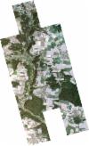
Static Map Catalogue - Full Metadata Record
Collection SkySat
SkySat ESA Archive. More details.
SSC_OPER_SSC_DEF_CO_20220823T091003_N49-133_E011-534_01
Download Product | BrowsePath | E011 |
Row | N49 |
Start Date | 2022-08-23T09:10:03Z |
Stop Date | 2022-08-23T09:10:03Z |
Availability Time | 2022-08-23T09:10:03Z |
Platform Short Name | SkySat |
Instrument Short Name | SkySat Camera |
Sensor Type | OPTICAL |
Operational mode | CAMERA |
Resolution | 0.5 |
Orbit Number | 0 |
Orbit Direction | |
Illumination Azimuth Angle | 134.4 |
Illumination Elevation Angle | 44.1 |
Across Track Incidence Angle | 4 |
Footprint | 49.0900581663 11.5369813978 49.0957005021 11.5350915533 49.0956782164 11.53494114 49.101204642 11.5330619867 49.1011854404 11.532930949 49.1042997462 11.5318695016 49.1070516135 11.5506632011 49.1030833609 11.5519981199 49.1031042598 11.5521427545 49.0975354612 11.5540230488 49.0975573149 11.5541744634 49.0919858274 11.55605268 49.0920065038 11.5561959694 49.0864374524 11.5580738507 49.0899802328 11.5827365071 49.0968279404 11.5804297771 49.0968062567 11.5802793445 49.1023797085 11.5784033245 49.102356795 11.5782447942 49.1079176677 11.5763709997 49.1078961262 11.5762213702 49.1134583996 11.5743433288 49.1134364065 11.5741900795 49.1190230099 11.5723233997 49.1190039511 11.5721910992 49.1246151626 11.5703307388 49.1245973354 11.5702090051 49.1302055287 11.5683526379 49.1301896477 11.5682452204 49.1357728348 11.5663822857 49.1357576435 11.5662787756 49.1413482844 11.5644184877 49.1413328461 11.5643137808 49.1469100642 11.5624387827 49.1468964312 11.5623456927 49.1524663184 11.5604667015 49.1524531206 11.560376306 49.1580480504 11.5585126204 49.1580341054 11.5584176221 49.1635892398 11.5565356115 49.1635775661 11.5564555247 49.1691637806 11.5545792595 49.1660520547 11.5331369865 49.1699754599 11.5317838105 49.1699657614 11.5317181426 49.1755594826 11.529823006 49.175548391 11.5297482155 49.1811341245 11.5278616423 49.1811248236 11.5277987973 49.1866771348 11.5258843359 49.1830482711 11.5012010888 49.1762054741 11.5035122264 49.1762170061 11.5035898248 49.170623416 11.505470257 49.1706358941 11.5055544297 49.1650697946 11.507445996 49.1650824501 11.5075316616 49.1619771863 11.5086006687 49.1587658276 11.4865401152 49.1518769706 11.4888361974 49.1518902309 11.4889250879 49.1463288054 11.4908173889 49.1463412314 11.4909007499 49.14078716 11.4928017669 49.1408001662 11.4928893004 49.1351932589 11.4947661006 49.1352067563 11.4948562861 49.1296323153 11.4967484167 49.1296450414 11.4968336923 49.1240579128 11.4987229124 49.1240715294 11.4988146414 49.1185242963 11.5007133883 49.1185389562 11.5008129437 49.1129870045 11.5027043647 49.113002186 11.502808763 49.1074542632 11.5046972627 49.1074703722 11.5048095475 49.1018707663 11.5066977467 49.1018896211 11.5068273605 49.0963082113 11.5087155963 49.096328188 11.5088512876 49.0907550224 11.5107410137 49.0907757704 11.5108817939 49.0852058789 11.5127734118 49.0852253675 11.5129077069 49.0796696887 11.5147918566 49.083237831 11.5394297401 49.0900774199 11.5371140718 49.0900581663 11.5369813978 |
Scene Centre | 49.1331834011 11.5346383111 |
Size | 6181466193 |
Product type | SSC_DEF_CO |
Acquisition Type | NOMINAL |
Cloud-Cover Percentage | 0 |
Original Name | 20220823_091003_ssc14_u0002_SkySatCollect |
Bounding Box | 49.1866771348 11.4865401152 49.0796696887 11.4865401152 49.0796696887 11.5827365071 49.1866771348 11.5827365071 |
