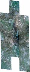
Static Map Catalogue - Full Metadata Record
Collection SkySat
SkySat ESA Archive. More details.
SSC_OPER_SSC_DEF_CO_20220323T100651_N53-499_E010-215_01
Download Product | BrowsePath | E010 |
Row | N53 |
Start Date | 2022-03-23T10:06:51Z |
Stop Date | 2022-03-23T10:06:51Z |
Availability Time | 2022-03-23T10:06:51Z |
Platform Short Name | SkySat |
Instrument Short Name | SkySat Camera |
Sensor Type | OPTICAL |
Operational mode | CAMERA |
Resolution | 0.5 |
Orbit Number | 0 |
Orbit Direction | |
Illumination Azimuth Angle | 155.7 |
Illumination Elevation Angle | 35.1 |
Across Track Incidence Angle | 27.4 |
Footprint | 53.4270656123 10.2717678793 53.4349260085 10.2719025678 53.4349450754 10.2716759344 53.443353232 10.271809749 53.4433704739 10.2716058283 53.4517697532 10.2717372893 53.4517866983 10.2715379438 53.4601938424 10.2716749842 53.4602155219 10.2714213073 53.4686477527 10.271553271 53.4686749932 10.2712361996 53.4772518853 10.2711299811 53.4772768397 10.2708353698 53.485701257 10.2709638891 53.4857258511 10.2706791896 53.4941480961 10.2707846145 53.4941716448 10.2705080983 53.5025913981 10.2706251711 53.502609447 10.2704157657 53.5109071905 10.2707050855 53.5109216977 10.2705423856 53.5193088744 10.2706397565 53.5193249833 10.2704614323 53.5277275772 10.2705739539 53.5277381063 10.2704568667 53.5361312653 10.2705306361 53.5361352719 10.2704859243 53.5445069429 10.27055317 53.5476517547 10.2353789849 53.5523265229 10.2354545616 53.552340215 10.2352923121 53.560805216 10.2353673988 53.5608115262 10.2352928792 53.5692293571 10.2353933314 53.5692341865 10.2353365508 53.5776453378 10.2354665794 53.5810891329 10.1955160477 53.5712022295 10.1954326615 53.5711953215 10.1955131496 53.5627970173 10.1953759458 53.5627857039 10.1955078867 53.554337082 10.1954235031 53.5543243393 10.195573627 53.5505451385 10.1955075095 53.5536005168 10.1601249617 53.5437548204 10.1599162091 53.5437449333 10.1600280659 53.5353293579 10.1599421093 53.5353175155 10.1600787733 53.5269328861 10.1599218898 53.5269176868 10.1600983665 53.5185249019 10.15992781 53.5185054793 10.1601540205 53.5100218265 10.1601076834 53.5100028138 10.1603318602 53.5015442538 10.1602677522 53.5015218929 10.1605346223 53.4930827601 10.1603973536 53.4930575391 10.1606927544 53.4846195337 10.1605421138 53.4845938055 10.1608435857 53.4761293981 10.1607207413 53.476105872 10.1609979387 53.4676445527 10.1608566852 53.4676244072 10.161095014 53.4591548094 10.1609705187 53.4591378882 10.1611712578 53.4506909754 10.1610330567 53.4506747605 10.1612268195 53.4422400677 10.1610902839 53.4422214943 10.1613131884 53.4337715636 10.1611837176 53.4337517643 10.1614231758 53.4258554322 10.1612756005 53.4225702107 10.2011364207 53.4322863879 10.2012843444 53.4323051052 10.201055105 53.4402064428 10.2011774914 53.4402236664 10.2009682273 53.44865804 10.2011020979 53.4486751763 10.2008954847 53.452636109 10.2009563498 53.4501588071 10.2315124898 53.4454137696 10.2314342723 53.4453959997 10.2316425351 53.4369898672 10.231502745 53.4369709174 10.2317260541 53.4285552454 10.2315984095 53.4285355161 10.2318324798 53.420658503 10.2317125938 53.4172874162 10.27185576 53.4270468237 10.2719927935 53.4270656123 10.2717678793 |
Scene Centre | 53.499201378 10.2159545013 |
Size | 12336493204 |
Product type | SSC_DEF_CO |
Acquisition Type | NOMINAL |
Cloud-Cover Percentage | 0 |
Original Name | 20220323_100651_ssc13_u0001_SkySatCollect |
Bounding Box | 53.5810891329 10.1599162091 53.4172874162 10.1599162091 53.4172874162 10.2719927935 53.5810891329 10.2719927935 |
