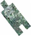
Static Map Catalogue - Full Metadata Record
Collection SkySat
SkySat ESA Archive. More details.
SSC_OPER_SSC_DEF_CO_20220411T113327_N52-348_E010-234_01
Download Product | BrowsePath | E010 |
Row | N52 |
Start Date | 2022-04-11T11:33:27Z |
Stop Date | 2022-04-11T11:33:27Z |
Availability Time | 2022-04-11T11:33:27Z |
Platform Short Name | SkySat |
Instrument Short Name | SkySat Camera |
Sensor Type | OPTICAL |
Operational mode | CAMERA |
Resolution | 0.5 |
Orbit Number | 0 |
Orbit Direction | |
Illumination Azimuth Angle | 184.9 |
Illumination Elevation Angle | 46 |
Across Track Incidence Angle | 12.9 |
Footprint | 52.3292554059 10.3031042308 52.3342964387 10.2969449641 52.3342388159 10.2968266349 52.339292983 10.2906697633 52.3392294691 10.2905394159 52.34427311 10.2843749196 52.3442063284 10.2842376526 52.3492579244 10.2780653336 52.3491983823 10.2779428473 52.3542406014 10.2717640608 52.3541904657 10.2716607755 52.3592377537 10.265472862 52.3591995319 10.2653939439 52.3642609965 10.2592041467 52.3642273893 10.2591348146 52.3692633064 10.2529443322 52.3692294441 10.252874293 52.3742711844 10.2466838255 52.3742427348 10.2466248892 52.3792935367 10.240432068 52.379272125 10.2403876441 52.384301315 10.2342075987 52.384279326 10.2341619017 52.3893237201 10.2279708193 52.3893033295 10.2279284401 52.3943573786 10.2217338967 52.3853194354 10.2029468826 52.3879400314 10.1997132459 52.3879332528 10.1996992375 52.3929712683 10.1934887814 52.3929623593 10.1934703952 52.3979859353 10.1872551926 52.3979818186 10.187246658 52.4030260697 10.1810094794 52.3926540479 10.1594983317 52.3869419672 10.166532577 52.3869468067 10.1665426125 52.3818781548 10.1727706494 52.3818855789 10.1727859876 52.3768596128 10.1789970351 52.3768603247 10.1789985086 52.3752857178 10.1809322794 52.3661844837 10.1620661418 52.3604382645 10.1691230807 52.360441965 10.1691307343 52.3553703273 10.1753488825 52.3553731938 10.1753548003 52.3510054459 10.1807308735 52.351002856 10.18072553 52.3452587799 10.1877694091 52.345266458 10.1877852405 52.3401988856 10.1939990828 52.3402063582 10.1940144571 52.3351427523 10.2002421429 52.3351485705 10.2002541036 52.3300757709 10.2064836004 52.3300886498 10.2065100685 52.3250169756 10.2127297012 52.3250387311 10.2127743035 52.319974987 10.2189841394 52.3200049777 10.2190455886 52.3149410442 10.2252529073 52.3149763438 10.2253251718 52.3099065494 10.2315255673 52.3099361637 10.2315861654 52.3048719517 10.2377889655 52.3048964712 10.2378390331 52.2998267475 10.2440351156 52.2998483517 10.2440790847 52.2948114212 10.2502662341 52.3054433606 10.2719474085 52.3111941426 10.2649351033 52.3111602724 10.2648661822 52.3162006804 10.2586897794 52.3161624088 10.2586116063 52.3212127882 10.2524276541 52.3211683058 10.2523366557 52.3227449462 10.2504104967 52.3306664385 10.2665518171 52.3280231101 10.269781127 52.3280782543 10.2698943246 52.3230295788 10.2760522156 52.3230793606 10.2761544867 52.3180423371 10.2823068345 52.3180865591 10.282397721 52.3130470176 10.2885450113 52.3236065078 10.3102147236 52.329309296 10.303215017 52.3292554059 10.3031042308 |
Scene Centre | 52.3489427133 10.2348565276 |
Size | 7582970194 |
Product type | SSC_DEF_CO |
Acquisition Type | NOMINAL |
Cloud-Cover Percentage | 0.01 |
Original Name | 20220411_113327_ssc15_u0006_SkySatCollect |
Bounding Box | 52.4030260697 10.1594983317 52.2948114212 10.1594983317 52.2948114212 10.3102147236 52.4030260697 10.3102147236 |
