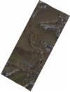
Static Map Catalogue - Full Metadata Record
Collection SkySat
SkySat ESA Archive. More details.
SSC_OPER_SSC_DEF_SC_20210219T134218_N50-675_E010-543_01
Download Product | BrowsePath | E010 |
Row | N50 |
Start Date | 2021-02-19T13:42:18Z |
Stop Date | 2021-02-19T13:42:18Z |
Availability Time | 2021-02-19T13:42:18Z |
Platform Short Name | SkySat |
Instrument Short Name | SkySat Camera |
Sensor Type | OPTICAL |
Operational mode | CAMERA |
Resolution | 0.5 |
Orbit Number | 0 |
Orbit Direction | |
Illumination Azimuth Angle | 214.9 |
Illumination Elevation Angle | 22 |
Across Track Incidence Angle | 16.2 |
Footprint | 50.669403873 10.5318174968 50.665703135 10.5418789515 50.6819112944 10.5557885927 50.6854702788 10.5456046869 50.669403873 10.5318174968 |
Scene Centre | 50.67562246 10.5437714374 |
Size | 187995447 |
Product type | SSC_DEF_SC |
Acquisition Type | NOMINAL |
Cloud-Cover Percentage | 0 |
Original Name | 20210219_134218_ssc19d2_0043_SkySatScene |
Bounding Box | 50.6854702788 10.5318174968 50.665703135 10.5318174968 50.665703135 10.5557885927 50.6854702788 10.5557885927 |
