Static Map Catalogue - Full Metadata Record
Collection SkySat
SkySat ESA Archive. More details.
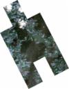
SSC_OPER_SSC_DEF_CO_20220811T132404_N48-202_E010-546_01
Download Product | BrowsePath | E010 |
Row | N48 |
Start Date | 2022-08-11T13:24:04Z |
Stop Date | 2022-08-11T13:24:04Z |
Availability Time | 2022-08-11T13:24:04Z |
Platform Short Name | SkySat |
Instrument Short Name | SkySat Camera |
Sensor Type | OPTICAL |
Operational mode | CAMERA |
Resolution | 0.5 |
Orbit Number | 0 |
Orbit Direction | |
Illumination Azimuth Angle | 227.5 |
Illumination Elevation Angle | 48.6 |
Across Track Incidence Angle | 7.1 |
Footprint | 48.164795016 10.5548598041 48.169712431 10.5512559842 48.1697128123 10.5512571447 48.1698432642 10.5511601006 48.1708929173 10.5503908426 48.1708898536 10.5503815354 48.1759572653 10.5466118525 48.1805730449 10.5432835982 48.1875893299 10.564406524 48.1824834066 10.5681693116 48.1824889109 10.5681861034 48.1775735963 10.5717375133 48.1775730291 10.5717357886 48.1769737293 10.5721709289 48.1763810918 10.5725991209 48.1763816512 10.5726008255 48.1702726112 10.5770364839 48.170281486 10.5770634977 48.1641908032 10.5815336526 48.172794506 10.6077130466 48.1801039207 10.6023917765 48.180090368 10.6023505952 48.1861845195 10.5979184342 48.1861722614 10.5978811643 48.1922524738 10.5934053448 48.1922376838 10.5933602902 48.1983082538 10.5888801539 48.1982922757 10.5888314468 48.2043482542 10.5843406165 48.2043269634 10.5842757087 48.2104071226 10.5798907889 48.2103921022 10.5798449483 48.2164356116 10.5753831769 48.216422993 10.5753446195 48.222492051 10.5709422146 48.2224656818 10.5708616402 48.228522199 10.5664104803 48.2285120143 10.5663793428 48.2345840255 10.5619224343 48.2345700212 10.5618795839 48.2406736811 10.5574534772 48.2330860735 10.5342140818 48.2369561606 10.5313523173 48.236957241 10.531355597 48.2441918891 10.5260048475 48.2441901472 10.5259995627 48.2490961779 10.5223773148 48.2490989338 10.5223856949 48.2563217548 10.5170378472 48.2477980941 10.4911435655 48.2417097886 10.4956066213 48.2417064617 10.4955965221 48.2353058924 10.5002973627 48.229565266 10.5044786553 48.2295536973 10.5044436103 48.2248413614 10.5079294436 48.2171497469 10.4844385686 48.2098942604 10.4897381569 48.2098976211 10.4897484317 48.2049609312 10.493356529 48.204955078 10.4933386601 48.1988933241 10.4978216061 48.1988873129 10.4978032658 48.192815727 10.50223432 48.1928049256 10.5022013559 48.1867374074 10.5066537416 48.1867322276 10.5066379466 48.1806556975 10.5110847735 48.1806505409 10.5110690635 48.1745694601 10.5155458127 48.1745641452 10.5155296342 48.1684630524 10.5199854944 48.1684535653 10.5199566314 48.1623304884 10.5243789881 48.1623208993 10.5243498572 48.1562274919 10.5288398466 48.1562185066 10.5288125579 48.1489105987 10.5340892216 48.157498653 10.5601957945 48.164796518 10.5548643657 48.164795016 10.5548598041 |
Scene Centre | 48.2026326502 10.5460758076 |
Size | 6896792917 |
Product type | SSC_DEF_CO |
Acquisition Type | NOMINAL |
Cloud-Cover Percentage | 0.04 |
Original Name | 20220811_132404_ssc8_u0003_SkySatCollect |
Bounding Box | 48.2563217548 10.4844385686 48.1489105987 10.4844385686 48.1489105987 10.6077130466 48.2563217548 10.6077130466 |
