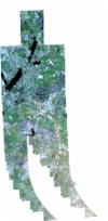
Static Map Catalogue - Full Metadata Record
Collection SkySat
SkySat ESA Archive. More details.
SSC_OPER_SSC_DEF_CO_20210418T141420_N54-181_E009-957_01
Download Product | BrowsePath | E009 |
Row | N54 |
Start Date | 2021-04-18T14:14:20Z |
Stop Date | 2021-04-18T14:14:20Z |
Availability Time | 2021-04-18T14:14:20Z |
Platform Short Name | SkySat |
Instrument Short Name | SkySat Camera |
Sensor Type | OPTICAL |
Operational mode | CAMERA |
Resolution | 0.5 |
Orbit Number | 0 |
Orbit Direction | |
Illumination Azimuth Angle | 235.7 |
Illumination Elevation Angle | 34.8 |
Across Track Incidence Angle | 25.6 |
Footprint | 54.1046090757 10.0140100052 54.1124297418 10.0139776573 54.1122886803 10.0106757059 54.1141964722 10.0106662329 54.1137229911 9.99945354215 54.121137088 9.99946077785 54.1210396262 9.99714094255 54.12208528 9.99714076489 54.1222742603 10.0011476939 54.1308852465 10.0011481864 54.1302587864 9.98806275743 54.1310323604 9.98806493991 54.1309439275 9.9859161178 54.1381277838 9.98591693405 54.1379772363 9.98263222577 54.1399408535 9.98263366391 54.1397984025 9.97952104571 54.1450376939 9.97952880357 54.1449676661 9.97770536761 54.1523104165 9.97770599763 54.1522834145 9.97695293087 54.1593739865 9.97695184634 54.1593625665 9.97661253553 54.1669215224 9.97661480174 54.1669102427 9.97626383746 54.1745761363 9.97624827091 54.1745639505 9.97583943424 54.1819230507 9.97582914756 54.181909304 9.97534298838 54.1893504826 9.97534714093 54.1893354765 9.97479124472 54.1968820604 9.97481672385 54.1968666281 9.97424984313 54.2044190356 9.97426171715 54.2044114445 9.97393461481 54.2118035699 9.97393554488 54.2118026077 9.97388667357 54.2191517005 9.97392388726 54.219150583 9.97386598721 54.2269512789 9.97386242061 54.2269478164 9.97366857236 54.2343130807 9.97366387017 54.2343105445 9.97349917786 54.2416498769 9.97344134486 54.2412851105 9.94557661662 54.2462191669 9.94546754998 54.2462190348 9.94546159915 54.2541339773 9.94536854987 54.2541315605 9.94522496079 54.2617565112 9.94526359322 54.2617538755 9.94511659402 54.2693212631 9.94511556654 54.2687179029 9.91318920124 54.2598409461 9.91331153147 54.2598429889 9.9134501682 54.2522278994 9.91348838716 54.2522298757 9.9136272963 54.2445937507 9.91363376499 54.2445944785 9.91366836904 54.2409485658 9.91373000825 54.2405247446 9.88552101596 54.2316945593 9.88563111475 54.2316963213 9.88576844707 54.2241387857 9.88586053873 54.2241412054 9.88599066935 54.2166198272 9.88608182465 54.2166203602 9.88610939979 54.2086783345 9.88620003749 54.2086789639 9.88622954286 54.2012202146 9.88629560084 54.2012273193 9.88659701616 54.1936782236 9.88668186445 54.1936917525 9.88721274792 54.1859818854 9.88728730437 54.1859955222 9.88776564792 54.1783635196 9.88784137193 54.1783762645 9.88829360002 54.1707877 9.88839678824 54.1707986871 9.88875509658 54.1633141417 9.88885859761 54.163323067 9.88913039666 54.15551749 9.88922444415 54.1555261967 9.8894886064 54.1478793035 9.88958621764 54.1479021784 9.8902431669 54.1406937245 9.89032875286 54.1407565085 9.89204943836 54.1332647597 9.89213599526 54.1333915266 9.89550201281 54.1260070832 9.89560743676 54.1262087793 9.9006594217 54.1190735447 9.90078021622 54.1191135309 9.90176182713 54.1179900407 9.90178064302 54.1183158516 9.90975626977 54.1107023604 9.90985878387 54.1108059538 9.91218490945 54.1090379355 9.91221103348 54.109517317 9.92336973636 54.1020333309 9.92345890304 54.1021793356 9.92674628217 54.1002378486 9.92676943452 54.1009169011 9.9418778386 54.0929682537 9.9419871486 54.0943829796 9.9734331753 54.1029368298 9.97344950121 54.1022418415 9.95825944286 54.1101850599 9.9581453265 54.1100403543 9.95487193551 54.1119749538 9.95484740346 54.1114841186 9.94367833735 54.1189562815 9.94357716263 54.1188588438 9.94128423633 54.1206651097 9.9412599338 54.1203220733 9.933251556 54.1278726798 9.93315862464 54.1278323998 9.93217823626 54.1289614308 9.93216464519 54.1287507433 9.92709540455 54.1358686366 9.92703275666 54.1357325158 9.92362322182 54.1431134723 9.92357624383 54.1430465601 9.92182455308 54.1504575196 9.92175370459 54.1504338456 9.92108429518 54.1576162505 9.92102369998 54.1576063653 9.92073867575 54.161213436 9.92072051395 54.1613030099 9.92297937776 54.1538279976 9.92299424259 54.1540470456 9.92809224682 54.1469158397 9.92816580859 54.146957945 9.92915443499 54.1458308498 9.92916620067 54.1461830419 9.93747397609 54.1385745607 9.93743149932 54.1386785483 9.93973550112 54.1368638605 9.93972677964 54.1372276075 9.94782059407 54.1351573832 9.94782664262 54.1352795468 9.95092164312 54.1298657064 9.95094677745 54.1298826369 9.95131980075 54.1279869741 9.95132906712 54.1281041537 9.95426153327 54.1280640723 9.95426174874 54.1281647166 9.95645404278 54.1211150627 9.95646774693 54.1211555087 9.95745405622 54.1200462617 9.9574567757 54.1203793017 9.96554965278 54.112916171 9.96556810881 54.1130126131 9.96787471978 54.1112232005 9.96787830311 54.1116908627 9.97907441236 54.1042867846 9.97910393172 54.1044304445 9.98240916045 54.1025085756 9.98241371697 54.1031760851 9.99762668409 54.0953222446 9.99764566558 54.0967310109 10.0293199502 54.1053277327 10.0293641036 54.1046090757 10.0140100052 |
Scene Centre | 54.1811661794 9.95744255978 |
Size | 11131076479 |
Product type | SSC_DEF_CO |
Acquisition Type | NOMINAL |
Cloud-Cover Percentage | 0 |
Original Name | 20210418_141420_ssc17_u0001_SkySatCollect |
Bounding Box | 54.2693212631 9.88552101596 54.0929682537 9.88552101596 54.0929682537 10.0293641036 54.2693212631 10.0293641036 |
