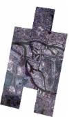
Static Map Catalogue - Full Metadata Record
Collection SkySat
SkySat ESA Archive. More details.
SSC_OPER_SSC_DEF_CO_20180408T125236_N53-520_E009-959_01
Download Product | BrowsePath | E009 |
Row | N53 |
Start Date | 2018-04-08T12:52:36Z |
Stop Date | 2018-04-08T12:52:36Z |
Availability Time | 2018-04-08T12:52:36Z |
Platform Short Name | SkySat |
Instrument Short Name | SkySat Camera |
Sensor Type | OPTICAL |
Operational mode | CAMERA |
Resolution | 0.5 |
Orbit Number | 0 |
Orbit Direction | |
Illumination Azimuth Angle | 210.1 |
Illumination Elevation Angle | 40.3 |
Across Track Incidence Angle | 25.6 |
Footprint | 53.4599395959 9.92540979462 53.4599307948 9.92546844638 53.4698247383 9.92891395437 53.4698286337 9.92888805768 53.478295837 9.93184527294 53.4783107998 9.93174246062 53.4820150179 9.93304389536 53.4768515362 9.96601606526 53.4723230783 9.96441749568 53.4722998457 9.96458126609 53.463955834 9.96167845018 53.4639424322 9.9617703685 53.4553165165 9.95874771448 53.4553133905 9.95876849382 53.4466564264 9.95574021953 53.4399394468 9.99894354655 53.4497781998 10.0023519926 53.4497917561 10.0022649837 53.4586009866 10.0053640064 53.4586247788 10.0052066485 53.4674072194 10.0083086562 53.4674385063 10.0080959745 53.4759141882 10.0111013386 53.4759487278 10.0108593484 53.4844868109 10.0138872499 53.4844917931 10.0138512309 53.4930035014 10.0168777344 53.4930300757 10.0166794177 53.5014707542 10.0196980642 53.5014933108 10.0195241588 53.5089493387 10.0221630439 53.5089399048 10.0222415684 53.5186444505 10.0256885228 53.5186658153 10.0255116648 53.5272170111 10.0285498413 53.5272322421 10.0284191711 53.5356847474 10.0314355971 53.5357083945 10.0312249017 53.5445552059 10.0343802256 53.5445694672 10.0342479963 53.5533377328 10.0373910766 53.5533444085 10.0373266053 53.5621618066 10.0405078514 53.5659744743 10.0021034168 53.5698076555 10.0034369396 53.5698284835 10.0032525262 53.5785621448 10.0062966185 53.5785747276 10.0061804866 53.5872501429 10.00919258 53.5872561295 10.0091349412 53.5960004461 10.0122651401 53.6003845794 9.96804363604 53.5905537177 9.96463065259 53.5905369185 9.96480087526 53.5820279787 9.96182020765 53.582009169 9.96200256423 53.5735534573 9.95901895372 53.5735275255 9.95925982229 53.5699069859 9.95798699624 53.5738146782 9.91785742522 53.5639331858 9.91434619616 53.5639117639 9.91456883061 53.5556650598 9.91167193138 53.5556378968 9.91194126203 53.5474273838 9.90901836648 53.5473988369 9.90928885908 53.5390940831 9.90618038172 53.5390742365 9.90636130448 53.5311277054 9.90355492207 53.5311029079 9.90377262602 53.5230402231 9.90093954985 53.5230333614 9.90099756491 53.5149388525 9.89818623025 53.5149194347 9.89834468187 53.506888746 9.89552582354 53.5068704745 9.89566967055 53.5007036021 9.89349316468 53.5007108779 9.89343981348 53.4909255652 9.88998365968 53.4909086828 9.89010776462 53.4828551379 9.88725215337 53.4828465735 9.88731307969 53.4764266528 9.88502505381 53.4764306824 9.88499826525 53.4681247693 9.88203312675 53.4681442853 9.88190750213 53.4581882496 9.87832395202 53.4513540699 9.9224342956 53.4599395959 9.92540979462 |
Scene Centre | 53.5201894463 9.95941590171 |
Size | 5038448768 |
Product type | SSC_DEF_CO |
Acquisition Type | NOMINAL |
Cloud-Cover Percentage | 0.03 |
Original Name | 20180408_125236_ssc10_u0001_SkySatCollect |
Bounding Box | 53.6003845794 9.87832395202 53.4399394468 9.87832395202 53.4399394468 10.0405078514 53.6003845794 10.0405078514 |
