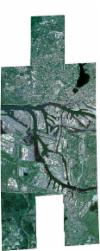
Static Map Catalogue - Full Metadata Record
Collection SkySat
SkySat ESA Archive. More details.
SSC_OPER_SSC_DEF_CO_20170511T125207_N53-526_E009-958_01
Download Product | BrowsePath | E009 |
Row | N53 |
Start Date | 2017-05-11T12:52:07Z |
Stop Date | 2017-05-11T12:52:07Z |
Availability Time | 2017-05-11T12:52:07Z |
Platform Short Name | SkySat |
Instrument Short Name | SkySat Camera |
Sensor Type | OPTICAL |
Operational mode | CAMERA |
Resolution | 0.5 |
Orbit Number | 0 |
Orbit Direction | |
Illumination Azimuth Angle | 0 |
Illumination Elevation Angle | 0 |
Across Track Incidence Angle | 22.4 |
Footprint | 53.4380638233 9.93914556903 53.4501070852 9.93924178607 53.4500931 9.93882962893 53.4621083731 9.93887642641 53.4621007078 9.93862382598 53.4677739314 9.93864307511 53.4691483547 9.97668744411 53.4616132963 9.97663626594 53.4616248175 9.97701673214 53.4500666398 9.97692433795 53.4500841245 9.97747465874 53.4380732687 9.97735881489 53.4380910451 9.97791090309 53.4260771593 9.97779402102 53.4277239327 10.0268187125 53.4413282806 10.0269719069 53.4413055865 10.0262831839 53.453179629 10.0263942265 53.4531564674 10.0256966305 53.4650781719 10.0257972946 53.4650623881 10.0252852316 53.4764914286 10.025365337 53.4764752885 10.0248082485 53.4879103731 10.0248817084 53.4879005763 10.0245386943 53.4992868116 10.0246013947 53.4992796057 10.0243387931 53.5107586619 10.0244068353 53.5107540912 10.0242344483 53.5223758069 10.0242841549 53.5223720457 10.0241349799 53.533489824 10.024208335 53.5334845637 10.0239918543 53.5450492887 10.0240719695 53.545045417 10.0239047702 53.5546623113 10.0239468485 53.554665357 10.0240864442 53.5660985634 10.0241895659 53.5661023622 10.0243669482 53.5775605132 10.0244346779 53.5775626146 10.0245395627 53.5904485941 10.024598248 53.589545821 9.98146259094 53.5948669526 9.98146212709 53.5948725999 9.98171170385 53.6061830315 9.98170378631 53.6061899012 9.98202466336 53.6175294933 9.98196348483 53.6175345011 9.98220557863 53.6304331211 9.98213209828 53.629453001 9.93461226689 53.6181406558 9.93460248082 53.6181338096 9.93428251358 53.6068398533 9.93425622785 53.606830364 9.93383717616 53.595590043 9.9337907175 53.595581683 9.93343967135 53.5884596229 9.93342039866 53.5875879659 9.89204848794 53.5760426953 9.89207534951 53.5760328416 9.89162901451 53.5645572354 9.89166761678 53.5645448276 9.89112377143 53.5531663555 9.89114937609 53.553155838 9.8906883339 53.5417727701 9.89075349327 53.541767546 9.89053532174 53.5300693615 9.89057872669 53.5300663256 9.89045748277 53.5188201254 9.89048749396 53.5188155564 9.89031088039 53.5070464152 9.89032426509 53.5070408097 9.89011802356 53.4954445999 9.89015416078 53.4954410462 9.89002522576 53.4839206616 9.8900319092 53.4839191481 9.88997896188 53.4705016756 9.88995641482 53.4705062755 9.89010759067 53.458772421 9.89007880236 53.4587755438 9.89018346541 53.4470537479 9.8901555942 53.4470619256 9.89040480902 53.4348334569 9.89037238429 53.4348421091 9.89062500941 53.4227500924 9.8905776319 53.4245008812 9.93942357925 53.4380783111 9.93955749091 53.4380638233 9.93914556903 |
Scene Centre | 53.5266111848 9.95846416086 |
Size | 7618179746 |
Product type | SSC_DEF_CO |
Acquisition Type | NOMINAL |
Cloud-Cover Percentage | 0 |
Original Name | 20170511_125207_ss02_u0001_SkySatCollect |
Bounding Box | 53.6304331211 9.88995641482 53.4227500924 9.88995641482 53.4227500924 10.0269719069 53.6304331211 10.0269719069 |
