Static Map Catalogue - Full Metadata Record
Collection SkySat
SkySat ESA Archive. More details.
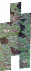
SSC_OPER_SSC_DEF_CO_20211123T095358_N49-203_E009-099_01
Download Product | BrowsePath | E009 |
Row | N49 |
Start Date | 2021-11-23T09:53:58Z |
Stop Date | 2021-11-23T09:53:58Z |
Availability Time | 2021-11-23T09:53:58Z |
Platform Short Name | SkySat |
Instrument Short Name | SkySat Camera |
Sensor Type | OPTICAL |
Operational mode | CAMERA |
Resolution | 0.5 |
Orbit Number | 0 |
Orbit Direction | |
Illumination Azimuth Angle | 161.2 |
Illumination Elevation Angle | 18.4 |
Across Track Incidence Angle | 26.6 |
Footprint | 49.1404211129 9.08473757988 49.148347509 9.08478025648 49.1483374756 9.08463149399 49.1563860619 9.08502848147 49.1563832331 9.0849872711 49.1601247374 9.08507247 49.1617966683 9.11184375777 49.1587639066 9.11176468337 49.1587612317 9.11172388081 49.1495079629 9.11154073109 49.1495120381 9.11160118495 49.1415252687 9.11144258883 49.1415284247 9.11149095223 49.1336218007 9.11152370488 49.1358661276 9.14625070831 49.1442737776 9.14619552844 49.1518564991 9.14637989979 49.1518616282 9.14645598754 49.1598434117 9.14650430717 49.1598475308 9.14656598157 49.1679492175 9.1468478387 49.167957519 9.14696977646 49.1760206059 9.14712895497 49.1760315231 9.14728283044 49.1839579009 9.14721518311 49.1839642522 9.1473068689 49.1919684286 9.14727244346 49.1919835862 9.14749186123 49.2001077807 9.14774502299 49.2001164367 9.14786710852 49.2082124488 9.14809339296 49.2082201429 9.1481991327 49.2162112687 9.14827785038 49.2162142985 9.14831785143 49.2248057735 9.14844911362 49.224814798 9.14856900432 49.2333390316 9.14853098017 49.2333512056 9.14869424982 49.2411913302 9.14856351695 49.2411915995 9.14856735691 49.2507525308 9.1489853309 49.2483731909 9.11758185569 49.2512457724 9.11764325631 49.2512501403 9.11770356258 49.2597570194 9.1176413825 49.2597604379 9.11768953173 49.2679612754 9.11805169083 49.2679704952 9.1181719268 49.2771054255 9.11779075977 49.2746846017 9.08273655881 49.2652335933 9.08247982032 49.2652382011 9.08253991015 49.257258813 9.08245460009 49.2572618842 9.08249785818 49.2486873969 9.08231998884 49.2486889459 9.0823413757 49.240037077 9.0820329536 49.2400425378 9.08210805557 49.2370320427 9.08204696294 49.234650793 9.05045544612 49.225074424 9.05001584745 49.2250900801 9.05021051203 49.2166479489 9.05001386936 49.2166493184 9.05003178561 49.2081700442 9.04992095973 49.2081837934 9.05010778529 49.2003243043 9.05005824886 49.2003364994 9.05022165693 49.1925026296 9.05026668427 49.1925033712 9.05027720739 49.1857458196 9.04995206013 49.1857437089 9.04992290317 49.1847705938 9.04990513604 49.1843845928 9.04988656316 49.1843854422 9.04989810394 49.1763959837 9.04975223242 49.1764021225 9.04983594326 49.1684447288 9.04967229573 49.1684496364 9.04974000574 49.1605111903 9.04962618952 49.1605177232 9.04971619407 49.152590427 9.04959068375 49.1526013325 9.04974468858 49.1446054392 9.04940176041 49.1446198068 9.04961190292 49.1367206139 9.0494448787 49.1367357661 9.04966343954 49.128938477 9.04977903479 49.1314258941 9.08523047424 49.1404269317 9.0848236385 49.1404211129 9.08473757988 |
Scene Centre | 49.2030326527 9.09919354565 |
Size | 10123981683 |
Product type | SSC_DEF_CO |
Acquisition Type | NOMINAL |
Cloud-Cover Percentage | 0 |
Original Name | 20211123_095358_ssc12_u0001_SkySatCollect |
Bounding Box | 49.2771054255 9.04940176041 49.128938477 9.04940176041 49.128938477 9.1489853309 49.2771054255 9.1489853309 |
