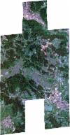
Static Map Catalogue - Full Metadata Record
Collection SkySat
SkySat ESA Archive. More details.
SSC_OPER_SSC_DEF_CO_20220520T095916_N48-158_E009-039_01
Download Product | BrowsePath | E009 |
Row | N48 |
Start Date | 2022-05-20T09:59:16Z |
Stop Date | 2022-05-20T09:59:16Z |
Availability Time | 2022-05-20T09:59:16Z |
Platform Short Name | SkySat |
Instrument Short Name | SkySat Camera |
Sensor Type | OPTICAL |
Operational mode | CAMERA |
Resolution | 0.5 |
Orbit Number | 0 |
Orbit Direction | |
Illumination Azimuth Angle | 142.8 |
Illumination Elevation Angle | 57.5 |
Across Track Incidence Angle | 27.1 |
Footprint | 48.1060511051 9.02535611864 48.112300076 9.02541781815 48.1123088263 9.02553118968 48.1215636839 9.02524606127 48.1215555253 9.02513709037 48.1268620184 9.02506018825 48.1291171275 9.05268796222 48.1224587572 9.05271996384 48.122469362 9.05286131454 48.1147678285 9.05303590886 48.1147777392 9.05317440585 48.1069462113 9.05293614078 48.1069633271 9.05315909975 48.0993710892 9.05354520468 48.1020318792 9.08965829742 48.1115026857 9.08974037758 48.1114770184 9.08941562962 48.1190818912 9.08923127666 48.1190687055 9.0890507962 48.126884966 9.08939482012 48.1268662721 9.08915217857 48.1345481791 9.08910191217 48.1345256906 9.08880354023 48.1422398614 9.08900200508 48.1422241465 9.08879114332 48.1499095192 9.08879793076 48.1499003512 9.08867374655 48.1576399841 9.08882035469 48.1576005232 9.08829064338 48.1641062453 9.08843680956 48.1732879705 9.08915425668 48.1732619108 9.08881002809 48.1811087991 9.08929477739 48.1811011054 9.08919402921 48.1888472817 9.08925489328 48.188833701 9.08907076077 48.1964572463 9.08890809157 48.1944827956 9.057570229 48.1990386233 9.05732830655 48.1990485064 9.05746043773 48.2065705653 9.05685181865 48.2065727944 9.05688654648 48.2157641072 9.05673194964 48.2157487787 9.0564720661 48.2235062233 9.05682391023 48.2213079943 9.02181042333 48.2135055668 9.02218402986 48.2043133343 9.02168684216 48.204325885 9.02188236695 48.1977987296 9.02121944458 48.1977795475 9.0209647288 48.1913714366 9.02093932742 48.1893513815 8.9899336247 48.1815576024 8.99005227052 48.1815507482 8.98995088775 48.1735857882 8.98971036029 48.1735713893 8.98950660208 48.1657522486 8.98967030821 48.1657388781 8.98948050176 48.157824813 8.98950370885 48.1578041068 8.98920669188 48.1491786358 8.98950511683 48.1422196946 8.98926439865 48.1422150798 8.98920218929 48.1410880269 8.9892252529 48.1407453412 8.98921339899 48.1407466703 8.9892322383 48.1329936163 8.98939089405 48.1330045656 8.98954588725 48.1266866275 8.98951198967 48.1266779461 8.98939342579 48.1173871657 8.98948063752 48.1173895352 8.98951301988 48.1110491206 8.98946858178 48.1110468364 8.98943925144 48.1100324118 8.98946145597 48.1095245703 8.98945789666 48.1095257011 8.98947254726 48.103253854 8.98960983045 48.1032473576 8.98952681223 48.0938484775 8.98948043219 48.0966906579 9.0255516311 48.106060402 9.02547492461 48.1060511051 9.02535611864 |
Scene Centre | 48.1586883095 9.03947128344 |
Size | 8690344294 |
Product type | SSC_DEF_CO |
Acquisition Type | NOMINAL |
Cloud-Cover Percentage | 0 |
Original Name | 20220520_095916_ssc4_u0002_SkySatCollect |
Bounding Box | 48.2235062233 8.98920218929 48.0938484775 8.98920218929 48.0938484775 9.08974037758 48.2235062233 9.08974037758 |
