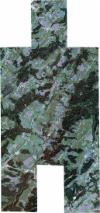
Static Map Catalogue - Full Metadata Record
Collection SkySat
SkySat ESA Archive. More details.
SSC_OPER_SSC_DEF_CO_20220825T085200_N47-544_E009-877_01
Download Product | BrowsePath | E009 |
Row | N47 |
Start Date | 2022-08-25T08:52:00Z |
Stop Date | 2022-08-25T08:52:00Z |
Availability Time | 2022-08-25T08:52:00Z |
Platform Short Name | SkySat |
Instrument Short Name | SkySat Camera |
Sensor Type | OPTICAL |
Operational mode | CAMERA |
Resolution | 0.5 |
Orbit Number | 0 |
Orbit Direction | |
Illumination Azimuth Angle | 126.8 |
Illumination Elevation Angle | 41.5 |
Across Track Incidence Angle | 8.8 |
Footprint | 47.5023182801 9.91128410605 47.5080018912 9.91135851033 47.5080018198 9.91133560549 47.5135662382 9.9114314248 47.5135666949 9.91139342047 47.5192087357 9.91148775569 47.5192095217 9.91144547119 47.5250180744 9.91150948681 47.5250190871 9.91145708519 47.5308427676 9.91151256361 47.5308436845 9.91146841099 47.5367267316 9.91151609209 47.5367276858 9.91147098624 47.5425675067 9.91151899829 47.5425684864 9.91147649656 47.5483622564 9.9115209949 47.5483631751 9.91148285481 47.5542427801 9.9115348917 47.5542435785 9.91149524188 47.560032352 9.91154367478 47.5600328577 9.91151617805 47.565974679 9.91157405298 47.5659750108 9.91154637727 47.5718015575 9.91160487501 47.5719727464 9.89014199583 47.5753897891 9.89015411102 47.5753898103 9.89015857547 47.5810831057 9.89017662596 47.5810831212 9.89018122944 47.5868229696 9.89020689298 47.5868229787 9.89021114558 47.59387291 9.89024087759 47.593914496 9.8656260401 47.5867705499 9.86560014883 47.5867705501 9.86560024998 47.5810001148 9.86557889975 47.5810001186 9.86558002091 47.5765978582 9.8655621535 47.5765978565 9.86556167377 47.5723837028 9.86554325076 47.5723442908 9.8441054633 47.566516659 9.84409620716 47.566516591 9.84408089409 47.5608949486 9.84406501549 47.560895018 9.84404048887 47.5551828499 9.84403141594 47.5551828695 9.84402106392 47.5494095396 9.84400414297 47.5494095646 9.84399202688 47.543671304 9.84397442379 47.5436713065 9.84397290248 47.5379341168 9.84395413505 47.5379341259 9.84393871569 47.5321589127 9.84392368217 47.532158882 9.84389753123 47.5263749485 9.84388807897 47.5263749337 9.84387618645 47.5206080769 9.84384516401 47.5206080473 9.84383462861 47.5149819745 9.84377528616 47.5149823224 9.84371965666 47.5092143501 9.84371157433 47.5092145027 9.84369090507 47.5034546831 9.84366554729 47.5034551809 9.8436331071 47.4964257651 9.84356049338 47.49577051 9.86836409347 47.5016940525 9.86834317452 47.5016938763 9.86835380182 47.5076705921 9.86832814203 47.507670509 9.86833901517 47.513493119 9.86835146155 47.5134930555 9.86836181443 47.51778789 9.86836704642 47.5172658452 9.88686840471 47.5124875037 9.88684640098 47.5124873783 9.88686578351 47.5065859134 9.88685410242 47.506586026 9.8868741098 47.5009404379 9.88679680896 47.5009404916 9.88681269559 47.4953432772 9.88670575408 47.4953067146 9.9112211183 47.5023183609 9.91130706395 47.5023182801 9.91128410605 |
Scene Centre | 47.544615636 9.87758268419 |
Size | 5870164209 |
Product type | SSC_DEF_CO |
Acquisition Type | NOMINAL |
Cloud-Cover Percentage | 0 |
Original Name | 20220825_085200_ssc15_u0002_SkySatCollect |
Bounding Box | 47.593914496 9.84356049338 47.4953067146 9.84356049338 47.4953067146 9.91160487501 47.593914496 9.91160487501 |
