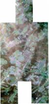
Static Map Catalogue - Full Metadata Record
Collection SkySat
SkySat ESA Archive. More details.
SSC_OPER_SSC_DEF_CO_20220814T130034_N47-545_E009-877_01
Download Product | BrowsePath | E009 |
Row | N47 |
Start Date | 2022-08-14T13:00:34Z |
Stop Date | 2022-08-14T13:00:34Z |
Availability Time | 2022-08-14T13:00:34Z |
Platform Short Name | SkySat |
Instrument Short Name | SkySat Camera |
Sensor Type | OPTICAL |
Operational mode | CAMERA |
Resolution | 0.5 |
Orbit Number | 0 |
Orbit Direction | |
Illumination Azimuth Angle | 218.8 |
Illumination Elevation Angle | 51.3 |
Across Track Incidence Angle | 2.9 |
Footprint | 47.5039933988 9.86820868348 47.5097995724 9.86822553094 47.5098000412 9.86816442541 47.5155876555 9.86825021119 47.5155880994 9.8681893283 47.5183838559 9.86822602711 47.5181300223 9.88683718305 47.5146963513 9.88676746278 47.5146953664 9.88685959358 47.5088851997 9.88683314924 47.5088844197 9.88692538755 47.5031084679 9.88680273323 47.5031075879 9.88691298915 47.497358687 9.88667995092 47.4971425095 9.91070827692 47.5039983929 9.91088226396 47.5039991862 9.91077970452 47.5097585001 9.91096894583 47.5097594032 9.91086664578 47.5155089984 9.91110446428 47.5155102709 9.91099288818 47.5212823277 9.91114496538 47.5212838139 9.91101717397 47.5270872717 9.91110890577 47.5270888166 9.91097500752 47.5328998071 9.91107362927 47.5329012445 9.91094453231 47.5387050263 9.91102017645 47.5387063868 9.91089273977 47.5445154604 9.91098927067 47.5445165954 9.91086937862 47.5502918236 9.91096795948 47.5502931279 9.91083630058 47.5560961056 9.91091230594 47.5560971201 9.91080638882 47.561893993 9.91089612141 47.5618948688 9.91080270558 47.5677281698 9.91090039177 47.5677290165 9.91079443516 47.5735396011 9.91090624942 47.5737046566 9.88998248712 47.5770297646 9.89004999297 47.5770302 9.88997527558 47.5828098182 9.89009751811 47.5828102365 9.89002339402 47.5886025572 9.89013107182 47.5886031055 9.89004527012 47.5944168986 9.890156406 47.5945791529 9.86608758194 47.5877167541 9.86599765541 47.5877159545 9.86612386142 47.581905269 9.86602381497 47.5819047975 9.86610336444 47.5761101323 9.86597960582 47.5761097075 9.86605233444 47.5734374423 9.86599094815 47.5736069532 9.84454842731 47.5667467677 9.84445543386 47.5667464588 9.8444971238 47.5609217301 9.84437807948 47.5609209691 9.84448698848 47.5551128511 9.84436627639 47.5551123249 9.8444440783 47.5493255646 9.84435909194 47.5493249757 9.84444244917 47.5435496555 9.84434074622 47.5435493441 9.84438142924 47.537775913 9.84427638549 47.5377754836 9.84433721266 47.5319933836 9.84424776419 47.5319929713 9.84431083874 47.5262054076 9.84423267673 47.526205122 9.84427855548 47.520423016 9.8441791645 47.5204226653 9.84423950072 47.514664396 9.84408455802 47.5146641257 9.84412257652 47.5088801967 9.84402149456 47.5088799408 9.84405583044 47.5030961463 9.84394513231 47.5030959429 9.84396827625 47.4973211633 9.84381638652 47.4970632648 9.86827011916 47.503993036 9.86825000356 47.5039933988 9.86820868348 |
Scene Centre | 47.5458261342 9.87748067595 |
Size | 6198439587 |
Product type | SSC_DEF_CO |
Acquisition Type | NOMINAL |
Cloud-Cover Percentage | 0 |
Original Name | 20220814_130034_ssc14_u0002_SkySatCollect |
Bounding Box | 47.5945791529 9.84381638652 47.4970632648 9.84381638652 47.4970632648 9.91114496538 47.5945791529 9.91114496538 |
