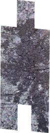
Static Map Catalogue - Full Metadata Record
Collection SkySat
SkySat ESA Archive. More details.
SSC_OPER_SSC_DEF_CO_20221214T095958_N53-143_E008-197_01
Download Product | BrowsePath | E008 |
Row | N53 |
Start Date | 2022-12-14T09:59:58Z |
Stop Date | 2022-12-14T09:59:58Z |
Availability Time | 2022-12-14T09:59:58Z |
Platform Short Name | SkySat |
Instrument Short Name | SkySat Camera |
Sensor Type | OPTICAL |
Operational mode | CAMERA |
Resolution | 0.5 |
Orbit Number | 0 |
Orbit Direction | |
Illumination Azimuth Angle | 160.9 |
Illumination Elevation Angle | 11.7 |
Across Track Incidence Angle | 28.3 |
Footprint | 53.0709676191 8.24735030772 53.0709541378 8.24758175189 53.081364794 8.24763248226 53.0813682012 8.24757379058 53.0903851509 8.24761112378 53.0903879663 8.24756313694 53.0993994938 8.24760487315 53.0994004933 8.24758746861 53.108380642 8.24764230148 53.1083814678 8.24762800695 53.1173671272 8.24766759398 53.1173686991 8.24763960522 53.1247604442 8.24768285776 53.1247603027 8.24768533147 53.1337139482 8.2477253288 53.1337132374 8.24773785101 53.1426375818 8.24779596529 53.1426371544 8.24780346318 53.153253722 8.24785921293 53.1532539707 8.24785482433 53.1622470534 8.24788833547 53.1622485071 8.24786191338 53.1712171384 8.24791738074 53.1712195452 8.24787367017 53.180137253 8.24793906427 53.1801404399 8.2478816223 53.1890688167 8.24793863717 53.1908363245 8.21578643846 53.1964367702 8.2158390378 53.1964405581 8.21576765141 53.2054386372 8.21585991729 53.2054439584 8.21576093824 53.2144798992 8.21584013169 53.2144850628 8.21574247757 53.2234867907 8.21582696246 53.2254208898 8.17917069078 53.2148328982 8.17903714238 53.2148231461 8.17921989537 53.2058726003 8.17909806736 53.2058631433 8.17927311191 53.1968727442 8.17915782359 53.1968644544 8.17931351282 53.1920992271 8.17924369848 53.1938713213 8.1463023398 53.1832137672 8.14612455888 53.1832000702 8.14637721181 53.174320952 8.14622552388 53.1743079432 8.14646307666 53.1654535816 8.1462934654 53.165440749 8.14652257246 53.1564962583 8.1463717232 53.1564851704 8.1465748465 53.1475677611 8.14641177645 53.1475549769 8.14664574907 53.1386783626 8.14648891193 53.138668193 8.14666975052 53.1297314401 8.14653279546 53.1297213912 8.14671319713 53.1208188049 8.14656457587 53.1208078289 8.1467580906 53.1118849164 8.14662290542 53.1118738913 8.14681693844 53.1029644985 8.14667482795 53.1029467388 8.14698426088 53.0940985007 8.14684230261 53.0940905313 8.14697647485 53.0850772711 8.14682000281 53.0850637989 8.14705100108 53.0761171429 8.14689145929 53.0761031153 8.14712762911 53.0671616464 8.14694297672 53.0649601994 8.18325952687 53.0753443142 8.18339170858 53.0753550683 8.18321105317 53.0843978381 8.18329589481 53.0844071503 8.18313374846 53.0933900498 8.18323384205 53.0933979534 8.18309537781 53.0975265354 8.1831421362 53.0959506095 8.21105595203 53.0910513899 8.2110173084 53.0910452539 8.2111224377 53.0820569357 8.21107216199 53.0820500353 8.21119062697 53.0746177237 8.21113492477 53.0746255502 8.21099241553 53.0642026228 8.210986636 53.0622712617 8.24730229054 53.0709676191 8.24735030772 |
Scene Centre | 53.1438569297 8.19703181157 |
Size | 13089665249 |
Product type | SSC_DEF_CO |
Acquisition Type | NOMINAL |
Cloud-Cover Percentage | 0 |
Original Name | 20221214_095958_ssc12_u0001_SkySatCollect |
Bounding Box | 53.2254208898 8.14612455888 53.0622712617 8.14612455888 53.0622712617 8.24793906427 53.2254208898 8.24793906427 |
