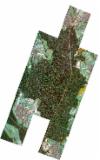
Static Map Catalogue - Full Metadata Record
Collection SkySat
SkySat ESA Archive. More details.
SSC_OPER_SSC_DEF_CO_20210613T175851_N49-214_E008-576_01
Download Product | BrowsePath | E008 |
Row | N49 |
Start Date | 2021-06-13T17:58:51Z |
Stop Date | 2021-06-13T17:58:51Z |
Availability Time | 2021-06-13T17:58:51Z |
Platform Short Name | SkySat |
Instrument Short Name | SkySat Camera |
Sensor Type | OPTICAL |
Operational mode | CAMERA |
Resolution | 0.5 |
Orbit Number | 0 |
Orbit Direction | |
Illumination Azimuth Angle | 291.5 |
Illumination Elevation Angle | 12.3 |
Across Track Incidence Angle | 26.9 |
Footprint | 49.1666329171 8.54526611755 49.1666022741 8.54539670768 49.1733938852 8.54899252685 49.1733520063 8.54917090839 49.1802427062 8.55292981409 49.1802239258 8.55300945284 49.1860839483 8.55622206819 49.1813337434 8.57724557675 49.1766558654 8.57470766584 49.1766795529 8.57460838888 49.1699210505 8.57094996193 49.169972473 8.57072910761 49.1631575836 8.56705577466 49.1631711483 8.56699718584 49.1547273179 8.56241431788 49.1485380033 8.58939602554 49.1552363078 8.59306849071 49.1552210222 8.59313362268 49.1618613343 8.59674927705 49.1618078287 8.59697644046 49.1685638671 8.60064354002 49.1685176374 8.60083755069 49.1770676677 8.60548751324 49.1771031485 8.60533900205 49.1841112135 8.60914540275 49.184172616 8.60888901402 49.1912954187 8.61275335936 49.1913145438 8.61267371004 49.1964984476 8.61551602811 49.1964690541 8.61563534319 49.2032096628 8.61934853752 49.2031521508 8.61957938444 49.2099967603 8.62336827441 49.2099780717 8.62344252001 49.218657699 8.62822162513 49.2186891074 8.62809697644 49.2257257774 8.63199224139 49.2257727087 8.6318084495 49.231029482 8.6346131575 49.2310051172 8.63470682056 49.2397683889 8.63940121316 49.2460031869 8.61566684287 49.2520180291 8.61893604796 49.2520578888 8.61877731922 49.2592595702 8.62268237233 49.2592957264 8.62253837318 49.2664153598 8.6264164526 49.2664158903 8.62641435638 49.2734210792 8.63022706798 49.2803455773 8.60322469 49.2716284742 8.59844789658 49.2716225238 8.59847114478 49.2645826835 8.59461680762 49.2645362646 8.59480023949 49.2573576091 8.5908801626 49.2573108199 8.59106506524 49.2531640865 8.58880741149 49.2594836001 8.56458609282 49.2524685977 8.56075945915 49.2524694358 8.56075626598 49.2521071338 8.5605622832 49.2508500126 8.55987653257 49.2508470738 8.55988762515 49.2437744303 8.55610080883 49.2437123285 8.55633757053 49.2364794595 8.55243057179 49.2364254829 8.55263848771 49.2308420533 8.54961547998 49.2308497365 8.54958520897 49.223826898 8.54577861275 49.2238719671 8.54559675488 49.2168382162 8.54178422855 49.2168580584 8.54170334067 49.2082642216 8.53705313742 49.2082324129 8.5371817791 49.2010916031 8.53337041162 49.2010218187 8.53365820815 49.1937517051 8.52978628304 49.1937096568 8.52996221743 49.1881705104 8.52701851195 49.1881832218 8.52696449242 49.1812582775 8.52328242905 49.1812918873 8.52313649871 49.1744622361 8.51929730282 49.174527 8.51901852809 49.1659944316 8.51450647914 49.1597713363 8.54162145984 49.1666329171 8.54526611755 |
Scene Centre | 49.214458622 8.57695384615 |
Size | 9026207988 |
Product type | SSC_DEF_CO |
Acquisition Type | NOMINAL |
Cloud-Cover Percentage | 0 |
Original Name | 20210613_175851_ssc17_u0003_SkySatCollect |
Bounding Box | 49.2803455773 8.51450647914 49.1485380033 8.51450647914 49.1485380033 8.63940121316 49.2803455773 8.63940121316 |
