Static Map Catalogue - Full Metadata Record
Collection SkySat
SkySat ESA Archive. More details.
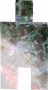
SSC_OPER_SSC_DEF_CO_20220520T131704_N48-183_E008-974_01
Download Product | BrowsePath | E008 |
Row | N48 |
Start Date | 2022-05-20T13:17:04Z |
Stop Date | 2022-05-20T13:17:04Z |
Availability Time | 2022-05-20T13:17:04Z |
Platform Short Name | SkySat |
Instrument Short Name | SkySat Camera |
Sensor Type | OPTICAL |
Operational mode | CAMERA |
Resolution | 0.5 |
Orbit Number | 0 |
Orbit Direction | |
Illumination Azimuth Angle | 230.1 |
Illumination Elevation Angle | 53.4 |
Across Track Incidence Angle | 14.5 |
Footprint | 48.1394940198 9.01666184865 48.1453573803 9.01678831754 48.145356029 9.016854517 48.1524303509 9.0168481709 48.152429808 9.01687579291 48.1606908205 9.01683149307 48.1606910016 9.01682179398 48.1677423143 9.01693393741 48.1677426606 9.01691470156 48.1736032763 9.01701354784 48.1736028034 9.01704170787 48.1818557082 9.01700058163 48.1818567151 9.01694198089 48.1877311862 9.01701843837 48.1877309941 9.01703021592 48.1959566758 9.01707758548 48.195957043 9.01705570666 48.2029981489 9.01711960141 48.2030003099 9.01697985627 48.210153631 9.01650442485 48.2105570016 8.99031193206 48.2139812628 8.99024423874 48.2204217191 8.99071688108 48.2204202365 8.99078910857 48.2213851759 8.99078758577 48.2216135366 8.99080434435 48.221613903 8.99078722481 48.2286449547 8.9907761289 48.2286465932 8.99069471332 48.2356980896 8.99057560431 48.2361756781 8.9603902084 48.2292608204 8.96017423351 48.2292631259 8.96005967571 48.2210545838 8.95988673944 48.2210527654 8.95997532207 48.2153141172 8.95983857121 48.2153148053 8.95980292107 48.2145645368 8.95982070886 48.2140744063 8.95980902914 48.2140739918 8.95983233897 48.2107640167 8.95991081373 48.2111707076 8.93282717618 48.2028512279 8.93310644899 48.2028492123 8.93324459363 48.1970379844 8.93371420327 48.1970383981 8.93368283214 48.188754311 8.93374041758 48.1887534352 8.93379506781 48.1817309997 8.93381953096 48.181730821 8.93383107051 48.1759758489 8.93379886603 48.1759760857 8.93378562829 48.1677197751 8.93369763357 48.1677188291 8.93375149597 48.1619404484 8.93377384246 48.161940562 8.93376744764 48.1536640233 8.93372472228 48.1536635533 8.93375030311 48.1478705992 8.93380431195 48.1478708926 8.93378821945 48.1408651046 8.93371274466 48.1408655737 8.93368774404 48.1325783391 8.93358297033 48.1320106267 8.96378057677 48.1390564038 8.96385141164 48.1390558804 8.96388033095 48.1460859183 8.96397238152 48.1460855253 8.96399468391 48.1531066652 8.96406275302 48.153106279 8.96408377396 48.1537327639 8.96406882298 48.1543335849 8.96407464786 48.1543339713 8.96405447523 48.1575928338 8.96397670285 48.1571642978 8.98686107693 48.1530215569 8.98677179782 48.1530204376 8.98682873988 48.1471891406 8.98676389388 48.1471909694 8.98667963888 48.138909611 8.98676485201 48.1389095174 8.9867695368 48.1318657243 8.98670218997 48.1312407851 9.01661742132 48.1394939951 9.01666302338 48.1394940198 9.01666184865 |
Scene Centre | 48.1837159344 8.97497338879 |
Size | 6821197311 |
Product type | SSC_DEF_CO |
Acquisition Type | NOMINAL |
Cloud-Cover Percentage | 0 |
Original Name | 20220520_131704_ssc10_u0002_SkySatCollect |
Bounding Box | 48.2361756781 8.93282717618 48.1312407851 8.93282717618 48.1312407851 9.01711960141 48.2361756781 9.01711960141 |
