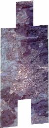
Static Map Catalogue - Full Metadata Record
Collection SkySat
SkySat ESA Archive. More details.
SSC_OPER_SSC_DEF_CO_20220301T100131_N48-710_E008-991_01
Download Product | BrowsePath | E008 |
Row | N48 |
Start Date | 2022-03-01T10:01:31Z |
Stop Date | 2022-03-01T10:01:31Z |
Availability Time | 2022-03-01T10:01:31Z |
Platform Short Name | SkySat |
Instrument Short Name | SkySat Camera |
Sensor Type | OPTICAL |
Operational mode | CAMERA |
Resolution | 0.5 |
Orbit Number | 0 |
Orbit Direction | |
Illumination Azimuth Angle | 152.6 |
Illumination Elevation Angle | 30.1 |
Across Track Incidence Angle | 26.6 |
Footprint | 48.6456081556 8.97894713677 48.6539527064 8.97901655988 48.6539470111 8.97891479352 48.6622736735 8.97898102569 48.6622723378 8.97895484075 48.6669430493 8.97899583394 48.6685354754 9.00369856266 48.6626255815 9.00361313904 48.6626315035 9.00372633616 48.6542158051 9.00356907084 48.6542253445 9.00372026264 48.6459007719 9.0036070457 48.6459102988 9.00378088902 48.6374410709 9.00365047452 48.6395694011 9.03649355563 48.6495750438 9.03661716395 48.649556864 9.03632203193 48.6580457239 9.03647809169 48.6580280838 9.0362185823 48.6660133046 9.03629601062 48.6660060126 9.03614963814 48.6746148335 9.03634766549 48.6746036375 9.03615652993 48.6829657788 9.03627934898 48.6829576553 9.03611764373 48.6911675152 9.0361700083 48.6911582747 9.03595255632 48.6995624242 9.03612585908 48.6995542569 9.03593365318 48.7081025446 9.03612960874 48.7080925991 9.03592326052 48.7162060489 9.03594605632 48.7161994707 9.03578427694 48.724691541 9.03592808185 48.7246814847 9.03571428245 48.7328558361 9.03580513754 48.73284751 9.03562052531 48.7412660911 9.03579726642 48.7412580959 9.03559154364 48.7494947275 9.03571862469 48.7494872389 9.03554348464 48.7579050496 9.03572882237 48.7565443243 9.00795789803 48.7619978813 9.00803539689 48.7619941608 9.00793940039 48.7702326053 9.00801350815 48.7702294209 9.007937263 48.7788952206 9.00816307177 48.7788924086 9.00811425934 48.7874512153 9.00828791443 48.7857095706 8.97603883856 48.7755658587 8.97579668326 48.7755684792 8.97584154526 48.7674398105 8.97586245059 48.7674406131 8.97588226851 48.7591341501 8.97585404216 48.7591359698 8.97589812015 48.7545370112 8.97579450647 48.7535375314 8.94768769867 48.7450105346 8.94757989075 48.7450093563 8.94755560127 48.7365214226 8.94744385191 48.736521254 8.94744050373 48.7280020659 8.9473364738 48.7279993906 8.94728545493 48.7195920615 8.9472458587 48.7195908706 8.94722439641 48.7112075375 8.94718577177 48.7112073589 8.94718255693 48.7028613191 8.94715838483 48.7028607546 8.94714755984 48.693011371 8.94711883208 48.6930117847 8.94712673978 48.6860313938 8.94705949385 48.6860299877 8.94703348717 48.6775669964 8.94696526453 48.6775653056 8.94693446255 48.6689968153 8.94684115497 48.6689927967 8.94676369646 48.6606276244 8.94671083015 48.6606248018 8.94665549299 48.650552302 8.94658013744 48.6505532733 8.94659789548 48.6418665088 8.94651125112 48.6418695502 8.94655916006 48.6332497585 8.94647730654 48.6354425876 8.97894752544 48.6456155579 8.9790629246 48.6456081556 8.97894713677 |
Scene Centre | 48.7103592759 8.99154723524 |
Size | 11618719832 |
Product type | SSC_DEF_CO |
Acquisition Type | NOMINAL |
Cloud-Cover Percentage | 0 |
Original Name | 20220301_100131_ssc12_u0001_SkySatCollect |
Bounding Box | 48.7874512153 8.94647730654 48.6332497585 8.94647730654 48.6332497585 9.03661716395 48.7874512153 9.03661716395 |
