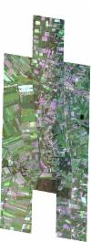
Static Map Catalogue - Full Metadata Record
Collection SkySat
SkySat ESA Archive. More details.
SSC_OPER_SSC_DEF_CO_20210909T100741_N53-037_E007-218_01
Download Product | BrowsePath | E007 |
Row | N53 |
Start Date | 2021-09-09T10:07:41Z |
Stop Date | 2021-09-09T10:07:41Z |
Availability Time | 2021-09-09T10:07:41Z |
Platform Short Name | SkySat |
Instrument Short Name | SkySat Camera |
Sensor Type | OPTICAL |
Operational mode | CAMERA |
Resolution | 0.5 |
Orbit Number | 0 |
Orbit Direction | |
Illumination Azimuth Angle | 153.6 |
Illumination Elevation Angle | 39.4 |
Across Track Incidence Angle | 26.8 |
Footprint | 52.9667398977 7.27019880985 52.9750579354 7.2703550345 52.9750778561 7.27012441324 52.9834055312 7.27027201753 52.9834245616 7.27005108945 52.9917356992 7.27021954416 52.9917536926 7.270007408 53.0000797523 7.27016695051 53.0000968944 7.26996484444 53.0083999293 7.27013520788 53.008418006 7.26992187334 53.0167199752 7.27009228223 53.0167374392 7.26988502541 53.02504648 7.27004686653 53.0250619201 7.26986290493 53.0333296418 7.27007026851 53.033350224 7.26982763897 53.041720055 7.26998255195 53.0417364779 7.26978565035 53.0500845886 7.26993578153 53.0501013866 7.26973248344 53.0584347775 7.26990747723 53.0584516047 7.26970387938 53.0668030383 7.26983946766 53.0668211963 7.26961718727 53.0751430179 7.26978742761 53.0751601493 7.26957791214 53.0834869262 7.26973376945 53.0860853487 7.23773216841 53.0909454761 7.23780208418 53.0909588628 7.23764115506 53.0992340075 7.23775411862 53.0992491199 7.23757208366 53.1075269509 7.23767727263 53.1075392937 7.23752752775 53.1157970186 7.23762882243 53.1188502558 7.20048395672 53.1091640359 7.20037339063 53.1091526906 7.20051195291 53.1008839214 7.20040541511 53.1008718727 7.20055215132 53.0925911345 7.20045849813 53.0925800563 7.20059296498 53.0884421862 7.20054877434 53.0911616012 7.16730288854 53.0815013514 7.16721167861 53.0814908013 7.16734120363 53.0731760612 7.1672582472 53.0731660327 7.16738101791 53.0648510971 7.16730282686 53.0648420065 7.16741371962 53.0565107028 7.16732897454 53.056501623 7.16743919058 53.0481671828 7.16735727686 53.0481596716 7.16744817171 53.0398256542 7.1673665991 53.0398177167 7.16746235332 53.0314998087 7.16739366341 53.0314912266 7.16749659582 53.0231798164 7.16743504958 53.0231717076 7.16753225898 53.0148941098 7.16744557002 53.0148857693 7.16754481808 53.0065935852 7.16746628325 53.0065856973 7.16755966498 52.9982837445 7.1674813722 52.9982767846 7.16756358967 52.9899766108 7.16747583253 52.9899651141 7.16761107233 52.9816517277 7.1675270146 52.9816415254 7.16764636226 52.9733280983 7.16756885807 52.973317552 7.1676915228 52.9650083985 7.16760745189 52.9617888446 7.2048540517 52.9717045232 7.2049763476 52.9717187195 7.20481212345 52.9800310913 7.20491802892 52.9800441274 7.20476613998 52.9883472716 7.20487528568 52.9883617498 7.20470584924 52.9930022193 7.20476682132 52.9905151489 7.23319503364 52.9850754752 7.23309152588 52.9850606812 7.23326485996 52.9767198645 7.23316386304 52.976704522 7.23334325336 52.9683614875 7.23324645738 52.9683455203 7.23343279015 52.9600273135 7.23331736379 52.9568516006 7.2702327172 52.9667199753 7.27042964972 52.9667398977 7.27019880985 |
Scene Centre | 53.0378620954 7.21882066417 |
Size | 11308622761 |
Product type | SSC_DEF_CO |
Acquisition Type | NOMINAL |
Cloud-Cover Percentage | 0 |
Original Name | 20210909_100741_ssc12_u0001_SkySatCollect |
Bounding Box | 53.1188502558 7.16721167861 52.9568516006 7.16721167861 52.9568516006 7.27042964972 53.1188502558 7.27042964972 |
