ESA TPM Map Catalogue - Product List
back to previous node |
list of download URLs

Collection SkySat
SkySat ESA Archive. More details.
List of available products (path: W009, row: N28).
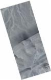
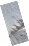
SSC_OPER_SSC_DEF_SC_20201212T141641_N28-512_W009-453_01
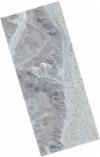
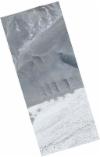
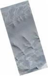
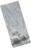
Download Product | Product Info | Browse
Resolution | 0.5 |
Product type | SSC_DEF_SC |
Cloud-Cover Percentage | 0 |
Start Date | 2020-12-12T14:16:41Z |
Stop Date | 2020-12-12T14:16:41Z |
Path | W009 |
Row | N28 |
Original Name | 20201212_141641_ssc16d3_0038_SkySatScene |
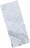
SSC_OPER_SSC_DEF_SC_20201212T141641_N28-442_W009-604_01
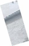
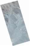
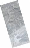
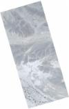
Download Product | Product Info | Browse
Resolution | 0.5 |
Product type | SSC_DEF_SC |
Cloud-Cover Percentage | 0 |
Start Date | 2020-12-12T14:16:41Z |
Stop Date | 2020-12-12T14:16:41Z |
Path | W009 |
Row | N28 |
Original Name | 20201212_141641_ssc16d1_0013_SkySatScene |
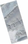
SSC_OPER_SSC_DEF_SC_20201212T141641_N28-487_W009-489_01
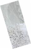
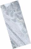
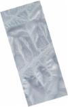
Download Product | Product Info | Browse
Resolution | 0.5 |
Product type | SSC_DEF_SC |
Cloud-Cover Percentage | 0 |
Start Date | 2020-12-12T14:16:41Z |
Stop Date | 2020-12-12T14:16:41Z |
Path | W009 |
Row | N28 |
Original Name | 20201212_141641_ssc16d2_0028_SkySatScene |
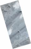
SSC_OPER_SSC_DEF_SC_20201212T141641_N28-455_W009-553_01
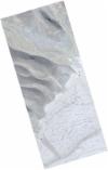
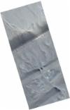
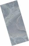
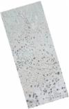
Download Product | Product Info | Browse
Resolution | 0.5 |
Product type | SSC_DEF_SC |
Cloud-Cover Percentage | 0 |
Start Date | 2020-12-12T14:16:41Z |
Stop Date | 2020-12-12T14:16:41Z |
Path | W009 |
Row | N28 |
Original Name | 20201212_141641_ssc16d1_0021_SkySatScene |
SSC_OPER_SSC_DEF_SC_20201212T141641_N28-526_W009-396_01
Download Product | Product Info | Browse
Resolution | 0.5 |
Product type | SSC_DEF_SC |
Cloud-Cover Percentage | 0 |
Start Date | 2020-12-12T14:16:41Z |
Stop Date | 2020-12-12T14:16:41Z |
Path | W009 |
Row | N28 |
Original Name | 20201212_141641_ssc16d3_0047_SkySatScene |
SSC_OPER_SSC_DEF_SC_20201212T141641_N28-452_W009-565_01
Download Product | Product Info | Browse
Resolution | 0.5 |
Product type | SSC_DEF_SC |
Cloud-Cover Percentage | 0 |
Start Date | 2020-12-12T14:16:41Z |
Stop Date | 2020-12-12T14:16:41Z |
Path | W009 |
Row | N28 |
Original Name | 20201212_141641_ssc16d1_0019_SkySatScene |
SSC_OPER_SSC_DEF_SC_20201212T141641_N28-498_W009-504_01
Download Product | Product Info | Browse
Resolution | 0.5 |
Product type | SSC_DEF_SC |
Cloud-Cover Percentage | 0 |
Start Date | 2020-12-12T14:16:41Z |
Stop Date | 2020-12-12T14:16:41Z |
Path | W009 |
Row | N28 |
Original Name | 20201212_141641_ssc16d3_0030_SkySatScene |
SSC_OPER_SSC_DEF_SC_20201212T141641_N28-546_W009-320_01
Download Product | Product Info | Browse
Resolution | 0.5 |
Product type | SSC_DEF_SC |
Cloud-Cover Percentage | 0 |
Start Date | 2020-12-12T14:16:41Z |
Stop Date | 2020-12-12T14:16:41Z |
Path | W009 |
Row | N28 |
Original Name | 20201212_141641_ssc16d3_0059_SkySatScene |
SSC_OPER_SSC_DEF_SC_20201212T141641_N28-525_W009-402_01
Download Product | Product Info | Browse
Resolution | 0.5 |
Product type | SSC_DEF_SC |
Cloud-Cover Percentage | 0 |
Start Date | 2020-12-12T14:16:41Z |
Stop Date | 2020-12-12T14:16:41Z |
Path | W009 |
Row | N28 |
Original Name | 20201212_141641_ssc16d3_0046_SkySatScene |
SSC_OPER_SSC_DEF_SC_20201212T141641_N28-475_W009-476_01
Download Product | Product Info | Browse
Resolution | 0.5 |
Product type | SSC_DEF_SC |
Cloud-Cover Percentage | 0 |
Start Date | 2020-12-12T14:16:41Z |
Stop Date | 2020-12-12T14:16:41Z |
Path | W009 |
Row | N28 |
Original Name | 20201212_141641_ssc16d1_0033_SkySatScene |
SSC_OPER_SSC_DEF_SC_20201212T141641_N28-493_W009-523_01
Download Product | Product Info | Browse
Resolution | 0.5 |
Product type | SSC_DEF_SC |
Cloud-Cover Percentage | 0 |
Start Date | 2020-12-12T14:16:41Z |
Stop Date | 2020-12-12T14:16:41Z |
Path | W009 |
Row | N28 |
Original Name | 20201212_141641_ssc16d3_0027_SkySatScene |
SSC_OPER_SSC_DEF_SC_20201212T141641_N28-471_W009-489_01
Download Product | Product Info | Browse
Resolution | 0.5 |
Product type | SSC_DEF_SC |
Cloud-Cover Percentage | 0 |
Start Date | 2020-12-12T14:16:41Z |
Stop Date | 2020-12-12T14:16:41Z |
Path | W009 |
Row | N28 |
Original Name | 20201212_141641_ssc16d1_0031_SkySatScene |
SSC_OPER_SSC_DEF_SC_20201212T141641_N28-492_W009-413_01
Download Product | Product Info | Browse
Resolution | 0.5 |
Product type | SSC_DEF_SC |
Cloud-Cover Percentage | 0 |
Start Date | 2020-12-12T14:16:41Z |
Stop Date | 2020-12-12T14:16:41Z |
Path | W009 |
Row | N28 |
Original Name | 20201212_141641_ssc16d1_0043_SkySatScene |
SSC_OPER_SSC_DEF_SC_20201212T141641_N28-541_W009-279_01
Download Product | Product Info | Browse
Resolution | 0.5 |
Product type | SSC_DEF_SC |
Cloud-Cover Percentage | 0 |
Start Date | 2020-12-12T14:16:41Z |
Stop Date | 2020-12-12T14:16:41Z |
Path | W009 |
Row | N28 |
Original Name | 20201212_141641_ssc16d2_0061_SkySatScene |
SSC_OPER_SSC_DEF_SC_20201212T141641_N28-445_W009-591_01
Download Product | Product Info | Browse
Resolution | 0.5 |
Product type | SSC_DEF_SC |
Cloud-Cover Percentage | 0 |
Start Date | 2020-12-12T14:16:41Z |
Stop Date | 2020-12-12T14:16:41Z |
Path | W009 |
Row | N28 |
Original Name | 20201212_141641_ssc16d1_0015_SkySatScene |
SSC_OPER_SSC_DEF_SC_20201212T141641_N28-513_W009-330_01
Download Product | Product Info | Browse
Resolution | 0.5 |
Product type | SSC_DEF_SC |
Cloud-Cover Percentage | 0 |
Start Date | 2020-12-12T14:16:41Z |
Stop Date | 2020-12-12T14:16:41Z |
Path | W009 |
Row | N28 |
Original Name | 20201212_141641_ssc16d1_0056_SkySatScene |
SSC_OPER_SSC_DEF_SC_20201212T141641_N28-492_W009-530_01
Download Product | Product Info | Browse
Resolution | 0.5 |
Product type | SSC_DEF_SC |
Cloud-Cover Percentage | 0 |
Start Date | 2020-12-12T14:16:41Z |
Stop Date | 2020-12-12T14:16:41Z |
Path | W009 |
Row | N28 |
Original Name | 20201212_141641_ssc16d3_0026_SkySatScene |
SSC_OPER_SSC_DEF_SC_20201212T141641_N28-495_W009-517_01
Download Product | Product Info | Browse
Resolution | 0.5 |
Product type | SSC_DEF_SC |
Cloud-Cover Percentage | 0 |
Start Date | 2020-12-12T14:16:41Z |
Stop Date | 2020-12-12T14:16:41Z |
Path | W009 |
Row | N28 |
Original Name | 20201212_141641_ssc16d3_0028_SkySatScene |
SSC_OPER_SSC_DEF_SC_20201212T141641_N28-528_W009-390_01
Download Product | Product Info | Browse
Resolution | 0.5 |
Product type | SSC_DEF_SC |
Cloud-Cover Percentage | 0 |
Start Date | 2020-12-12T14:16:41Z |
Stop Date | 2020-12-12T14:16:41Z |
Path | W009 |
Row | N28 |
Original Name | 20201212_141641_ssc16d3_0048_SkySatScene |
SSC_OPER_SSC_DEF_SC_20201212T141641_N28-468_W009-502_01
Download Product | Product Info | Browse
Resolution | 0.5 |
Product type | SSC_DEF_SC |
Cloud-Cover Percentage | 0 |
Start Date | 2020-12-12T14:16:41Z |
Stop Date | 2020-12-12T14:16:41Z |
Path | W009 |
Row | N28 |
Original Name | 20201212_141641_ssc16d1_0029_SkySatScene |
SSC_OPER_SSC_DEF_SC_20201212T141641_N28-502_W009-432_01
Download Product | Product Info | Browse
Resolution | 0.5 |
Product type | SSC_DEF_SC |
Cloud-Cover Percentage | 0 |
Start Date | 2020-12-12T14:16:41Z |
Stop Date | 2020-12-12T14:16:41Z |
Path | W009 |
Row | N28 |
Original Name | 20201212_141641_ssc16d2_0037_SkySatScene |
SSC_OPER_SSC_DEF_SC_20201212T141641_N28-497_W009-451_01
Download Product | Product Info | Browse
Resolution | 0.5 |
Product type | SSC_DEF_SC |
Cloud-Cover Percentage | 0 |
Start Date | 2020-12-12T14:16:41Z |
Stop Date | 2020-12-12T14:16:41Z |
Path | W009 |
Row | N28 |
Original Name | 20201212_141641_ssc16d2_0034_SkySatScene |
SSC_OPER_SSC_DEF_SC_20201212T141641_N28-488_W009-483_01
Download Product | Product Info | Browse
Resolution | 0.5 |
Product type | SSC_DEF_SC |
Cloud-Cover Percentage | 0 |
Start Date | 2020-12-12T14:16:41Z |
Stop Date | 2020-12-12T14:16:41Z |
Path | W009 |
Row | N28 |
Original Name | 20201212_141641_ssc16d2_0029_SkySatScene |
SSC_OPER_SSC_DEF_SC_20201212T141641_N28-505_W009-479_01
Download Product | Product Info | Browse
Resolution | 0.5 |
Product type | SSC_DEF_SC |
Cloud-Cover Percentage | 0 |
Start Date | 2020-12-12T14:16:41Z |
Stop Date | 2020-12-12T14:16:41Z |
Path | W009 |
Row | N28 |
Original Name | 20201212_141641_ssc16d3_0034_SkySatScene |
SSC_OPER_SSC_DEF_SC_20201212T141641_N28-512_W009-394_01
Download Product | Product Info | Browse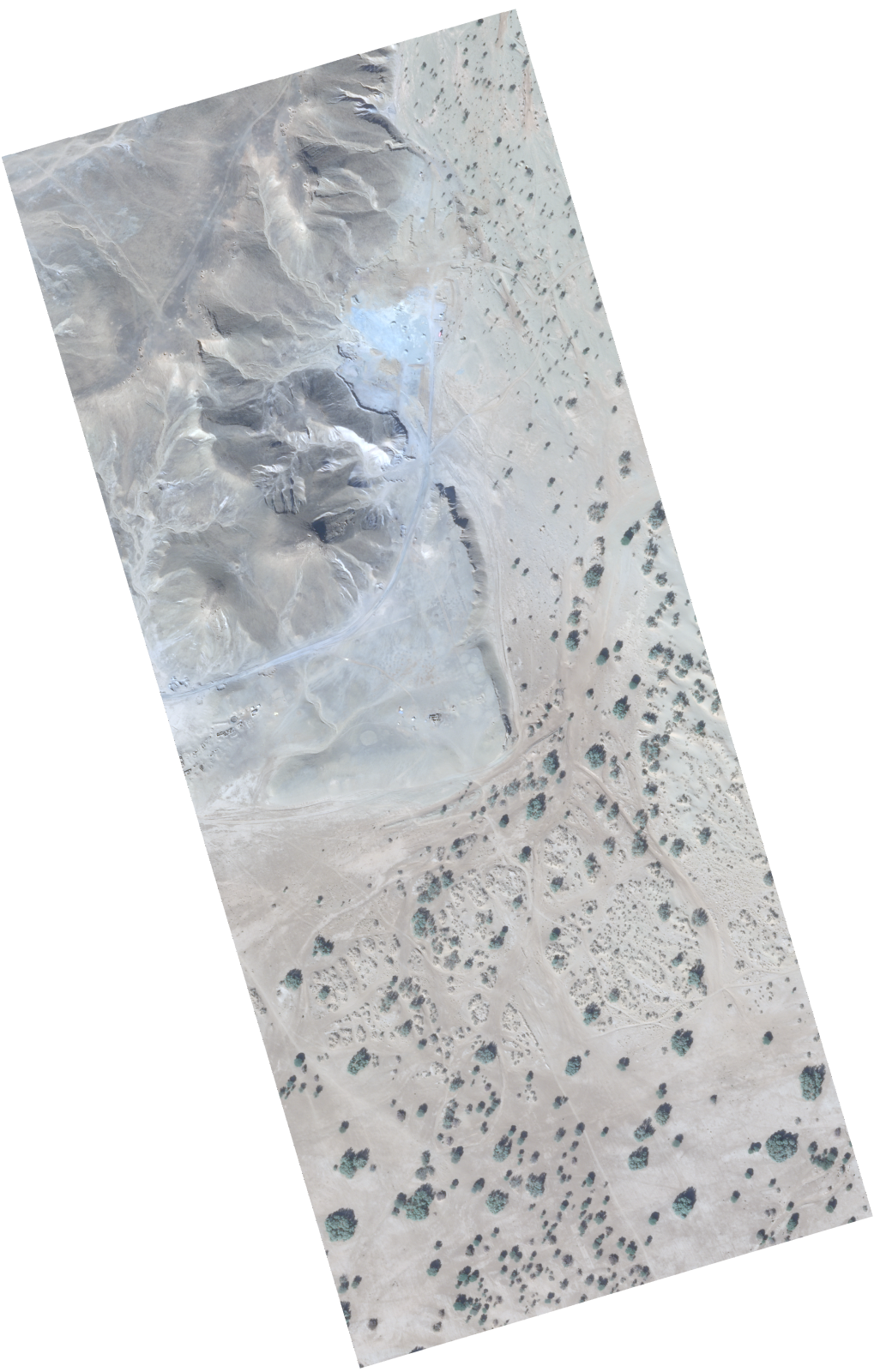
Resolution | 0.5 |
Product type | SSC_DEF_SC |
Cloud-Cover Percentage | 0 |
Start Date | 2020-12-12T14:16:41Z |
Stop Date | 2020-12-12T14:16:41Z |
Path | W009 |
Row | N28 |
Original Name | 20201212_141641_ssc16d2_0043_SkySatScene |
SSC_OPER_SSC_DEF_SC_20201212T141641_N28-444_W009-597_01
Download Product | Product Info | Browse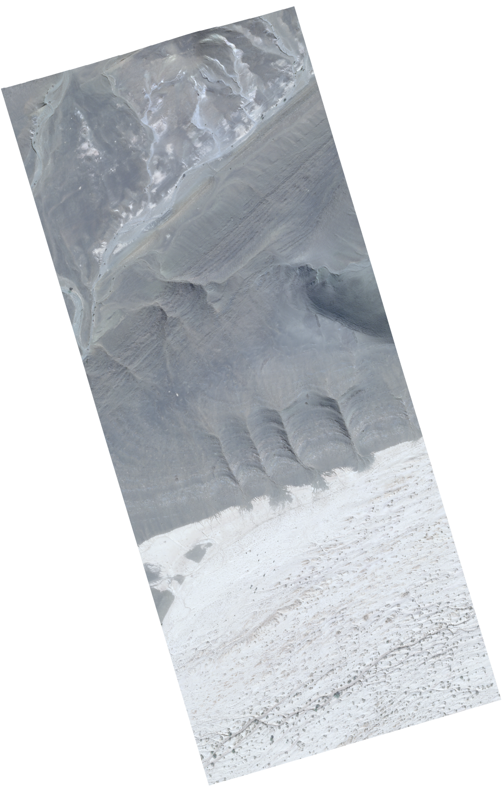
Resolution | 0.5 |
Product type | SSC_DEF_SC |
Cloud-Cover Percentage | 0 |
Start Date | 2020-12-12T14:16:41Z |
Stop Date | 2020-12-12T14:16:41Z |
Path | W009 |
Row | N28 |
Original Name | 20201212_141641_ssc16d1_0014_SkySatScene |
SSC_OPER_SSC_DEF_SC_20201212T141641_N28-471_W009-553_01
Download Product | Product Info | Browse
Resolution | 0.5 |
Product type | SSC_DEF_SC |
Cloud-Cover Percentage | 0 |
Start Date | 2020-12-12T14:16:41Z |
Stop Date | 2020-12-12T14:16:41Z |
Path | W009 |
Row | N28 |
Original Name | 20201212_141641_ssc16d2_0018_SkySatScene |
SSC_OPER_SSC_DEF_SC_20201212T141641_N28-515_W009-381_01
Download Product | Product Info | Browse
Resolution | 0.5 |
Product type | SSC_DEF_SC |
Cloud-Cover Percentage | 0 |
Start Date | 2020-12-12T14:16:41Z |
Stop Date | 2020-12-12T14:16:41Z |
Path | W009 |
Row | N28 |
Original Name | 20201212_141641_ssc16d2_0045_SkySatScene |
SSC_OPER_SSC_DEF_SC_20201212T141641_N28-461_W009-591_01
Download Product | Product Info | Browse
Resolution | 0.5 |
Product type | SSC_DEF_SC |
Cloud-Cover Percentage | 0 |
Start Date | 2020-12-12T14:16:41Z |
Stop Date | 2020-12-12T14:16:41Z |
Path | W009 |
Row | N28 |
Original Name | 20201212_141641_ssc16d2_0012_SkySatScene |
SSC_OPER_SSC_DEF_SC_20201212T141641_N28-490_W009-477_01
Download Product | Product Info | Browse
Resolution | 0.5 |
Product type | SSC_DEF_SC |
Cloud-Cover Percentage | 0 |
Start Date | 2020-12-12T14:16:41Z |
Stop Date | 2020-12-12T14:16:41Z |
Path | W009 |
Row | N28 |
Original Name | 20201212_141641_ssc16d2_0030_SkySatScene |
SSC_OPER_SSC_DEF_SC_20201212T141641_N28-540_W009-286_01
Download Product | Product Info | Browse
Resolution | 0.5 |
Product type | SSC_DEF_SC |
Cloud-Cover Percentage | 0 |
Start Date | 2020-12-12T14:16:41Z |
Stop Date | 2020-12-12T14:16:41Z |
Path | W009 |
Row | N28 |
Original Name | 20201212_141641_ssc16d2_0060_SkySatScene |
SSC_OPER_SSC_DEF_SC_20201212T141641_N28-482_W009-508_01
Download Product | Product Info | Browse
Resolution | 0.5 |
Product type | SSC_DEF_SC |
Cloud-Cover Percentage | 0 |
Start Date | 2020-12-12T14:16:41Z |
Stop Date | 2020-12-12T14:16:41Z |
Path | W009 |
Row | N28 |
Original Name | 20201212_141641_ssc16d2_0025_SkySatScene |
SSC_OPER_SSC_DEF_SC_20201212T141641_N28-450_W009-572_01
Download Product | Product Info | Browse
Resolution | 0.5 |
Product type | SSC_DEF_SC |
Cloud-Cover Percentage | 0 |
Start Date | 2020-12-12T14:16:41Z |
Stop Date | 2020-12-12T14:16:41Z |
Path | W009 |
Row | N28 |
Original Name | 20201212_141641_ssc16d1_0018_SkySatScene |
SSC_OPER_SSC_DEF_SC_20201212T141641_N28-550_W009-307_01
Download Product | Product Info | Browse
Resolution | 0.5 |
Product type | SSC_DEF_SC |
Cloud-Cover Percentage | 0 |
Start Date | 2020-12-12T14:16:41Z |
Stop Date | 2020-12-12T14:16:41Z |
Path | W009 |
Row | N28 |
Original Name | 20201212_141641_ssc16d3_0061_SkySatScene |
SSC_OPER_SSC_DEF_SC_20201212T141641_N28-473_W009-483_01
Download Product | Product Info | Browse
Resolution | 0.5 |
Product type | SSC_DEF_SC |
Cloud-Cover Percentage | 0 |
Start Date | 2020-12-12T14:16:41Z |
Stop Date | 2020-12-12T14:16:41Z |
Path | W009 |
Row | N28 |
Original Name | 20201212_141641_ssc16d1_0032_SkySatScene |
SSC_OPER_SSC_DEF_SC_20201212T141641_N28-480_W009-515_01
Download Product | Product Info | Browse
Resolution | 0.5 |
Product type | SSC_DEF_SC |
Cloud-Cover Percentage | 0 |
Start Date | 2020-12-12T14:16:41Z |
Stop Date | 2020-12-12T14:16:41Z |
Path | W009 |
Row | N28 |
Original Name | 20201212_141641_ssc16d2_0024_SkySatScene |
SSC_OPER_SSC_DEF_SC_20201212T141641_N28-535_W009-305_01
Download Product | Product Info | Browse
Resolution | 0.5 |
Product type | SSC_DEF_SC |
Cloud-Cover Percentage | 0 |
Start Date | 2020-12-12T14:16:41Z |
Stop Date | 2020-12-12T14:16:41Z |
Path | W009 |
Row | N28 |
Original Name | 20201212_141641_ssc16d2_0057_SkySatScene |
SSC_OPER_SSC_DEF_SC_20201212T141641_N28-505_W009-419_01
Download Product | Product Info | Browse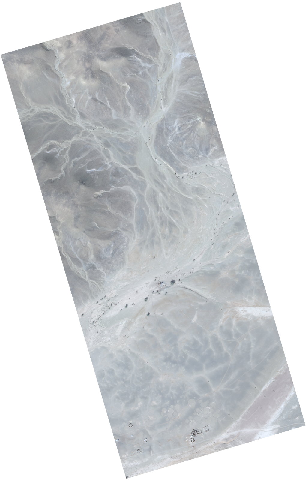
Resolution | 0.5 |
Product type | SSC_DEF_SC |
Cloud-Cover Percentage | 0 |
Start Date | 2020-12-12T14:16:41Z |
Stop Date | 2020-12-12T14:16:41Z |
Path | W009 |
Row | N28 |
Original Name | 20201212_141641_ssc16d2_0039_SkySatScene |
SSC_OPER_SSC_DEF_SC_20201212T141641_N28-518_W009-368_01
Download Product | Product Info | Browse
Resolution | 0.5 |
Product type | SSC_DEF_SC |
Cloud-Cover Percentage | 0 |
Start Date | 2020-12-12T14:16:41Z |
Stop Date | 2020-12-12T14:16:41Z |
Path | W009 |
Row | N28 |
Original Name | 20201212_141641_ssc16d2_0047_SkySatScene |
SSC_OPER_SSC_DEF_SC_20201212T141641_N28-508_W009-349_01
Download Product | Product Info | Browse
Resolution | 0.5 |
Product type | SSC_DEF_SC |
Cloud-Cover Percentage | 0 |
Start Date | 2020-12-12T14:16:41Z |
Stop Date | 2020-12-12T14:16:41Z |
Path | W009 |
Row | N28 |
Original Name | 20201212_141641_ssc16d1_0053_SkySatScene |
SSC_OPER_SSC_DEF_SC_20201212T141641_N28-521_W009-298_01
Download Product | Product Info | Browse
Resolution | 0.5 |
Product type | SSC_DEF_SC |
Cloud-Cover Percentage | 0 |
Start Date | 2020-12-12T14:16:41Z |
Stop Date | 2020-12-12T14:16:41Z |
Path | W009 |
Row | N28 |
Original Name | 20201212_141641_ssc16d1_0061_SkySatScene |
SSC_OPER_SSC_DEF_SC_20201212T141641_N28-535_W009-364_01
Download Product | Product Info | Browse
Resolution | 0.5 |
Product type | SSC_DEF_SC |
Cloud-Cover Percentage | 0 |
Start Date | 2020-12-12T14:16:41Z |
Stop Date | 2020-12-12T14:16:41Z |
Path | W009 |
Row | N28 |
Original Name | 20201212_141641_ssc16d3_0052_SkySatScene |
SSC_OPER_SSC_DEF_SC_20201212T141641_N28-487_W009-549_01
Download Product | Product Info | Browse
Resolution | 0.5 |
Product type | SSC_DEF_SC |
Cloud-Cover Percentage | 0 |
Start Date | 2020-12-12T14:16:41Z |
Stop Date | 2020-12-12T14:16:41Z |
Path | W009 |
Row | N28 |
Original Name | 20201212_141641_ssc16d3_0023_SkySatScene |
SSC_OPER_SSC_DEF_SC_20201212T141641_N28-495_W009-457_01
Download Product | Product Info | Browse
Resolution | 0.5 |
Product type | SSC_DEF_SC |
Cloud-Cover Percentage | 0 |
Start Date | 2020-12-12T14:16:41Z |
Stop Date | 2020-12-12T14:16:41Z |
Path | W009 |
Row | N28 |
Original Name | 20201212_141641_ssc16d2_0033_SkySatScene |
SSC_OPER_SSC_DEF_SC_20201212T141641_N28-508_W009-466_01
Download Product | Product Info | Browse
Resolution | 0.5 |
Product type | SSC_DEF_SC |
Cloud-Cover Percentage | 0 |
Start Date | 2020-12-12T14:16:41Z |
Stop Date | 2020-12-12T14:16:41Z |
Path | W009 |
Row | N28 |
Original Name | 20201212_141641_ssc16d3_0036_SkySatScene |
SSC_OPER_SSC_DEF_SC_20201212T141641_N28-523_W009-349_01
Download Product | Product Info | Browse
Resolution | 0.5 |
Product type | SSC_DEF_SC |
Cloud-Cover Percentage | 0 |
Start Date | 2020-12-12T14:16:41Z |
Stop Date | 2020-12-12T14:16:41Z |
Path | W009 |
Row | N28 |
Original Name | 20201212_141641_ssc16d2_0050_SkySatScene |
SSC_OPER_SSC_DEF_SC_20201212T141641_N28-519_W009-305_01
Download Product | Product Info | Browse
Resolution | 0.5 |
Product type | SSC_DEF_SC |
Cloud-Cover Percentage | 0 |
Start Date | 2020-12-12T14:16:41Z |
Stop Date | 2020-12-12T14:16:41Z |
Path | W009 |
Row | N28 |
Original Name | 20201212_141641_ssc16d1_0060_SkySatScene |
SSC_OPER_SSC_DEF_SC_20201212T141641_N28-488_W009-542_01
Download Product | Product Info | Browse
Resolution | 0.5 |
Product type | SSC_DEF_SC |
Cloud-Cover Percentage | 0 |
Start Date | 2020-12-12T14:16:41Z |
Stop Date | 2020-12-12T14:16:41Z |
Path | W009 |
Row | N28 |
Original Name | 20201212_141641_ssc16d3_0024_SkySatScene |
SSC_OPER_SSC_DEF_SC_20201212T141641_N28-471_W009-613_01
Download Product | Product Info | Browse
Resolution | 0.5 |
Product type | SSC_DEF_SC |
Cloud-Cover Percentage | 0 |
Start Date | 2020-12-12T14:16:41Z |
Stop Date | 2020-12-12T14:16:41Z |
Path | W009 |
Row | N28 |
Original Name | 20201212_141641_ssc16d3_0013_SkySatScene |
SSC_OPER_SSC_DEF_SC_20201212T141641_N28-527_W009-337_01
Download Product | Product Info | Browse
Resolution | 0.5 |
Product type | SSC_DEF_SC |
Cloud-Cover Percentage | 0 |
Start Date | 2020-12-12T14:16:41Z |
Stop Date | 2020-12-12T14:16:41Z |
Path | W009 |
Row | N28 |
Original Name | 20201212_141641_ssc16d2_0052_SkySatScene |
SSC_OPER_SSC_DEF_SC_20201212T141641_N28-530_W009-324_01
Download Product | Product Info | Browse
Resolution | 0.5 |
Product type | SSC_DEF_SC |
Cloud-Cover Percentage | 0 |
Start Date | 2020-12-12T14:16:41Z |
Stop Date | 2020-12-12T14:16:41Z |
Path | W009 |
Row | N28 |
Original Name | 20201212_141641_ssc16d2_0054_SkySatScene |
SSC_OPER_SSC_DEF_SC_20201212T141641_N28-488_W009-425_01
Download Product | Product Info | Browse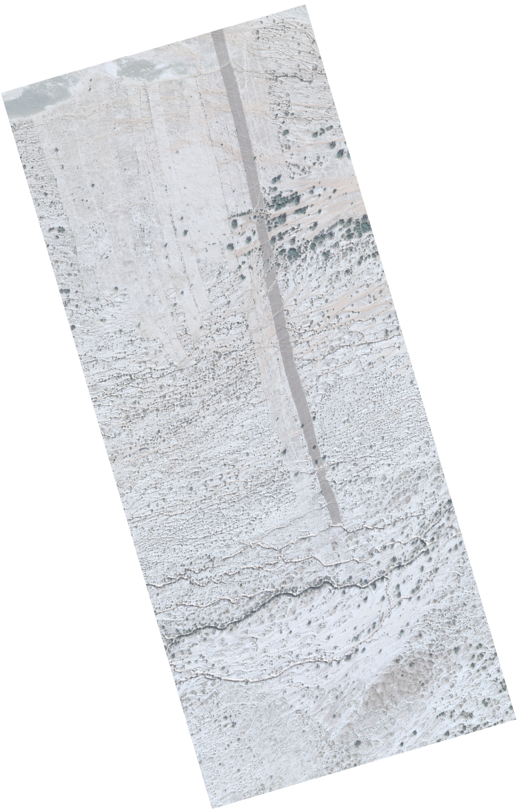
Resolution | 0.5 |
Product type | SSC_DEF_SC |
Cloud-Cover Percentage | 0 |
Start Date | 2020-12-12T14:16:41Z |
Stop Date | 2020-12-12T14:16:41Z |
Path | W009 |
Row | N28 |
Original Name | 20201212_141641_ssc16d1_0041_SkySatScene |
SSC_OPER_SSC_DEF_SC_20201212T141641_N28-516_W009-317_01
Download Product | Product Info | Browse
Resolution | 0.5 |
Product type | SSC_DEF_SC |
Cloud-Cover Percentage | 0 |
Start Date | 2020-12-12T14:16:41Z |
Stop Date | 2020-12-12T14:16:41Z |
Path | W009 |
Row | N28 |
Original Name | 20201212_141641_ssc16d1_0058_SkySatScene |
SSC_OPER_SSC_DEF_SC_20201212T141641_N28-513_W009-447_01
Download Product | Product Info | Browse
Resolution | 0.5 |
Product type | SSC_DEF_SC |
Cloud-Cover Percentage | 0 |
Start Date | 2020-12-12T14:16:41Z |
Stop Date | 2020-12-12T14:16:41Z |
Path | W009 |
Row | N28 |
Original Name | 20201212_141641_ssc16d3_0039_SkySatScene |
SSC_OPER_SSC_DEF_SC_20201212T141641_N28-474_W009-600_01
Download Product | Product Info | Browse
Resolution | 0.5 |
Product type | SSC_DEF_SC |
Cloud-Cover Percentage | 0 |
Start Date | 2020-12-12T14:16:41Z |
Stop Date | 2020-12-12T14:16:41Z |
Path | W009 |
Row | N28 |
Original Name | 20201212_141641_ssc16d3_0015_SkySatScene |
SSC_OPER_SSC_DEF_SC_20201212T141641_N28-522_W009-415_01
Download Product | Product Info | Browse
Resolution | 0.5 |
Product type | SSC_DEF_SC |
Cloud-Cover Percentage | 0 |
Start Date | 2020-12-12T14:16:41Z |
Stop Date | 2020-12-12T14:16:41Z |
Path | W009 |
Row | N28 |
Original Name | 20201212_141641_ssc16d3_0044_SkySatScene |
SSC_OPER_SSC_DEF_SC_20201212T141641_N28-551_W009-301_01
Download Product | Product Info | Browse
Resolution | 0.5 |
Product type | SSC_DEF_SC |
Cloud-Cover Percentage | 0 |
Start Date | 2020-12-12T14:16:41Z |
Stop Date | 2020-12-12T14:16:41Z |
Path | W009 |
Row | N28 |
Original Name | 20201212_141641_ssc16d3_0062_SkySatScene |
SSC_OPER_SSC_DEF_SC_20201212T141641_N28-458_W009-604_01
Download Product | Product Info | Browse
Resolution | 0.5 |
Product type | SSC_DEF_SC |
Cloud-Cover Percentage | 0 |
Start Date | 2020-12-12T14:16:41Z |
Stop Date | 2020-12-12T14:16:41Z |
Path | W009 |
Row | N28 |
Original Name | 20201212_141641_ssc16d2_0010_SkySatScene |
SSC_OPER_SSC_DEF_SC_20201212T141641_N28-507_W009-413_01
Download Product | Product Info | Browse
Resolution | 0.5 |
Product type | SSC_DEF_SC |
Cloud-Cover Percentage | 0 |
Start Date | 2020-12-12T14:16:41Z |
Stop Date | 2020-12-12T14:16:41Z |
Path | W009 |
Row | N28 |
Original Name | 20201212_141641_ssc16d2_0040_SkySatScene |
SSC_OPER_SSC_DEF_SC_20201212T141641_N28-465_W009-514_01
Download Product | Product Info | Browse
Resolution | 0.5 |
Product type | SSC_DEF_SC |
Cloud-Cover Percentage | 0 |
Start Date | 2020-12-12T14:16:41Z |
Stop Date | 2020-12-12T14:16:41Z |
Path | W009 |
Row | N28 |
Original Name | 20201212_141641_ssc16d1_0027_SkySatScene |
SSC_OPER_SSC_DEF_SC_20201212T141641_N28-485_W009-496_01
Download Product | Product Info | Browse
Resolution | 0.5 |
Product type | SSC_DEF_SC |
Cloud-Cover Percentage | 0 |
Start Date | 2020-12-12T14:16:41Z |
Stop Date | 2020-12-12T14:16:41Z |
Path | W009 |
Row | N28 |
Original Name | 20201212_141641_ssc16d2_0027_SkySatScene |
SSC_OPER_SSC_DEF_SC_20201212T141641_N28-493_W009-464_01
Download Product | Product Info | Browse
Resolution | 0.5 |
Product type | SSC_DEF_SC |
Cloud-Cover Percentage | 0 |
Start Date | 2020-12-12T14:16:41Z |
Stop Date | 2020-12-12T14:16:41Z |
Path | W009 |
Row | N28 |
Original Name | 20201212_141641_ssc16d2_0032_SkySatScene |
SSC_OPER_SSC_DEF_SC_20201212T141641_N28-504_W009-426_01
Download Product | Product Info | Browse
Resolution | 0.5 |
Product type | SSC_DEF_SC |
Cloud-Cover Percentage | 0 |
Start Date | 2020-12-12T14:16:41Z |
Stop Date | 2020-12-12T14:16:41Z |
Path | W009 |
Row | N28 |
Original Name | 20201212_141641_ssc16d2_0038_SkySatScene |
SSC_OPER_SSC_DEF_SC_20201212T141641_N28-526_W009-279_01
Download Product | Product Info | Browse
Resolution | 0.5 |
Product type | SSC_DEF_SC |
Cloud-Cover Percentage | 0 |
Start Date | 2020-12-12T14:16:41Z |
Stop Date | 2020-12-12T14:16:41Z |
Path | W009 |
Row | N28 |
Original Name | 20201212_141641_ssc16d1_0064_SkySatScene |
SSC_OPER_SSC_DEF_SC_20201212T141641_N28-501_W009-491_01
Download Product | Product Info | Browse
Resolution | 0.5 |
Product type | SSC_DEF_SC |
Cloud-Cover Percentage | 0 |
Start Date | 2020-12-12T14:16:41Z |
Stop Date | 2020-12-12T14:16:41Z |
Path | W009 |
Row | N28 |
Original Name | 20201212_141641_ssc16d3_0032_SkySatScene |
SSC_OPER_SSC_DEF_SC_20201212T141641_N28-487_W009-432_01
Download Product | Product Info | Browse
Resolution | 0.5 |
Product type | SSC_DEF_SC |
Cloud-Cover Percentage | 0 |
Start Date | 2020-12-12T14:16:41Z |
Stop Date | 2020-12-12T14:16:41Z |
Path | W009 |
Row | N28 |
Original Name | 20201212_141641_ssc16d1_0040_SkySatScene |
SSC_OPER_SSC_DEF_SC_20201212T141641_N28-463_W009-521_01
Download Product | Product Info | Browse
Resolution | 0.5 |
Product type | SSC_DEF_SC |
Cloud-Cover Percentage | 0 |
Start Date | 2020-12-12T14:16:41Z |
Stop Date | 2020-12-12T14:16:41Z |
Path | W009 |
Row | N28 |
Original Name | 20201212_141641_ssc16d1_0026_SkySatScene |
SSC_OPER_SSC_DEF_SC_20201212T141641_N28-469_W009-559_01
Download Product | Product Info | Browse
Resolution | 0.5 |
Product type | SSC_DEF_SC |
Cloud-Cover Percentage | 0 |
Start Date | 2020-12-12T14:16:41Z |
Stop Date | 2020-12-12T14:16:41Z |
Path | W009 |
Row | N28 |
Original Name | 20201212_141641_ssc16d2_0017_SkySatScene |
SSC_OPER_SSC_DEF_SC_20201212T141641_N28-499_W009-445_01
Download Product | Product Info | Browse
Resolution | 0.5 |
Product type | SSC_DEF_SC |
Cloud-Cover Percentage | 0 |
Start Date | 2020-12-12T14:16:41Z |
Stop Date | 2020-12-12T14:16:41Z |
Path | W009 |
Row | N28 |
Original Name | 20201212_141641_ssc16d2_0035_SkySatScene |
SSC_OPER_SSC_DEF_SC_20201212T141641_N28-527_W009-273_01
Download Product | Product Info | Browse
Resolution | 0.5 |
Product type | SSC_DEF_SC |
Cloud-Cover Percentage | 0 |
Start Date | 2020-12-12T14:16:41Z |
Stop Date | 2020-12-12T14:16:41Z |
Path | W009 |
Row | N28 |
Original Name | 20201212_141641_ssc16d1_0065_SkySatScene |
SSC_OPER_SSC_DEF_SC_20201212T141641_N28-531_W009-317_01
Download Product | Product Info | Browse
Resolution | 0.5 |
Product type | SSC_DEF_SC |
Cloud-Cover Percentage | 0 |
Start Date | 2020-12-12T14:16:41Z |
Stop Date | 2020-12-12T14:16:41Z |
Path | W009 |
Row | N28 |
Original Name | 20201212_141641_ssc16d2_0055_SkySatScene |
SSC_OPER_SSC_DEF_SC_20201212T141641_N28-482_W009-451_01
Download Product | Product Info | Browse
Resolution | 0.5 |
Product type | SSC_DEF_SC |
Cloud-Cover Percentage | 0 |
Start Date | 2020-12-12T14:16:41Z |
Stop Date | 2020-12-12T14:16:41Z |
Path | W009 |
Row | N28 |
Original Name | 20201212_141641_ssc16d1_0037_SkySatScene |
SSC_OPER_SSC_DEF_SC_20201212T141641_N28-464_W009-578_01
Download Product | Product Info | Browse
Resolution | 0.5 |
Product type | SSC_DEF_SC |
Cloud-Cover Percentage | 0 |
Start Date | 2020-12-12T14:16:41Z |
Stop Date | 2020-12-12T14:16:41Z |
Path | W009 |
Row | N28 |
Original Name | 20201212_141641_ssc16d2_0014_SkySatScene |
SSC_OPER_SSC_DEF_SC_20201212T141641_N28-533_W009-371_01
Download Product | Product Info | Browse
Resolution | 0.5 |
Product type | SSC_DEF_SC |
Cloud-Cover Percentage | 0 |
Start Date | 2020-12-12T14:16:41Z |
Stop Date | 2020-12-12T14:16:41Z |
Path | W009 |
Row | N28 |
Original Name | 20201212_141641_ssc16d3_0051_SkySatScene |
SSC_OPER_SSC_DEF_SC_20201212T141641_N28-479_W009-581_01
Download Product | Product Info | Browse
Resolution | 0.5 |
Product type | SSC_DEF_SC |
Cloud-Cover Percentage | 0 |
Start Date | 2020-12-12T14:16:41Z |
Stop Date | 2020-12-12T14:16:41Z |
Path | W009 |
Row | N28 |
Original Name | 20201212_141641_ssc16d3_0018_SkySatScene |
SSC_OPER_SSC_DEF_SC_20201212T141641_N28-474_W009-540_01
Download Product | Product Info | Browse
Resolution | 0.5 |
Product type | SSC_DEF_SC |
Cloud-Cover Percentage | 0 |
Start Date | 2020-12-12T14:16:41Z |
Stop Date | 2020-12-12T14:16:41Z |
Path | W009 |
Row | N28 |
Original Name | 20201212_141641_ssc16d2_0020_SkySatScene |
SSC_OPER_SSC_DEF_SC_20201212T141641_N28-543_W009-332_01
Download Product | Product Info | Browse
Resolution | 0.5 |
Product type | SSC_DEF_SC |
Cloud-Cover Percentage | 0 |
Start Date | 2020-12-12T14:16:41Z |
Stop Date | 2020-12-12T14:16:41Z |
Path | W009 |
Row | N28 |
Original Name | 20201212_141641_ssc16d3_0057_SkySatScene |
SSC_OPER_SSC_DEF_SC_20201212T141641_N28-477_W009-587_01
Download Product | Product Info | Browse
Resolution | 0.5 |
Product type | SSC_DEF_SC |
Cloud-Cover Percentage | 0 |
Start Date | 2020-12-12T14:16:41Z |
Stop Date | 2020-12-12T14:16:41Z |
Path | W009 |
Row | N28 |
Original Name | 20201212_141641_ssc16d3_0017_SkySatScene |
SSC_OPER_SSC_DEF_SC_20201212T141641_N28-466_W009-572_01
Download Product | Product Info | Browse
Resolution | 0.5 |
Product type | SSC_DEF_SC |
Cloud-Cover Percentage | 0 |
Start Date | 2020-12-12T14:16:41Z |
Stop Date | 2020-12-12T14:16:41Z |
Path | W009 |
Row | N28 |
Original Name | 20201212_141641_ssc16d2_0015_SkySatScene |
SSC_OPER_SSC_DEF_SC_20201212T141641_N28-505_W009-362_01
Download Product | Product Info | Browse
Resolution | 0.5 |
Product type | SSC_DEF_SC |
Cloud-Cover Percentage | 0 |
Start Date | 2020-12-12T14:16:41Z |
Stop Date | 2020-12-12T14:16:41Z |
Path | W009 |
Row | N28 |
Original Name | 20201212_141641_ssc16d1_0051_SkySatScene |
SSC_OPER_SSC_DEF_SC_20201212T141641_N28-541_W009-339_01
Download Product | Product Info | Browse
Resolution | 0.5 |
Product type | SSC_DEF_SC |
Cloud-Cover Percentage | 0 |
Start Date | 2020-12-12T14:16:41Z |
Stop Date | 2020-12-12T14:16:41Z |
Path | W009 |
Row | N28 |
Original Name | 20201212_141641_ssc16d3_0056_SkySatScene |
SSC_OPER_SSC_DEF_SC_20201212T141641_N28-520_W009-362_01
Download Product | Product Info | Browse
Resolution | 0.5 |
Product type | SSC_DEF_SC |
Cloud-Cover Percentage | 0 |
Start Date | 2020-12-12T14:16:41Z |
Stop Date | 2020-12-12T14:16:41Z |
Path | W009 |
Row | N28 |
Original Name | 20201212_141641_ssc16d2_0048_SkySatScene |
SSC_OPER_SSC_DEF_SC_20201212T141641_N28-493_W009-406_01
Download Product | Product Info | Browse
Resolution | 0.5 |
Product type | SSC_DEF_SC |
Cloud-Cover Percentage | 0 |
Start Date | 2020-12-12T14:16:41Z |
Stop Date | 2020-12-12T14:16:41Z |
Path | W009 |
Row | N28 |
Original Name | 20201212_141641_ssc16d1_0044_SkySatScene |
SSC_OPER_SSC_DEF_SC_20201212T141641_N28-538_W009-351_01
Download Product | Product Info | Browse
Resolution | 0.5 |
Product type | SSC_DEF_SC |
Cloud-Cover Percentage | 0 |
Start Date | 2020-12-12T14:16:41Z |
Stop Date | 2020-12-12T14:16:41Z |
Path | W009 |
Row | N28 |
Original Name | 20201212_141641_ssc16d3_0054_SkySatScene |
SSC_OPER_SSC_DEF_SC_20201212T141641_N28-533_W009-311_01
Download Product | Product Info | Browse
Resolution | 0.5 |
Product type | SSC_DEF_SC |
Cloud-Cover Percentage | 0 |
Start Date | 2020-12-12T14:16:41Z |
Stop Date | 2020-12-12T14:16:41Z |
Path | W009 |
Row | N28 |
Original Name | 20201212_141641_ssc16d2_0056_SkySatScene |
SSC_OPER_SSC_DEF_SC_20201212T141641_N28-500_W009-498_01
Download Product | Product Info | Browse
Resolution | 0.5 |
Product type | SSC_DEF_SC |
Cloud-Cover Percentage | 0 |
Start Date | 2020-12-12T14:16:41Z |
Stop Date | 2020-12-12T14:16:41Z |
Path | W009 |
Row | N28 |
Original Name | 20201212_141641_ssc16d3_0031_SkySatScene |
SSC_OPER_SSC_DEF_SC_20201212T141641_N28-495_W009-400_01
Download Product | Product Info | Browse
Resolution | 0.5 |
Product type | SSC_DEF_SC |
Cloud-Cover Percentage | 0 |
Start Date | 2020-12-12T14:16:41Z |
Stop Date | 2020-12-12T14:16:41Z |
Path | W009 |
Row | N28 |
Original Name | 20201212_141641_ssc16d1_0045_SkySatScene |
SSC_OPER_SSC_DEF_SC_20201212T141641_N28-518_W009-311_01
Download Product | Product Info | Browse
Resolution | 0.5 |
Product type | SSC_DEF_SC |
Cloud-Cover Percentage | 0 |
Start Date | 2020-12-12T14:16:41Z |
Stop Date | 2020-12-12T14:16:41Z |
Path | W009 |
Row | N28 |
Original Name | 20201212_141641_ssc16d1_0059_SkySatScene |
SSC_OPER_SSC_DEF_SC_20201212T141641_N28-458_W009-540_01
Download Product | Product Info | Browse
Resolution | 0.5 |
Product type | SSC_DEF_SC |
Cloud-Cover Percentage | 0 |
Start Date | 2020-12-12T14:16:41Z |
Stop Date | 2020-12-12T14:16:41Z |
Path | W009 |
Row | N28 |
Original Name | 20201212_141641_ssc16d1_0023_SkySatScene |
SSC_OPER_SSC_DEF_SC_20201212T141641_N28-476_W009-594_01
Download Product | Product Info | Browse
Resolution | 0.5 |
Product type | SSC_DEF_SC |
Cloud-Cover Percentage | 0 |
Start Date | 2020-12-12T14:16:41Z |
Stop Date | 2020-12-12T14:16:41Z |
Path | W009 |
Row | N28 |
Original Name | 20201212_141641_ssc16d3_0016_SkySatScene |
SSC_OPER_SSC_DEF_SC_20201212T141641_N28-483_W009-445_01
Download Product | Product Info | Browse
Resolution | 0.5 |
Product type | SSC_DEF_SC |
Cloud-Cover Percentage | 0 |
Start Date | 2020-12-12T14:16:41Z |
Stop Date | 2020-12-12T14:16:41Z |
Path | W009 |
Row | N28 |
Original Name | 20201212_141641_ssc16d1_0038_SkySatScene |
SSC_OPER_SSC_DEF_SC_20201212T141641_N28-523_W009-409_01
Download Product | Product Info | Browse
Resolution | 0.5 |
Product type | SSC_DEF_SC |
Cloud-Cover Percentage | 0 |
Start Date | 2020-12-12T14:16:41Z |
Stop Date | 2020-12-12T14:16:41Z |
Path | W009 |
Row | N28 |
Original Name | 20201212_141641_ssc16d3_0045_SkySatScene |
SSC_OPER_SSC_DEF_SC_20201212T141641_N28-548_W009-313_01
Download Product | Product Info | Browse
Resolution | 0.5 |
Product type | SSC_DEF_SC |
Cloud-Cover Percentage | 0 |
Start Date | 2020-12-12T14:16:41Z |
Stop Date | 2020-12-12T14:16:41Z |
Path | W009 |
Row | N28 |
Original Name | 20201212_141641_ssc16d3_0060_SkySatScene |
SSC_OPER_SSC_DEF_SC_20201212T141641_N28-531_W009-377_01
Download Product | Product Info | Browse
Resolution | 0.5 |
Product type | SSC_DEF_SC |
Cloud-Cover Percentage | 0 |
Start Date | 2020-12-12T14:16:41Z |
Stop Date | 2020-12-12T14:16:41Z |
Path | W009 |
Row | N28 |
Original Name | 20201212_141641_ssc16d3_0050_SkySatScene |
SSC_OPER_SSC_DEF_SC_20201212T141641_N28-501_W009-375_01
Download Product | Product Info | Browse
Resolution | 0.5 |
Product type | SSC_DEF_SC |
Cloud-Cover Percentage | 0 |
Start Date | 2020-12-12T14:16:41Z |
Stop Date | 2020-12-12T14:16:41Z |
Path | W009 |
Row | N28 |
Original Name | 20201212_141641_ssc16d1_0049_SkySatScene |
SSC_OPER_SSC_DEF_SC_20201212T141641_N28-536_W009-358_01
Download Product | Product Info | Browse
Resolution | 0.5 |
Product type | SSC_DEF_SC |
Cloud-Cover Percentage | 0 |
Start Date | 2020-12-12T14:16:41Z |
Stop Date | 2020-12-12T14:16:41Z |
Path | W009 |
Row | N28 |
Original Name | 20201212_141641_ssc16d3_0053_SkySatScene |
SSC_OPER_SSC_DEF_SC_20201212T141641_N28-490_W009-419_01
Download Product | Product Info | Browse
Resolution | 0.5 |
Product type | SSC_DEF_SC |
Cloud-Cover Percentage | 0 |
Start Date | 2020-12-12T14:16:41Z |
Stop Date | 2020-12-12T14:16:41Z |
Path | W009 |
Row | N28 |
Original Name | 20201212_141641_ssc16d1_0042_SkySatScene |
SSC_OPER_SSC_DEF_SC_20201212T141641_N28-478_W009-464_01
Download Product | Product Info | Browse
Resolution | 0.5 |
Product type | SSC_DEF_SC |
Cloud-Cover Percentage | 0 |
Start Date | 2020-12-12T14:16:41Z |
Stop Date | 2020-12-12T14:16:41Z |
Path | W009 |
Row | N28 |
Original Name | 20201212_141641_ssc16d1_0035_SkySatScene |
SSC_OPER_SSC_DEF_SC_20201212T141641_N28-503_W009-485_01
Download Product | Product Info | Browse
Resolution | 0.5 |
Product type | SSC_DEF_SC |
Cloud-Cover Percentage | 0 |
Start Date | 2020-12-12T14:16:41Z |
Stop Date | 2020-12-12T14:16:41Z |
Path | W009 |
Row | N28 |
Original Name | 20201212_141641_ssc16d3_0033_SkySatScene |
SSC_OPER_SSC_DEF_SC_20201212T141641_N28-456_W009-610_01
Download Product | Product Info | Browse
Resolution | 0.5 |
Product type | SSC_DEF_SC |
Cloud-Cover Percentage | 0 |
Start Date | 2020-12-12T14:16:41Z |
Stop Date | 2020-12-12T14:16:41Z |
Path | W009 |
Row | N28 |
Original Name | 20201212_141641_ssc16d2_0009_SkySatScene |
SSC_OPER_SSC_DEF_SC_20201212T141641_N28-530_W009-383_01
Download Product | Product Info | Browse
Resolution | 0.5 |
Product type | SSC_DEF_SC |
Cloud-Cover Percentage | 0 |
Start Date | 2020-12-12T14:16:41Z |
Stop Date | 2020-12-12T14:16:41Z |
Path | W009 |
Row | N28 |
Original Name | 20201212_141641_ssc16d3_0049_SkySatScene |
SSC_OPER_SSC_DEF_SC_20201212T141641_N28-497_W009-511_01
Download Product | Product Info | Browse
Resolution | 0.5 |
Product type | SSC_DEF_SC |
Cloud-Cover Percentage | 0 |
Start Date | 2020-12-12T14:16:41Z |
Stop Date | 2020-12-12T14:16:41Z |
Path | W009 |
Row | N28 |
Original Name | 20201212_141641_ssc16d3_0029_SkySatScene |
SSC_OPER_SSC_DEF_SC_20201212T141641_N28-517_W009-375_01
Download Product | Product Info | Browse
Resolution | 0.5 |
Product type | SSC_DEF_SC |
Cloud-Cover Percentage | 0 |
Start Date | 2020-12-12T14:16:41Z |
Stop Date | 2020-12-12T14:16:41Z |
Path | W009 |
Row | N28 |
Original Name | 20201212_141641_ssc16d2_0046_SkySatScene |
SSC_OPER_SSC_DEF_SC_20201212T141641_N28-517_W009-434_01
Download Product | Product Info | Browse
Resolution | 0.5 |
Product type | SSC_DEF_SC |
Cloud-Cover Percentage | 0 |
Start Date | 2020-12-12T14:16:41Z |
Stop Date | 2020-12-12T14:16:41Z |
Path | W009 |
Row | N28 |
Original Name | 20201212_141641_ssc16d3_0041_SkySatScene |
SSC_OPER_SSC_DEF_SC_20201212T141641_N28-522_W009-292_01
Download Product | Product Info | Browse
Resolution | 0.5 |
Product type | SSC_DEF_SC |
Cloud-Cover Percentage | 0 |
Start Date | 2020-12-12T14:16:41Z |
Stop Date | 2020-12-12T14:16:41Z |
Path | W009 |
Row | N28 |
Original Name | 20201212_141641_ssc16d1_0062_SkySatScene |
SSC_OPER_SSC_DEF_SC_20201212T141641_N28-479_W009-521_01
Download Product | Product Info | Browse
Resolution | 0.5 |
Product type | SSC_DEF_SC |
Cloud-Cover Percentage | 0 |
Start Date | 2020-12-12T14:16:41Z |
Stop Date | 2020-12-12T14:16:41Z |
Path | W009 |
Row | N28 |
Original Name | 20201212_141641_ssc16d2_0023_SkySatScene |
SSC_OPER_SSC_DEF_SC_20201212T141641_N28-448_W009-578_01
Download Product | Product Info | Browse
Resolution | 0.5 |
Product type | SSC_DEF_SC |
Cloud-Cover Percentage | 0 |
Start Date | 2020-12-12T14:16:41Z |
Stop Date | 2020-12-12T14:16:41Z |
Path | W009 |
Row | N28 |
Original Name | 20201212_141641_ssc16d1_0017_SkySatScene |
SSC_OPER_SSC_DEF_SC_20201212T141641_N28-484_W009-562_01
Download Product | Product Info | Browse
Resolution | 0.5 |
Product type | SSC_DEF_SC |
Cloud-Cover Percentage | 0 |
Start Date | 2020-12-12T14:16:41Z |
Stop Date | 2020-12-12T14:16:41Z |
Path | W009 |
Row | N28 |
Original Name | 20201212_141641_ssc16d3_0021_SkySatScene |
SSC_OPER_SSC_DEF_SC_20201212T141641_N28-545_W009-326_01
Download Product | Product Info | Browse
Resolution | 0.5 |
Product type | SSC_DEF_SC |
Cloud-Cover Percentage | 0 |
Start Date | 2020-12-12T14:16:41Z |
Stop Date | 2020-12-12T14:16:41Z |
Path | W009 |
Row | N28 |
Original Name | 20201212_141641_ssc16d3_0058_SkySatScene |
SSC_OPER_SSC_DEF_SC_20201212T141641_N28-538_W009-292_01
Download Product | Product Info | Browse
Resolution | 0.5 |
Product type | SSC_DEF_SC |
Cloud-Cover Percentage | 0 |
Start Date | 2020-12-12T14:16:41Z |
Stop Date | 2020-12-12T14:16:41Z |
Path | W009 |
Row | N28 |
Original Name | 20201212_141641_ssc16d2_0059_SkySatScene |
SSC_OPER_SSC_DEF_SC_20201212T141641_N28-522_W009-356_01
Download Product | Product Info | Browse
Resolution | 0.5 |
Product type | SSC_DEF_SC |
Cloud-Cover Percentage | 0 |
Start Date | 2020-12-12T14:16:41Z |
Stop Date | 2020-12-12T14:16:41Z |
Path | W009 |
Row | N28 |
Original Name | 20201212_141641_ssc16d2_0049_SkySatScene |
SSC_OPER_SSC_DEF_SC_20201212T141641_N28-503_W009-368_01
Download Product | Product Info | Browse
Resolution | 0.5 |
Product type | SSC_DEF_SC |
Cloud-Cover Percentage | 0 |
Start Date | 2020-12-12T14:16:41Z |
Stop Date | 2020-12-12T14:16:41Z |
Path | W009 |
Row | N28 |
Original Name | 20201212_141641_ssc16d1_0050_SkySatScene |
SSC_OPER_SSC_DEF_SC_20201212T141641_N28-470_W009-495_01
Download Product | Product Info | Browse
Resolution | 0.5 |
Product type | SSC_DEF_SC |
Cloud-Cover Percentage | 0 |
Start Date | 2020-12-12T14:16:41Z |
Stop Date | 2020-12-12T14:16:41Z |
Path | W009 |
Row | N28 |
Original Name | 20201212_141641_ssc16d1_0030_SkySatScene |
SSC_OPER_SSC_DEF_SC_20201212T141641_N28-496_W009-394_01
Download Product | Product Info | Browse
Resolution | 0.5 |
Product type | SSC_DEF_SC |
Cloud-Cover Percentage | 0 |
Start Date | 2020-12-12T14:16:41Z |
Stop Date | 2020-12-12T14:16:41Z |
Path | W009 |
Row | N28 |
Original Name | 20201212_141641_ssc16d1_0046_SkySatScene |
SSC_OPER_SSC_DEF_SC_20201212T141641_N28-520_W009-421_01
Download Product | Product Info | Browse
Resolution | 0.5 |
Product type | SSC_DEF_SC |
Cloud-Cover Percentage | 0 |
Start Date | 2020-12-12T14:16:41Z |
Stop Date | 2020-12-12T14:16:41Z |
Path | W009 |
Row | N28 |
Original Name | 20201212_141641_ssc16d3_0043_SkySatScene |
SSC_OPER_SSC_DEF_SC_20201212T141641_N28-492_W009-470_01
Download Product | Product Info | Browse
Resolution | 0.5 |
Product type | SSC_DEF_SC |
Cloud-Cover Percentage | 0 |
Start Date | 2020-12-12T14:16:41Z |
Stop Date | 2020-12-12T14:16:41Z |
Path | W009 |
Row | N28 |
Original Name | 20201212_141641_ssc16d2_0031_SkySatScene |
SSC_OPER_SSC_DEF_SC_20201212T141641_N28-511_W009-336_01
Download Product | Product Info | Browse
Resolution | 0.5 |
Product type | SSC_DEF_SC |
Cloud-Cover Percentage | 0 |
Start Date | 2020-12-12T14:16:41Z |
Stop Date | 2020-12-12T14:16:41Z |
Path | W009 |
Row | N28 |
Original Name | 20201212_141641_ssc16d1_0055_SkySatScene |
SSC_OPER_SSC_DEF_SC_20201212T141641_N28-485_W009-555_01
Download Product | Product Info | Browse
Resolution | 0.5 |
Product type | SSC_DEF_SC |
Cloud-Cover Percentage | 0 |
Start Date | 2020-12-12T14:16:41Z |
Stop Date | 2020-12-12T14:16:41Z |
Path | W009 |
Row | N28 |
Original Name | 20201212_141641_ssc16d3_0022_SkySatScene |
SSC_OPER_SSC_DEF_SC_20201212T141641_N28-536_W009-298_01
Download Product | Product Info | Browse
Resolution | 0.5 |
Product type | SSC_DEF_SC |
Cloud-Cover Percentage | 0 |
Start Date | 2020-12-12T14:16:41Z |
Stop Date | 2020-12-12T14:16:41Z |
Path | W009 |
Row | N28 |
Original Name | 20201212_141641_ssc16d2_0058_SkySatScene |
SSC_OPER_SSC_DEF_SC_20201212T141641_N28-466_W009-508_01
Download Product | Product Info | Browse
Resolution | 0.5 |
Product type | SSC_DEF_SC |
Cloud-Cover Percentage | 0 |
Start Date | 2020-12-12T14:16:41Z |
Stop Date | 2020-12-12T14:16:41Z |
Path | W009 |
Row | N28 |
Original Name | 20201212_141641_ssc16d1_0028_SkySatScene |
SSC_OPER_SSC_DEF_SC_20201212T141641_N28-510_W009-460_01
Download Product | Product Info | Browse
Resolution | 0.5 |
Product type | SSC_DEF_SC |
Cloud-Cover Percentage | 0 |
Start Date | 2020-12-12T14:16:41Z |
Stop Date | 2020-12-12T14:16:41Z |
Path | W009 |
Row | N28 |
Original Name | 20201212_141641_ssc16d3_0037_SkySatScene |
SSC_OPER_SSC_DEF_SC_20201212T141641_N28-440_W009-610_01
Download Product | Product Info | Browse
Resolution | 0.5 |
Product type | SSC_DEF_SC |
Cloud-Cover Percentage | 0 |
Start Date | 2020-12-12T14:16:41Z |
Stop Date | 2020-12-12T14:16:41Z |
Path | W009 |
Row | N28 |
Original Name | 20201212_141641_ssc16d1_0012_SkySatScene |
SSC_OPER_SSC_DEF_SC_20201212T141641_N28-447_W009-584_01
Download Product | Product Info | Browse
Resolution | 0.5 |
Product type | SSC_DEF_SC |
Cloud-Cover Percentage | 0 |
Start Date | 2020-12-12T14:16:41Z |
Stop Date | 2020-12-12T14:16:41Z |
Path | W009 |
Row | N28 |
Original Name | 20201212_141641_ssc16d1_0016_SkySatScene |
SSC_OPER_SSC_DEF_SC_20201212T141641_N28-484_W009-502_01
Download Product | Product Info | Browse
Resolution | 0.5 |
Product type | SSC_DEF_SC |
Cloud-Cover Percentage | 0 |
Start Date | 2020-12-12T14:16:41Z |
Stop Date | 2020-12-12T14:16:41Z |
Path | W009 |
Row | N28 |
Original Name | 20201212_141641_ssc16d2_0026_SkySatScene |
SSC_OPER_SSC_DEF_SC_20201212T141641_N28-528_W009-330_01
Download Product | Product Info | Browse
Resolution | 0.5 |
Product type | SSC_DEF_SC |
Cloud-Cover Percentage | 0 |
Start Date | 2020-12-12T14:16:41Z |
Stop Date | 2020-12-12T14:16:41Z |
Path | W009 |
Row | N28 |
Original Name | 20201212_141641_ssc16d2_0053_SkySatScene |
SSC_OPER_SSC_DEF_SC_20201212T141641_N28-480_W009-457_01
Download Product | Product Info | Browse
Resolution | 0.5 |
Product type | SSC_DEF_SC |
Cloud-Cover Percentage | 0 |
Start Date | 2020-12-12T14:16:41Z |
Stop Date | 2020-12-12T14:16:41Z |
Path | W009 |
Row | N28 |
Original Name | 20201212_141641_ssc16d1_0036_SkySatScene |
SSC_OPER_SSC_DEF_SC_20201212T141641_N28-532_W009-253_01
Download Product | Product Info | Browse
Resolution | 0.5 |
Product type | SSC_DEF_SC |
Cloud-Cover Percentage | 0 |
Start Date | 2020-12-12T14:16:41Z |
Stop Date | 2020-12-12T14:16:41Z |
Path | W009 |
Row | N28 |
Original Name | 20201212_141641_ssc16d1_0068_SkySatScene |
SSC_OPER_SSC_DEF_SC_20201212T141641_N28-507_W009-472_01
Download Product | Product Info | Browse
Resolution | 0.5 |
Product type | SSC_DEF_SC |
Cloud-Cover Percentage | 0 |
Start Date | 2020-12-12T14:16:41Z |
Stop Date | 2020-12-12T14:16:41Z |
Path | W009 |
Row | N28 |
Original Name | 20201212_141641_ssc16d3_0035_SkySatScene |
SSC_OPER_SSC_DEF_SC_20201212T141641_N28-473_W009-606_01
Download Product | Product Info | Browse
Resolution | 0.5 |
Product type | SSC_DEF_SC |
Cloud-Cover Percentage | 0 |
Start Date | 2020-12-12T14:16:41Z |
Stop Date | 2020-12-12T14:16:41Z |
Path | W009 |
Row | N28 |
Original Name | 20201212_141641_ssc16d3_0014_SkySatScene |
SSC_OPER_SSC_DEF_SC_20201212T141641_N28-462_W009-527_01
Download Product | Product Info | Browse
Resolution | 0.5 |
Product type | SSC_DEF_SC |
Cloud-Cover Percentage | 0 |
Start Date | 2020-12-12T14:16:41Z |
Stop Date | 2020-12-12T14:16:41Z |
Path | W009 |
Row | N28 |
Original Name | 20201212_141641_ssc16d1_0025_SkySatScene |
SSC_OPER_SSC_DEF_SC_20201212T141641_N28-500_W009-381_01
Download Product | Product Info | Browse
Resolution | 0.5 |
Product type | SSC_DEF_SC |
Cloud-Cover Percentage | 0 |
Start Date | 2020-12-12T14:16:41Z |
Stop Date | 2020-12-12T14:16:41Z |
Path | W009 |
Row | N28 |
Original Name | 20201212_141641_ssc16d1_0048_SkySatScene |
SSC_OPER_SSC_DEF_SC_20201212T141641_N28-472_W009-546_01
Download Product | Product Info | Browse
Resolution | 0.5 |
Product type | SSC_DEF_SC |
Cloud-Cover Percentage | 0 |
Start Date | 2020-12-12T14:16:41Z |
Stop Date | 2020-12-12T14:16:41Z |
Path | W009 |
Row | N28 |
Original Name | 20201212_141641_ssc16d2_0019_SkySatScene |
SSC_OPER_SSC_DEF_SC_20201212T141641_N28-477_W009-470_01
Download Product | Product Info | Browse
Resolution | 0.5 |
Product type | SSC_DEF_SC |
Cloud-Cover Percentage | 0 |
Start Date | 2020-12-12T14:16:41Z |
Stop Date | 2020-12-12T14:16:41Z |
Path | W009 |
Row | N28 |
Original Name | 20201212_141641_ssc16d1_0034_SkySatScene |
SSC_OPER_SSC_DEF_SC_20201212T141641_N28-482_W009-568_01
Download Product | Product Info | Browse
Resolution | 0.5 |
Product type | SSC_DEF_SC |
Cloud-Cover Percentage | 0 |
Start Date | 2020-12-12T14:16:41Z |
Stop Date | 2020-12-12T14:16:41Z |
Path | W009 |
Row | N28 |
Original Name | 20201212_141641_ssc16d3_0020_SkySatScene |
SSC_OPER_SSC_DEF_SC_20201212T141641_N28-506_W009-355_01
Download Product | Product Info | Browse
Resolution | 0.5 |
Product type | SSC_DEF_SC |
Cloud-Cover Percentage | 0 |
Start Date | 2020-12-12T14:16:41Z |
Stop Date | 2020-12-12T14:16:41Z |
Path | W009 |
Row | N28 |
Original Name | 20201212_141641_ssc16d1_0052_SkySatScene |
SSC_OPER_SSC_DEF_SC_20201212T141641_N28-531_W009-260_01
Download Product | Product Info | Browse
Resolution | 0.5 |
Product type | SSC_DEF_SC |
Cloud-Cover Percentage | 0 |
Start Date | 2020-12-12T14:16:41Z |
Stop Date | 2020-12-12T14:16:41Z |
Path | W009 |
Row | N28 |
Original Name | 20201212_141641_ssc16d1_0067_SkySatScene |
SSC_OPER_SSC_DEF_SC_20201212T141641_N28-514_W009-388_01
Download Product | Product Info | Browse
Resolution | 0.5 |
Product type | SSC_DEF_SC |
Cloud-Cover Percentage | 0 |
Start Date | 2020-12-12T14:16:41Z |
Stop Date | 2020-12-12T14:16:41Z |
Path | W009 |
Row | N28 |
Original Name | 20201212_141641_ssc16d2_0044_SkySatScene |
SSC_OPER_SSC_DEF_SC_20201212T141641_N28-468_W009-566_01
Download Product | Product Info | Browse
Resolution | 0.5 |
Product type | SSC_DEF_SC |
Cloud-Cover Percentage | 0 |
Start Date | 2020-12-12T14:16:41Z |
Stop Date | 2020-12-12T14:16:41Z |
Path | W009 |
Row | N28 |
Original Name | 20201212_141641_ssc16d2_0016_SkySatScene |
SSC_OPER_SSC_DEF_SC_20201212T141641_N28-459_W009-597_01
Download Product | Product Info | Browse
Resolution | 0.5 |
Product type | SSC_DEF_SC |
Cloud-Cover Percentage | 0 |
Start Date | 2020-12-12T14:16:41Z |
Stop Date | 2020-12-12T14:16:41Z |
Path | W009 |
Row | N28 |
Original Name | 20201212_141641_ssc16d2_0011_SkySatScene |
SSC_OPER_SSC_DEF_SC_20201212T141641_N28-460_W009-533_01
Download Product | Product Info | Browse
Resolution | 0.5 |
Product type | SSC_DEF_SC |
Cloud-Cover Percentage | 0 |
Start Date | 2020-12-12T14:16:41Z |
Stop Date | 2020-12-12T14:16:41Z |
Path | W009 |
Row | N28 |
Original Name | 20201212_141641_ssc16d1_0024_SkySatScene |
SSC_OPER_SSC_DEF_SC_20201212T141641_N28-525_W009-343_01
Download Product | Product Info | Browse
Resolution | 0.5 |
Product type | SSC_DEF_SC |
Cloud-Cover Percentage | 0 |
Start Date | 2020-12-12T14:16:41Z |
Stop Date | 2020-12-12T14:16:41Z |
Path | W009 |
Row | N28 |
Original Name | 20201212_141641_ssc16d2_0051_SkySatScene |
SSC_OPER_SSC_DEF_SC_20201212T141641_N28-490_W009-536_01
Download Product | Product Info | Browse
Resolution | 0.5 |
Product type | SSC_DEF_SC |
Cloud-Cover Percentage | 0 |
Start Date | 2020-12-12T14:16:41Z |
Stop Date | 2020-12-12T14:16:41Z |
Path | W009 |
Row | N28 |
Original Name | 20201212_141641_ssc16d3_0025_SkySatScene |
SSC_OPER_SSC_DEF_SC_20201212T141641_N28-476_W009-534_01
Download Product | Product Info | Browse
Resolution | 0.5 |
Product type | SSC_DEF_SC |
Cloud-Cover Percentage | 0 |
Start Date | 2020-12-12T14:16:41Z |
Stop Date | 2020-12-12T14:16:41Z |
Path | W009 |
Row | N28 |
Original Name | 20201212_141641_ssc16d2_0021_SkySatScene |
SSC_OPER_SSC_DEF_SC_20201212T141641_N28-498_W009-387_01
Download Product | Product Info | Browse
Resolution | 0.5 |
Product type | SSC_DEF_SC |
Cloud-Cover Percentage | 0 |
Start Date | 2020-12-12T14:16:41Z |
Stop Date | 2020-12-12T14:16:41Z |
Path | W009 |
Row | N28 |
Original Name | 20201212_141641_ssc16d1_0047_SkySatScene |
SSC_OPER_SSC_DEF_SC_20201212T141641_N28-500_W009-438_01
Download Product | Product Info | Browse
Resolution | 0.5 |
Product type | SSC_DEF_SC |
Cloud-Cover Percentage | 0 |
Start Date | 2020-12-12T14:16:41Z |
Stop Date | 2020-12-12T14:16:41Z |
Path | W009 |
Row | N28 |
Original Name | 20201212_141641_ssc16d2_0036_SkySatScene |
SSC_OPER_SSC_DEF_SC_20201212T141641_N28-514_W009-324_01
Download Product | Product Info | Browse
Resolution | 0.5 |
Product type | SSC_DEF_SC |
Cloud-Cover Percentage | 0 |
Start Date | 2020-12-12T14:16:41Z |
Stop Date | 2020-12-12T14:16:41Z |
Path | W009 |
Row | N28 |
Original Name | 20201212_141641_ssc16d1_0057_SkySatScene |
SSC_OPER_SSC_DEF_SC_20201212T141641_N28-518_W009-428_01
Download Product | Product Info | Browse
Resolution | 0.5 |
Product type | SSC_DEF_SC |
Cloud-Cover Percentage | 0 |
Start Date | 2020-12-12T14:16:41Z |
Stop Date | 2020-12-12T14:16:41Z |
Path | W009 |
Row | N28 |
Original Name | 20201212_141641_ssc16d3_0042_SkySatScene |
SSC_OPER_SSC_DEF_SC_20201212T141641_N28-463_W009-585_01
Download Product | Product Info | Browse
Resolution | 0.5 |
Product type | SSC_DEF_SC |
Cloud-Cover Percentage | 0 |
Start Date | 2020-12-12T14:16:41Z |
Stop Date | 2020-12-12T14:16:41Z |
Path | W009 |
Row | N28 |
Original Name | 20201212_141641_ssc16d2_0013_SkySatScene |
SSC_OPER_SSC_DEF_SC_20201212T141641_N28-515_W009-441_01
Download Product | Product Info | Browse
Resolution | 0.5 |
Product type | SSC_DEF_SC |
Cloud-Cover Percentage | 0 |
Start Date | 2020-12-12T14:16:41Z |
Stop Date | 2020-12-12T14:16:41Z |
Path | W009 |
Row | N28 |
Original Name | 20201212_141641_ssc16d3_0040_SkySatScene |
SSC_OPER_SSC_DEF_SC_20201212T141641_N28-529_W009-266_01
Download Product | Product Info | Browse
Resolution | 0.5 |
Product type | SSC_DEF_SC |
Cloud-Cover Percentage | 0 |
Start Date | 2020-12-12T14:16:41Z |
Stop Date | 2020-12-12T14:16:41Z |
Path | W009 |
Row | N28 |
Original Name | 20201212_141641_ssc16d1_0066_SkySatScene |
SSC_OPER_SSC_DEF_SC_20201212T141641_N28-509_W009-343_01
Download Product | Product Info | Browse
Resolution | 0.5 |
Product type | SSC_DEF_SC |
Cloud-Cover Percentage | 0 |
Start Date | 2020-12-12T14:16:41Z |
Stop Date | 2020-12-12T14:16:41Z |
Path | W009 |
Row | N28 |
Original Name | 20201212_141641_ssc16d1_0054_SkySatScene |
SSC_OPER_SSC_DEF_SC_20201212T141641_N28-481_W009-574_01
Download Product | Product Info | Browse
Resolution | 0.5 |
Product type | SSC_DEF_SC |
Cloud-Cover Percentage | 0 |
Start Date | 2020-12-12T14:16:41Z |
Stop Date | 2020-12-12T14:16:41Z |
Path | W009 |
Row | N28 |
Original Name | 20201212_141641_ssc16d3_0019_SkySatScene |
SSC_OPER_SSC_DEF_SC_20201212T141641_N28-540_W009-345_01
Download Product | Product Info | Browse
Resolution | 0.5 |
Product type | SSC_DEF_SC |
Cloud-Cover Percentage | 0 |
Start Date | 2020-12-12T14:16:41Z |
Stop Date | 2020-12-12T14:16:41Z |
Path | W009 |
Row | N28 |
Original Name | 20201212_141641_ssc16d3_0055_SkySatScene |
SSC_OPER_SSC_DEF_SC_20201212T141641_N28-524_W009-285_01
Download Product | Product Info | Browse
Resolution | 0.5 |
Product type | SSC_DEF_SC |
Cloud-Cover Percentage | 0 |
Start Date | 2020-12-12T14:16:41Z |
Stop Date | 2020-12-12T14:16:41Z |
Path | W009 |
Row | N28 |
Original Name | 20201212_141641_ssc16d1_0063_SkySatScene |
SSC_OPER_SSC_DEF_SC_20201212T141641_N28-485_W009-438_01
Download Product | Product Info | Browse
Resolution | 0.5 |
Product type | SSC_DEF_SC |
Cloud-Cover Percentage | 0 |
Start Date | 2020-12-12T14:16:41Z |
Stop Date | 2020-12-12T14:16:41Z |
Path | W009 |
Row | N28 |
Original Name | 20201212_141641_ssc16d1_0039_SkySatScene |
SSC_OPER_SSC_DEF_SC_20201212T141641_N28-453_W009-559_01
Download Product | Product Info | Browse
Resolution | 0.5 |
Product type | SSC_DEF_SC |
Cloud-Cover Percentage | 0 |
Start Date | 2020-12-12T14:16:41Z |
Stop Date | 2020-12-12T14:16:41Z |
Path | W009 |
Row | N28 |
Original Name | 20201212_141641_ssc16d1_0020_SkySatScene |
SSC_OPER_SSC_DEF_SC_20201212T141641_N28-509_W009-407_01
Download Product | Product Info | Browse
Resolution | 0.5 |
Product type | SSC_DEF_SC |
Cloud-Cover Percentage | 0 |
Start Date | 2020-12-12T14:16:41Z |
Stop Date | 2020-12-12T14:16:41Z |
Path | W009 |
Row | N28 |
Original Name | 20201212_141641_ssc16d2_0041_SkySatScene |
SSC_OPER_SSC_DEF_SC_20201212T141641_N28-457_W009-546_01
Download Product | Product Info | Browse
Resolution | 0.5 |
Product type | SSC_DEF_SC |
Cloud-Cover Percentage | 0 |
Start Date | 2020-12-12T14:16:41Z |
Stop Date | 2020-12-12T14:16:41Z |
Path | W009 |
Row | N28 |
Original Name | 20201212_141641_ssc16d1_0022_SkySatScene |
SSC_OPER_SSC_DEF_SC_20201212T141641_N28-477_W009-527_01
Download Product | Product Info | Browse
Resolution | 0.5 |
Product type | SSC_DEF_SC |
Cloud-Cover Percentage | 0 |
Start Date | 2020-12-12T14:16:41Z |
Stop Date | 2020-12-12T14:16:41Z |
Path | W009 |
Row | N28 |
Original Name | 20201212_141641_ssc16d2_0022_SkySatScene |
SSC_OPER_SSC_DEF_SC_20201212T141641_N28-510_W009-400_01
Download Product | Product Info | Browse
Resolution | 0.5 |
Product type | SSC_DEF_SC |
Cloud-Cover Percentage | 0 |
Start Date | 2020-12-12T14:16:41Z |
Stop Date | 2020-12-12T14:16:41Z |
Path | W009 |
Row | N28 |
Original Name | 20201212_141641_ssc16d2_0042_SkySatScene |