ESA TPM Map Catalogue - Product List
back to previous node |
list of download URLs

Collection SkySat
SkySat ESA Archive. More details.
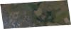
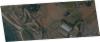
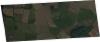
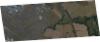
List of available products (path: W004, row: N55).
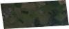
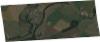
SSC_OPER_SSC_DEF_SC_20210724T140342_N55-456_W004-562_01
Download Product | Product Info | Browse
Resolution | 0.5 |
Product type | SSC_DEF_SC |
Cloud-Cover Percentage | 0 |
Start Date | 2021-07-24T14:03:42Z |
Stop Date | 2021-07-24T14:03:42Z |
Path | W004 |
Row | N55 |
Original Name | 20210724_140342_ssc7d1_0031_SkySatScene |
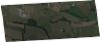
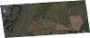
SSC_OPER_SSC_DEF_SC_20210724T140342_N55-502_W004-575_01
Download Product | Product Info | Browse
Resolution | 0.5 |
Product type | SSC_DEF_SC |
Cloud-Cover Percentage | 0 |
Start Date | 2021-07-24T14:03:42Z |
Stop Date | 2021-07-24T14:03:42Z |
Path | W004 |
Row | N55 |
Original Name | 20210724_140342_ssc7d1_0025_SkySatScene |
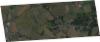
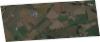
SSC_OPER_SSC_DEF_SC_20210724T140342_N55-536_W004-622_01
Download Product | Product Info | Browse
Resolution | 0.5 |
Product type | SSC_DEF_SC |
Cloud-Cover Percentage | 0 |
Start Date | 2021-07-24T14:03:42Z |
Stop Date | 2021-07-24T14:03:42Z |
Path | W004 |
Row | N55 |
Original Name | 20210724_140342_ssc7d2_0024_SkySatScene |
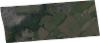
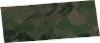
SSC_OPER_SSC_DEF_SC_20210724T140342_N55-540_W004-586_01
Download Product | Product Info | Browse
Resolution | 0.5 |
Product type | SSC_DEF_SC |
Cloud-Cover Percentage | 0 |
Start Date | 2021-07-24T14:03:42Z |
Stop Date | 2021-07-24T14:03:42Z |
Path | W004 |
Row | N55 |
Original Name | 20210724_140342_ssc7d1_0020_SkySatScene |
SSC_OPER_SSC_DEF_SC_20210724T140342_N55-426_W004-553_01
Download Product | Product Info | Browse
Resolution | 0.5 |
Product type | SSC_DEF_SC |
Cloud-Cover Percentage | 0 |
Start Date | 2021-07-24T14:03:42Z |
Stop Date | 2021-07-24T14:03:42Z |
Path | W004 |
Row | N55 |
Original Name | 20210724_140342_ssc7d1_0035_SkySatScene |
SSC_OPER_SSC_DEF_SC_20210724T140342_N55-449_W004-560_01
Download Product | Product Info | Browse
Resolution | 0.5 |
Product type | SSC_DEF_SC |
Cloud-Cover Percentage | 0 |
Start Date | 2021-07-24T14:03:42Z |
Stop Date | 2021-07-24T14:03:42Z |
Path | W004 |
Row | N55 |
Original Name | 20210724_140342_ssc7d1_0032_SkySatScene |
SSC_OPER_SSC_DEF_SC_20210724T140342_N55-479_W004-568_01
Download Product | Product Info | Browse
Resolution | 0.5 |
Product type | SSC_DEF_SC |
Cloud-Cover Percentage | 0 |
Start Date | 2021-07-24T14:03:42Z |
Stop Date | 2021-07-24T14:03:42Z |
Path | W004 |
Row | N55 |
Original Name | 20210724_140342_ssc7d1_0028_SkySatScene |
SSC_OPER_SSC_DEF_SC_20210724T140342_N55-570_W004-595_01
Download Product | Product Info | Browse
Resolution | 0.5 |
Product type | SSC_DEF_SC |
Cloud-Cover Percentage | 0 |
Start Date | 2021-07-24T14:03:42Z |
Stop Date | 2021-07-24T14:03:42Z |
Path | W004 |
Row | N55 |
Original Name | 20210724_140342_ssc7d1_0016_SkySatScene |
SSC_OPER_SSC_DEF_SC_20210724T140342_N55-562_W004-592_01
Download Product | Product Info | Browse
Resolution | 0.5 |
Product type | SSC_DEF_SC |
Cloud-Cover Percentage | 0 |
Start Date | 2021-07-24T14:03:42Z |
Stop Date | 2021-07-24T14:03:42Z |
Path | W004 |
Row | N55 |
Original Name | 20210724_140342_ssc7d1_0017_SkySatScene |
SSC_OPER_SSC_DEF_SC_20210724T140342_N55-528_W004-620_01
Download Product | Product Info | Browse
Resolution | 0.5 |
Product type | SSC_DEF_SC |
Cloud-Cover Percentage | 0 |
Start Date | 2021-07-24T14:03:42Z |
Stop Date | 2021-07-24T14:03:42Z |
Path | W004 |
Row | N55 |
Original Name | 20210724_140342_ssc7d2_0025_SkySatScene |
SSC_OPER_SSC_DEF_SC_20210724T140342_N55-418_W004-551_01
Download Product | Product Info | Browse
Resolution | 0.5 |
Product type | SSC_DEF_SC |
Cloud-Cover Percentage | 0 |
Start Date | 2021-07-24T14:03:42Z |
Stop Date | 2021-07-24T14:03:42Z |
Path | W004 |
Row | N55 |
Original Name | 20210724_140342_ssc7d1_0036_SkySatScene |
SSC_OPER_SSC_DEF_SC_20210724T140342_N55-525_W004-582_01
Download Product | Product Info | Browse
Resolution | 0.5 |
Product type | SSC_DEF_SC |
Cloud-Cover Percentage | 0 |
Start Date | 2021-07-24T14:03:42Z |
Stop Date | 2021-07-24T14:03:42Z |
Path | W004 |
Row | N55 |
Original Name | 20210724_140342_ssc7d1_0022_SkySatScene |
SSC_OPER_SSC_DEF_SC_20210724T140342_N55-464_W004-564_01
Download Product | Product Info | Browse
Resolution | 0.5 |
Product type | SSC_DEF_SC |
Cloud-Cover Percentage | 0 |
Start Date | 2021-07-24T14:03:42Z |
Stop Date | 2021-07-24T14:03:42Z |
Path | W004 |
Row | N55 |
Original Name | 20210724_140342_ssc7d1_0030_SkySatScene |
SSC_OPER_SSC_DEF_SC_20210724T140342_N55-472_W004-566_01
Download Product | Product Info | Browse
Resolution | 0.5 |
Product type | SSC_DEF_SC |
Cloud-Cover Percentage | 0 |
Start Date | 2021-07-24T14:03:42Z |
Stop Date | 2021-07-24T14:03:42Z |
Path | W004 |
Row | N55 |
Original Name | 20210724_140342_ssc7d1_0029_SkySatScene |
SSC_OPER_SSC_DEF_SC_20210724T140342_N55-494_W004-573_01
Download Product | Product Info | Browse
Resolution | 0.5 |
Product type | SSC_DEF_SC |
Cloud-Cover Percentage | 0 |
Start Date | 2021-07-24T14:03:42Z |
Stop Date | 2021-07-24T14:03:42Z |
Path | W004 |
Row | N55 |
Original Name | 20210724_140342_ssc7d1_0026_SkySatScene |
SSC_OPER_SSC_DEF_SC_20210724T140342_N55-487_W004-571_01
Download Product | Product Info | Browse
Resolution | 0.5 |
Product type | SSC_DEF_SC |
Cloud-Cover Percentage | 0 |
Start Date | 2021-07-24T14:03:42Z |
Stop Date | 2021-07-24T14:03:42Z |
Path | W004 |
Row | N55 |
Original Name | 20210724_140342_ssc7d1_0027_SkySatScene |
SSC_OPER_SSC_DEF_SC_20210724T140342_N55-555_W004-590_01
Download Product | Product Info | Browse
Resolution | 0.5 |
Product type | SSC_DEF_SC |
Cloud-Cover Percentage | 0 |
Start Date | 2021-07-24T14:03:42Z |
Stop Date | 2021-07-24T14:03:42Z |
Path | W004 |
Row | N55 |
Original Name | 20210724_140342_ssc7d1_0018_SkySatScene |
SSC_OPER_SSC_DEF_SC_20210724T140342_N55-517_W004-579_01
Download Product | Product Info | Browse
Resolution | 0.5 |
Product type | SSC_DEF_SC |
Cloud-Cover Percentage | 0 |
Start Date | 2021-07-24T14:03:42Z |
Stop Date | 2021-07-24T14:03:42Z |
Path | W004 |
Row | N55 |
Original Name | 20210724_140342_ssc7d1_0023_SkySatScene |
SSC_OPER_SSC_DEF_SC_20210724T140342_N55-521_W004-618_01
Download Product | Product Info | Browse
Resolution | 0.5 |
Product type | SSC_DEF_SC |
Cloud-Cover Percentage | 0 |
Start Date | 2021-07-24T14:03:42Z |
Stop Date | 2021-07-24T14:03:42Z |
Path | W004 |
Row | N55 |
Original Name | 20210724_140342_ssc7d2_0026_SkySatScene |
SSC_OPER_SSC_DEF_SC_20210724T140342_N55-433_W004-555_01
Download Product | Product Info | Browse
Resolution | 0.5 |
Product type | SSC_DEF_SC |
Cloud-Cover Percentage | 0 |
Start Date | 2021-07-24T14:03:42Z |
Stop Date | 2021-07-24T14:03:42Z |
Path | W004 |
Row | N55 |
Original Name | 20210724_140342_ssc7d1_0034_SkySatScene |
SSC_OPER_SSC_DEF_SC_20210724T140342_N55-510_W004-577_01
Download Product | Product Info | Browse
Resolution | 0.5 |
Product type | SSC_DEF_SC |
Cloud-Cover Percentage | 0 |
Start Date | 2021-07-24T14:03:42Z |
Stop Date | 2021-07-24T14:03:42Z |
Path | W004 |
Row | N55 |
Original Name | 20210724_140342_ssc7d1_0024_SkySatScene |
SSC_OPER_SSC_DEF_SC_20210724T140342_N55-441_W004-558_01
Download Product | Product Info | Browse
Resolution | 0.5 |
Product type | SSC_DEF_SC |
Cloud-Cover Percentage | 0 |
Start Date | 2021-07-24T14:03:42Z |
Stop Date | 2021-07-24T14:03:42Z |
Path | W004 |
Row | N55 |
Original Name | 20210724_140342_ssc7d1_0033_SkySatScene |
SSC_OPER_SSC_DEF_SC_20210724T140342_N55-547_W004-588_01
Download Product | Product Info | Browse
Resolution | 0.5 |
Product type | SSC_DEF_SC |
Cloud-Cover Percentage | 0 |
Start Date | 2021-07-24T14:03:42Z |
Stop Date | 2021-07-24T14:03:42Z |
Path | W004 |
Row | N55 |
Original Name | 20210724_140342_ssc7d1_0019_SkySatScene |
SSC_OPER_SSC_DEF_SC_20210724T140342_N55-543_W004-625_01
Download Product | Product Info | Browse
Resolution | 0.5 |
Product type | SSC_DEF_SC |
Cloud-Cover Percentage | 0 |
Start Date | 2021-07-24T14:03:42Z |
Stop Date | 2021-07-24T14:03:42Z |
Path | W004 |
Row | N55 |
Original Name | 20210724_140342_ssc7d2_0023_SkySatScene |
SSC_OPER_SSC_DEF_SC_20210724T140342_N55-532_W004-584_01
Download Product | Product Info | Browse
Resolution | 0.5 |
Product type | SSC_DEF_SC |
Cloud-Cover Percentage | 0 |
Start Date | 2021-07-24T14:03:42Z |
Stop Date | 2021-07-24T14:03:42Z |
Path | W004 |
Row | N55 |
Original Name | 20210724_140342_ssc7d1_0021_SkySatScene |
SSC_OPER_SSC_DEF_CO_20200419T141809_N55-557_W004-547_01
Download Product | Product Info | Browse
Resolution | 0.5 |
Product type | SSC_DEF_CO |
Cloud-Cover Percentage | 0 |
Start Date | 2020-04-19T14:18:09Z |
Stop Date | 2020-04-19T14:18:09Z |
Path | W004 |
Row | N55 |
Original Name | 20200419_141809_ssc10_u0001_SkySatCollect |
SSC_OPER_SSC_DEF_CO_20200419T141809_N55-398_W004-548_01
Download Product | Product Info | Browse
Resolution | 0.5 |
Product type | SSC_DEF_CO |
Cloud-Cover Percentage | 0 |
Start Date | 2020-04-19T14:18:09Z |
Stop Date | 2020-04-19T14:18:09Z |
Path | W004 |
Row | N55 |
Original Name | 20200419_141809_ssc10_u0002_SkySatCollect |