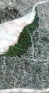
Static Map Catalogue - Full Metadata Record
Collection QuickBird-2
QuickBird-2. More details.
QB2_OPER_BGI_4B__MP_20110209T031423_N08-753_E104-887_0001
Download Product | BrowsePath | E104 |
Row | N08 |
Start Date | 2011-02-09T03:14:23.334Z |
Stop Date | 2011-02-09T03:14:23.334Z |
Availability Time | 2011-02-09T03:14:23.334Z |
Instrument Short Name | BGI |
Sensor Type | OPTICAL |
Sensor Mode | PM |
Orbit number | 0 |
Illumination Azimuth Angle | 128.1 |
Illumination Elevation Angle | 52.1 |
Footprint | 8.81856952 104.85313043 8.68880737 104.85318130 8.68882758 104.92157725 8.81859003 104.92155007 8.81856952 104.85313043 |
Scene Centre | 8.75370016064 104.887359765 |
Size | 112903309 |
Acquisition Type | NOMINAL |
Product Type | BGI_4B__MP |
Cloud-Cover Percentage | 0 |
Resolution | 2.0 |
Processing Level | other: LV3A |
Bounding Box | 8.81859003 104.85313043 8.68880737 104.85313043 8.68880737 104.92157725 8.81859003 104.92157725 |
Scale | 1:50.000 Orthorectified |
Satellite | QuickBird-2 |
