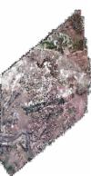
Static Map Catalogue - Full Metadata Record
Collection QuickBird-2
QuickBird-2. More details.
QB2_OPER_BGI_4B__MP_20060526T061006_N34-359_E073-503_0001
Download Product | BrowsePath | E073 |
Row | N34 |
Start Date | 2006-05-26T06:10:06.278Z |
Stop Date | 2006-05-26T06:10:06.278Z |
Availability Time | 2006-05-26T06:10:06.278Z |
Instrument Short Name | BGI |
Sensor Type | OPTICAL |
Sensor Mode | PM |
Orbit number | 0 |
Illumination Azimuth Angle | 134.9 |
Illumination Elevation Angle | 72.5 |
Footprint | 34.38552655 73.48705214 34.33370696 73.48798330 34.33410027 73.52017322 34.38592063 73.51926186 34.38552655 73.48705214 |
Scene Centre | 34.3598146573 73.5036177346 |
Size | 11843670 |
Acquisition Type | NOMINAL |
Product Type | BGI_4B__MP |
Cloud-Cover Percentage | 0 |
Resolution | 2.0 |
Processing Level | other: LV3A |
Bounding Box | 34.38592063 73.48705214 34.33370696 73.48705214 34.33370696 73.52017322 34.38592063 73.52017322 |
Scale | 1:50.000 Orthorectified |
Satellite | QuickBird-2 |
