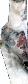
Static Map Catalogue - Full Metadata Record
Collection QuickBird-2
QuickBird-2. More details.
QB2_OPER_BGI_4B__2A_20080207T081334_N14-237_E040-324_0001
Download Product | BrowsePath | E040 |
Row | N14 |
Start Date | 2008-02-07T08:13:34.293Z |
Stop Date | 2008-02-07T08:13:34.293Z |
Availability Time | 2008-02-07T08:13:34.293Z |
Instrument Short Name | BGI |
Sensor Type | OPTICAL |
Sensor Mode | PM |
Orbit number | 0 |
Illumination Azimuth Angle | 145.8 |
Illumination Elevation Angle | 54.5 |
Footprint | 14.28162609 40.30890782 14.19323838 40.30839871 14.19306689 40.33941912 14.28145349 40.33994029 14.28162609 40.30890782 |
Scene Centre | 14.2373467133 40.3241664405 |
Size | 22442585 |
Acquisition Type | NOMINAL |
Product Type | BGI_4B__2A |
Cloud-Cover Percentage | 0 |
Resolution | 2.0 |
Processing Level | other: LV2A |
Bounding Box | |
Scale | |
Satellite | QuickBird-2 |
