Static Map Catalogue - Full Metadata Record
Collection QuickBird-2
QuickBird-2. More details.
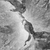
QB2_OPER_BGI_PAN_2A_20061106T081521_N13-602_E040-663_0001
Download Product | BrowsePath | E040 |
Row | N13 |
Start Date | 2006-11-06T08:15:21.902Z |
Stop Date | 2006-11-06T08:15:21.902Z |
Availability Time | 2006-11-06T08:15:21.902Z |
Instrument Short Name | BGI |
Sensor Type | OPTICAL |
Sensor Mode | PAN |
Orbit number | 0 |
Illumination Azimuth Angle | 158.7 |
Illumination Elevation Angle | 58.4 |
Footprint | 13.62588506 40.64020508 13.58037951 40.63989179 13.58006927 40.68640948 13.62557374 40.68673165 13.62588506 40.64020508 |
Scene Centre | 13.6029779744 40.6633095 |
Size | 75922790 |
Acquisition Type | NOMINAL |
Product Type | BGI_PAN_2A |
Cloud-Cover Percentage | 0 |
Resolution | 0.6 |
Processing Level | other: LV2A |
Bounding Box | |
Scale | |
Satellite | QuickBird-2 |
