Static Map Catalogue - Full Metadata Record
Collection QuickBird-2
QuickBird-2. More details.
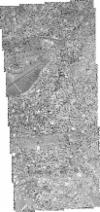
QB2_OPER_BGI_PAN_2A_20060731T082603_S01-286_E036-874_0001
Download Product | BrowsePath | E036 |
Row | S01 |
Start Date | 2006-07-31T08:26:03.671Z |
Stop Date | 2006-07-31T08:26:03.671Z |
Availability Time | 2006-07-31T08:26:03.671Z |
Instrument Short Name | BGI |
Sensor Type | OPTICAL |
Sensor Mode | PAN |
Orbit number | 0 |
Illumination Azimuth Angle | 41.7 |
Illumination Elevation Angle | 63.5 |
Footprint | -1.24770400 36.85578073 -1.32584893 36.85571545 -1.32588060 36.89234326 -1.24773380 36.89240743 -1.24770400 36.85578073 |
Scene Centre | -1.28679189821 36.8740617179 |
Size | 147463297 |
Acquisition Type | NOMINAL |
Product Type | BGI_PAN_2A |
Cloud-Cover Percentage | 0 |
Resolution | 0.5 |
Processing Level | other: LV2A |
Bounding Box | |
Scale | |
Satellite | QuickBird-2 |
