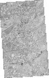
Static Map Catalogue - Full Metadata Record
Collection QuickBird-2
QuickBird-2. More details.
QB2_OPER_BGI_PAN_2A_20030114T075611_S01-286_E036-881_0001
Download Product | BrowsePath | E036 |
Row | S01 |
Start Date | 2003-01-14T07:56:11.284Z |
Stop Date | 2003-01-14T07:56:11.284Z |
Availability Time | 2003-01-14T07:56:11.284Z |
Instrument Short Name | BGI |
Sensor Type | OPTICAL |
Sensor Mode | PAN |
Orbit number | 0 |
Illumination Azimuth Angle | 130.0 |
Illumination Elevation Angle | 57.5 |
Footprint | -1.24692716 36.85660775 -1.32584965 36.85654186 -1.32589237 36.90612326 -1.24696733 36.90618763 -1.24692716 36.85660775 |
Scene Centre | -1.28640924787 36.8813651253 |
Size | 208716596 |
Acquisition Type | NOMINAL |
Product Type | BGI_PAN_2A |
Cloud-Cover Percentage | -99900 |
Resolution | 0.5 |
Processing Level | other: LV2A |
Bounding Box | |
Scale | |
Satellite | QuickBird-2 |
